Valvasorjev dom pod Stolom - Ajdna (climbing way)
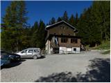
Starting point: Valvasorjev dom pod Stolom (1181 m)
| Latitude/Longitude: | 46,42600°N 14,14680°E |
| |
Route name: climbing way
Walking time: 40 min
Difficulty: difficult marked way
Elevation gain: -135 m
Elevation difference along the route: 50 m
Map: Karavanke - osrednji del 1:50.000
Recommended equipment (summer): helmet, self belay set
Recommended equipment (winter): helmet, self belay set, ice axe, crampons
Views: 10.376
 | 1 person like this post |
Access to starting point:
From the Ljubljana - Jesenice highway take the Lesce exit and follow the road ahead in the direction of Žirovnica and Jesenice. After a few km of driving, we will get to a crossroad, where the road to Žirovnica and Moste branches off to the right (from the direction of Jesenice left). Just a few meters ahead at the next crossroad, we turn left to Moste (right Žirovnica). Further, we drive past a monument to fallen soldiers, where the road starts ascending the hill below the railway track. On top of the slope, we turn right (at the sign Vila Karin), we continue driving towards Završniško jezero and Valvasorjev dom. The road then flattens and brings us to a crossroad, where the road to Valvasorjev dom branches off to the left. We go on the mentioned road (straight Koča pri izviru Završnice), which starts gently at first, then steeper and steeper ascending an occasionally quite rough road (the steepest parts are asphalted). Higher, the road brings us to a somewhat larger crossroad, where we continue left in the direction of Potoška planina (right Doslovška planina). The road then flattens and a little further brings us to the next crossroad. This time we continue slightly right in the direction of Valvasorjev dom (slightly left Ajdna and Potoška planina) and we drive on a steeper road all the way to the mentioned hut. We park on one of the parking lots by the road near the mountain hut, parking in front of the mountain hut is allowed only for guests.
From Poljane (crossroad before Završniško jezero) to Valvasorjev dom is 5 km.
Route description:
From Valvasorjev dom we continue on the marked path in the direction of Ajdna. The path, which bypasses the mountain hut on the left side, quickly enters the forest, where it first crosses slopes towards the west, then starts to descend noticeably towards the nearby forest road leading towards Potoška planina.
We reach the mentioned road exactly at a smaller crossroad, from which we continue right downwards in the direction of Ajdna. For a short time we continue on the mentioned road, then signs for Ajdna direct us steeply left downwards. Further, for some time we descend on a rough, partly ruined cart track, then the path passes onto a ridge, where it gradually flattens. When the marked path leaves the ridge, it turns slightly right and descends to a saddle between Mala Ajdna and Ajdna.
On the mentioned saddle there is a marked junction, we continue on the left path, which is marked as a very demanding path.
From the junction in a few steps we ascend to the wall, where we immediately encounter a steel cable, which accompanies us almost through the entire climbing part. The path on the climbing part first ascends transversely, then turns to the right and for a short time steeply ascends on the exposed slope. A somewhat easier part follows, then the path turns to the right, where it quickly passes onto a well-secured ridge, on which we ascend to the less steep part of Ajdna. When the path flattens, an easier path joins from the right, and just a few meters after the junction we arrive at the panoramic summit of Ajdna.

Photos:
 1
1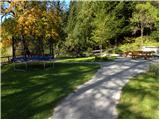 2
2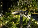 3
3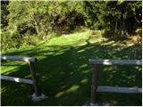 4
4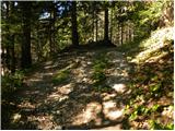 5
5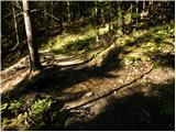 6
6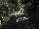 7
7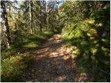 8
8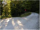 9
9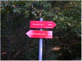 10
10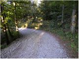 11
11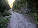 12
12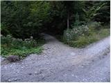 13
13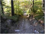 14
14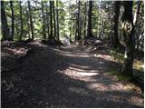 15
15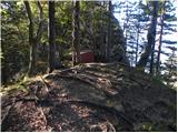 16
16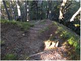 17
17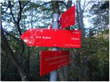 18
18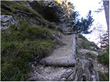 19
19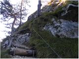 20
20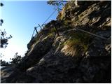 21
21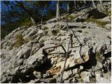 22
22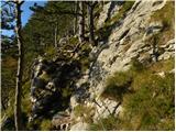 23
23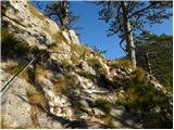 24
24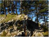 25
25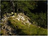 26
26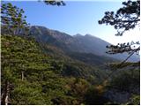 27
27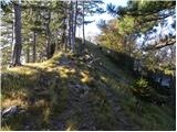 28
28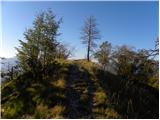 29
29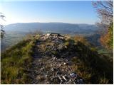 30
30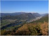 31
31
Discussion about the trip Valvasorjev dom pod Stolom - Ajdna (climbing way)
|
| CarpeDiem24716. 10. 2011 |
Wow, what a nice view of Sava and the Jesenice mountains. I must go on this walk sometime! 
|
|
|
|
| katty14. 10. 2012 |
Today I was in this area. We started of course from below, a bit higher than the parking lot, then continued along the gravel road. Hm, the plan was all along to conquer or step onto Ajdna , but then just before entering the climbing section I unfortunately had to turn back--not because I couldn't handle the challenge, but because of obligations , but then just before entering the climbing section I unfortunately had to turn back--not because I couldn't handle the challenge, but because of obligations  . I will definitely return, then in nice autumn weather, as the view from here, at least from what I saw, is stunning. We descended along a pleasant and nicely arranged path that leads to Valvasorjev dom--recently probably partially renovated, as there are pleasant height inscriptions on the rocks. All the time it was evident that there was quite a lot of visitors up there . I will definitely return, then in nice autumn weather, as the view from here, at least from what I saw, is stunning. We descended along a pleasant and nicely arranged path that leads to Valvasorjev dom--recently probably partially renovated, as there are pleasant height inscriptions on the rocks. All the time it was evident that there was quite a lot of visitors up there . .
|
|
|
|
| lilyd1. 03. 2020 |
Two guides Jože and Miha, group of trainees, we started the trail on Saturday in Završnica. After a good hour of ascent, there were good 500 meters of elevation behind us and we reached Valvasorjev dom pod Stolom. The trail towards the top is more slippery, crampons not needed. But winter gear is necessary for the ascent to Stol. We continued the trail to the archaeological site Ajdna, where the ruins are well secured, as well as parts of the first Christian church in Slovenia. The last section of the trail is well secured with cables. On the top beautiful views towards Triglav, Mežakla, Jelovica, Pokljuka. And of course Karavanke, from Dovška baba, Golica and Stol, the highest, like on the palm of your hand. On the top we learned more and more about rocks, clouds and winds... pity not everything stays in the head. Descent on the other side a bit snowy, careful descent, but also additionally secured, more cables than before. Walk back to the hut, followed by the theoretical part. The hut is nicely arranged, clean, good food. Besides us there were also Croatian trainees at the training. I'm already drawn to Stol in spring conditions, and also to Smolnik and Peči...
|
|
|
|
| Majdag30. 04. 2022 07:55:28 |
Smolnik - Ajdna...None of the titles match my path, I know. Started in Završnica and on the forest path at the junction for Smolnik, chose the steep one. The trail is dry, no obstacles. From Smolnik continued to the road and then towards Ajdna. At the junction for Ajdna the track is muddy, hauling wood. Up the climbing path to the top, rocks dry and primroses blooming. Descent from Ajdna via the lower path. Views from both summits wonderful. Worth seeing, and not far.
https://jelenkamenmajdag.blogspot.com/2022/04/razgledi-za-duso-smolnik-in-ajdna.html
|
|
|
To post a comment you must log in:
If you do not yet have a username, you must first
register.