Veliko Ubeljsko - Vojkova koča na Nanosu
Starting point: Veliko Ubeljsko (589 m)
| Latitude/Longitude: | 45,77200°N 14,07810°E |
| |
Walking time: 1 h 50 min
Difficulty: easy marked way
Elevation gain: 651 m
Elevation difference along the route: 651 m
Map: Nanos 1:50.000
Recommended equipment (summer):
Recommended equipment (winter): ice axe, crampons
Views: 35.322
 | 1 person like this post |
Access to starting point:
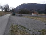
From the Ljubljana–Koper motorway we take the Razdrto exit and continue along the parallel old road towards Postojna. Soon we notice signs directing us left towards the villages Veliko Ubeljsko and Strane. In the village Malo Ubeljsko we reach a crossroads where we continue left (slightly right towards Strane) towards Veliko Ubeljsko. We follow the mentioned road to the parking area by the cemetery located just before the village Veliko Ubeljsko.
Route description:
From the cemetery we continue along the asphalted road which quickly takes us into Veliko Ubeljsko. The road then leads past the church to the upper part of the village where we see a hiking direction sign for Nanos. This directs us right onto a poorer forest road.
We continue the ascent on the mentioned road which we leave after a few minutes of walking. The signs for Nanos direct us left onto a track that gradually becomes steeper. Higher up the track turns into a footpath where the steepness increases further.
The path that climbs steeply above the village Veliko Ubeljsko later leads out of the forest onto very steep grassy slopes. Across these slopes, which are especially dangerous for slipping when wet, we then ascend in a steep traverse.
Higher up the steepness eases and the path joins a considerably wider path from Razdrto. We continue right (left to Razdrto on the steep path) and after less than five minutes of walking we reach Vojkova koča na Nanosu.

Along the route: Pod kamnom (639m), Razpotje pod Plešo (1236m)
Photos:
 1
1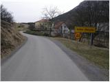 2
2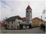 3
3 4
4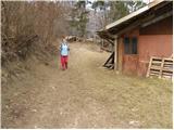 5
5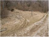 6
6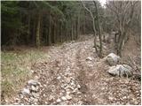 7
7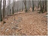 8
8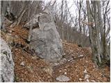 9
9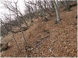 10
10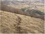 11
11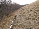 12
12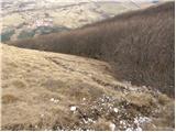 13
13 14
14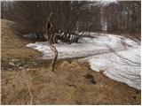 15
15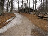 16
16 17
17
Discussion about the trip Veliko Ubeljsko - Vojkova koča na Nanosu
|
| Maja Pahor27. 02. 2021 |
It's a pleasant trip but the path is really extremely steep constantly
|
|
|
|
| garmont27. 02. 2021 |
...and muddy on the steep grassy slopes.
|
|
|
To post a comment you must log in:
If you do not yet have a username, you must first
register.