Vrtinjlogarski graben / Val Bartolo - Gorjanski vrh / Göriacher Berg / Monte Goriane (over saddle Kot / Sella Canton)
Starting point: Vrtinjlogarski graben / Val Bartolo (960 m)
Starting point Lat/Lon: 46.5289°N 13.5463°E 
Path name: over saddle Kot / Sella Canton
Time of walking: 3 h 10 min
Difficulty: easy marked way, easy unmarked way
Difficulty of skiing: no data
Altitude difference: 729 m
Altitude difference (by path): 805 m
Map: Julijske Alpe - zahodni del 1:50.000
Access to starting point:
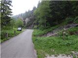
Over the border crossing Rateče, or over the border crossing Predel we drive to Trbiž / Tarvisio, and then we continue driving in the direction of the ski slope Svete Višarje / Monte Lussari. When Trbiž ends, from the roundabout after store Eurospar, we go to the exit in the direction of the settlement Žabnice / Camporosso in Valcanale, after that immediately right towards the settlement. After underpass under the railway track, we go left and then we follow the signs for Vrtinjlogarski graben / Val Bartolo. After the settlement, the asphalt ends, and the road brings us into the mentioned valley, through which we are ascending on usually well-settled macadam road which we follow to the spot, where we notice signposts for path 509, which leads on a saddle Kot / Sella Canton. We park on an appropriate place by the road.
Path description:
From the starting point, we go on the path in the direction of saddle Kot / Sella Canton, where we immediately step on an old mule track, on which we start ascending. On a mule track, we are mostly ascending through the forest, only higher forest for some time ends, where we cross a short steep slope and torrent stream. After approximately one hour of walking, the path flattens a little and passes into a smaller valley, through which we ascend to a saddle Kot, where there is a marked crossing, and by the crossing bigger bell from the year 1926.
From the saddle, where join two paths from Trbiž / Tarvisio and also forest road from the settlement Kokovo / Coccau, we continue in the direction of Gorjanski vrh / Monte Goriane and we continue on a worse macadam road which is then mostly ascending diagonally towards the right, and meanwhile few times a nice view opens up on Julian Alps, higher also in the direction towards Ojstrnik. The path ahead for some time leads on the southwestern ridge of Veliki Kopinj, and then the path which continues gently on a wide grassy cart track, turns a little to the right and on the right side bypasses the mentioned peak. When we return on the ridge, from the left joins the marked path which leads past saddle Vrtinjlogarsko sedlo, and after the crossing, we reach also the national border between Italy and Austria. The path ahead leads us on a wide cart track which runs on the Italian side of the border, and it continues with some shorter ascents and descents. Later we on the south side bypass Gorjanski vrh, and when the forest ends we reach the mountain pasture Gorjanska planina, where with nice views, we reach the main part of the mountain pasture, which is situated on the Austrian side of the border, where there is also more cottages.
From cottages on the mountain pasture, we continue left and we start ascending on a ridge, that runs on border between Austria and Italy. With nice views on Dobrač and Julian Alps, in few minutes we reach the panoramic peak.
The starting point - saddle Kot 1:10, saddle Kot - Gorjanska planina 1:50, Gorjanska planina - Gorjanski vrh 10 minutes.
Description and pictures refer to a condition in the year 2018 (May).
Pictures:
 1
1 2
2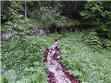 3
3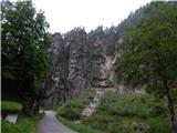 4
4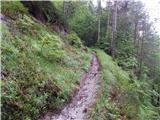 5
5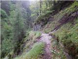 6
6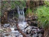 7
7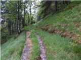 8
8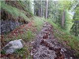 9
9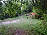 10
10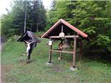 11
11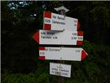 12
12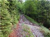 13
13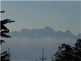 14
14 15
15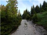 16
16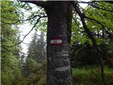 17
17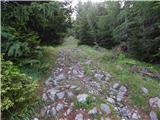 18
18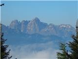 19
19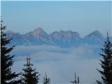 20
20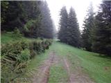 21
21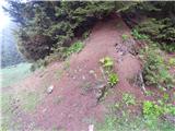 22
22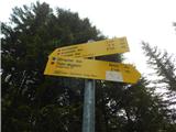 23
23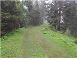 24
24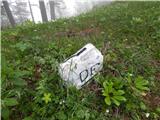 25
25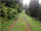 26
26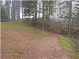 27
27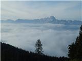 28
28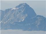 29
29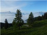 30
30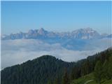 31
31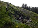 32
32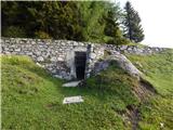 33
33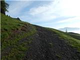 34
34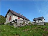 35
35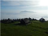 36
36 37
37 38
38 39
39 40
40 41
41 42
42 43
43 44
44 45
45 46
46 47
47 48
48