Winterleiten parking - Zirbitzkogel
Starting point: Winterleiten parking (1750 m)
| Latitude/Longitude: | 47,09490°N 14,57350°E |
| |
Walking time: 2 h 17 min
Difficulty: easy marked way
Elevation gain: 646 m
Elevation difference along the route: 646 m
Map: WK 212 (Seetaler & Seckauer Alpen 1:50.000)
Recommended equipment (summer):
Recommended equipment (winter): ice axe, crampons
Views: 7.267
 | 2 people like this post |
Access to starting point:
A) From the Gorenjska side we go over the border crossing Ljubelj to Celovec / Klagenfurt or through the Karavanks Tunnel to Beljak / Villach. Next we head on the motorway in the direction of signs for Gradec / Graz. We leave the motorway before the approximately 2 km long tunnel in the direction of Bad St. Leonhard. Further, we drive past the village St. Peter and the smaller town Obdach. Through Obdach we continue driving to Judenburg. All the time we follow the signs for Judenburg until we get to the center of Judenburg. In the roundabout, where in the middle there is a gas station, we turn left towards Seetaler Alps. We follow the road 17 km and signs for Winterleiten Hütte and park on the large parking lot before the road closure.
B) From Koroška we first drive to Dravograd and further into Austria. We follow the road ahead towards St. Paul, St. Andrä and Wolfsberg. In Wolfsberg we head towards Bad St. Leonhard and further towards St. Peter. Further, we follow the description from Gorenjska.
C) From the Štajerska side we drive to Maribor and further over the border crossing Šentilj into Austria. We follow the motorway in the direction of Celovec / Klagenfurt. We leave the motorway in the direction of the exit Bad St. Leonhard. Further, we follow the description from Gorenjska.
D) Access from Austria: First, we drive to Judenburg, which is situated by the river Mur in Austria. Further, we drive to the south part of the town, where we notice a hospital. Near the hospital a mountain road branches off towards Seetaler Alps. The road is marked with signs "Seetaler strasse". We follow the nice and at first asphalted road towards signs Winterleiten Hütte. We park on the large parking lot before the road closure.
Route description:
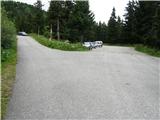
From the parking lot, we continue on the road which is closed with a barrier. After a short ascent on the road we come out of the forest, where in front of us we notice a lake and to the right of it a hut.
Next we continue on the left side of the lake past the chapel in the direction of "Lukas Max - steig". The path, which ascends only gently, we follow further on the slightly vegetated slope. The path then moderately ascends for a short time and brings us to the upper and larger Winterleiten lake.
Next follows the crossing of a wide stream, then the path turns left along the lake. This part of the path is quite swampy, so we must be careful not to get wet.
The path ahead again starts to ascend gently and brings us to a junction, where we again continue in the direction of "Lukas Max - steig". Next follows the crossing of a few smaller streams on a quite muddy path. The path ahead slowly turns to the left and continues through nice high-alpine terrain full of streams. The path then slowly transitions to more rocky terrain, where we leave the nice little valley and springs. The path ahead ascends more steeply through the rocky terrain and after 20 minutes of ascent brings us to a panoramic saddle.
We continue right up the ridge. The path along the somewhat steeper ridge lasts only a few minutes, then it turns left and traverses the slopes of Scharfes Eck in a gentle ascent. At the end of the traverse, the path brings us to a junction, where we continue straight ahead (slightly left) in the direction of Zirbitzkogel (right Scharfes Eck). Next follows a few minutes of walking along the flat wide ridge. The path ahead transitions to the summit slopes of Zirbitzkogel and begins to ascend moderately. After a short ascent we reach the hut, which is located only a few meters below the summit.
Further, we continue right and in two minutes of ascent past the chapel we reach the panoramic summit.

Photos:
 1
1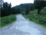 2
2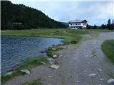 3
3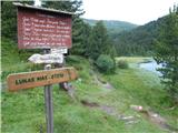 4
4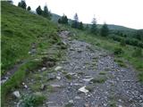 5
5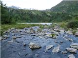 6
6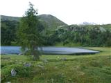 7
7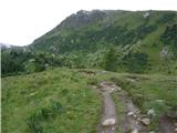 8
8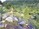 9
9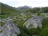 10
10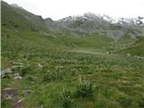 11
11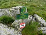 12
12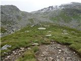 13
13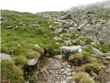 14
14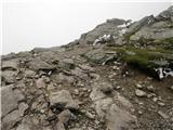 15
15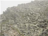 16
16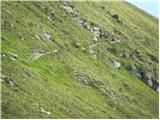 17
17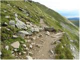 18
18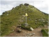 19
19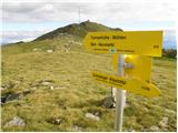 20
20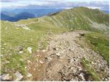 21
21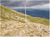 22
22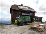 23
23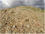 24
24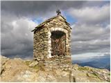 25
25 26
26
Discussion about the trip Winterleiten parking - Zirbitzkogel
To post a comment you must log in:
If you do not yet have a username, you must first
register.