Zadnjica - Triglavski dom na Kredarici
Starting point: Zadnjica (650 m)
| Latitude/Longitude: | 46,38240°N 13,76040°E |
| |
Walking time: 7 h 30 min
Difficulty: difficult marked way
Elevation gain: 1865 m
Elevation difference along the route: 1990 m
Map: Triglav 1:25.000
Recommended equipment (summer): helmet
Recommended equipment (winter): helmet, ice axe, crampons
Views: 10.279
 | 1 person like this post |
Access to starting point:
We drive from Kranjska Gora over the mountain pass Vršič towards Bovec or vice versa, but only to the 50th hairpin turn of the Vršič road or Ruska cesta (near the village of Trenta). Here we turn onto a side road, along which after a few hundred meters we park on a parking lot by the road.
Route description:
From the parking lot, we continue on the road, which past a few houses (mainly holiday cottages) in approximately 15 minutes brings us to the spot where the road splits into two parts (at the crossroads there used to be a parking lot, today parking is forbidden).
We continue on the lower right road (via the upper road we arrive at the cargo cableway that leads to Pogačnikov dom) in the direction of Dolič, Luknja and Prehodavci. At first we follow the gentle road, which leads us through scenic meadows, higher through the forest, almost to its end, or more precisely to a marked junction, where a marked footpath to Prehodavci branches off to the right (to here we need approximately 1 hour).
From the junction in the area named Utro we continue straight ahead, and the road here finally turns into a footpath or mule track. We continue the ascent on the old mule track, which further moderately ascends over occasionally steeper slopes. Further on, a climbing path over Komar soon branches off to the right, while we continue straight and continue the ascent on the wide path. The scenic path, which occasionally runs over very steep slopes, then brings us higher to the next marked junction.
From the junction we head right (left Luknja and Triglav via Plemenice) and continue the path in the direction of Koča na Doliču. The still wide path further begins to ascend towards the south, crossing the slopes of Vrh Zelenic (2468 m). When the slope flattens somewhat, the path over Komar joins from the right, and we follow the mule track to the next junction, where the path to Zasavska koča branches off to the right (Pot Mire Marko Debelakove via Kanjavčeve police).
Here we continue left, and the increasingly scenic and occasionally precipitous path brings us to a junction near Koča na Doliču.
Here we continue slightly right (left Triglav) on the path that quickly brings us to Koča na Doliču (sometimes Tržaška koča na Doliču).
From the hut we continue in the direction of Vodnikov dom on the path which gently ascends to the saddle Dolič.
At Dolič, where there is a marked junction, we take the left path in the direction of Dom Planika pod Triglavom (straight Vodnikov dom, right Hribarice). We continue the ascent on the path which ascends transversely onto the relatively steep slopes of Šmarjetna glava. At a somewhat more demanding spot, a steel cable helps us, and the path then gradually transitions to a less steep slope. The path ahead continues for some time over more plateau-like terrain, then slowly transitions to scree at the foot of Rjavec (2568 m). Across the mentioned scree we ascend transversely, and the path then brings us to a technically more demanding passage. Further on, with the help of numerous fixed protections, we ascend transversely over the less steep wall, then the path turns left and becomes technically easier. There follows a further approximately 20-minute ascent, and the increasingly scenic path brings us to Dom Planika pod Triglavom.
From the mentioned mountain hut we continue in the direction of Kredarica and continue on the path which crosses extensive scree under Mali Triglav. After a short traverse we leave the scree, as the path leads into the wall of Mali Triglav. Here with the help of fixed protections we cross locally crumbly wall, then the path again transitions to expansive scree. There follows a short descent and the path brings us to the spot where it splits into two parts.
We continue on the right path, which begins to descend noticeably towards the spot where we join the path from Pokljuka or Krma to Kredarica (if we continue on the left path we must cross an extensive snowfield above Snežna konta, which without appropriate equipment can be dangerous). When we join the path from the valley we continue left and continue the ascent on a well-trodden path, along which in approximately half an hour of further walking we arrive at Triglavski dom na Kredarici.

Photos:
 1
1 2
2 3
3 4
4 5
5 6
6 7
7 8
8 9
9 10
10 11
11 12
12 13
13 14
14 15
15 16
16 17
17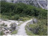 18
18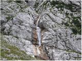 19
19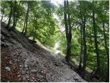 20
20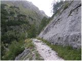 21
21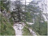 22
22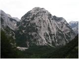 23
23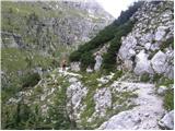 24
24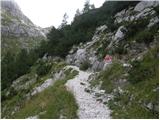 25
25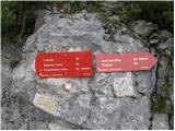 26
26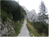 27
27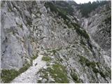 28
28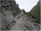 29
29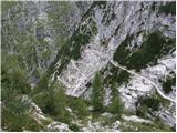 30
30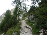 31
31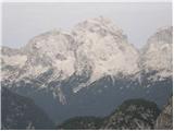 32
32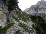 33
33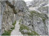 34
34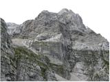 35
35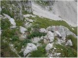 36
36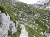 37
37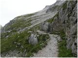 38
38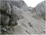 39
39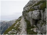 40
40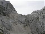 41
41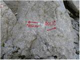 42
42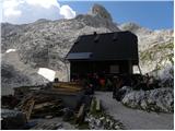 43
43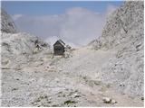 44
44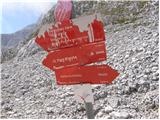 45
45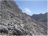 46
46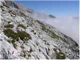 47
47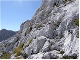 48
48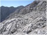 49
49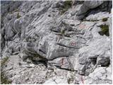 50
50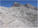 51
51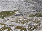 52
52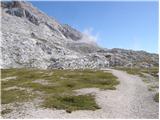 53
53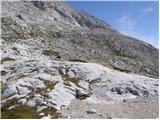 54
54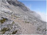 55
55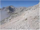 56
56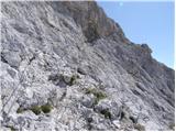 57
57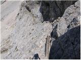 58
58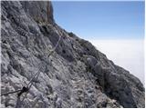 59
59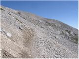 60
60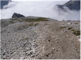 61
61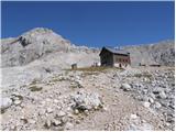 62
62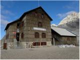 63
63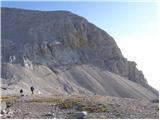 64
64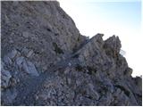 65
65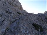 66
66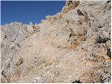 67
67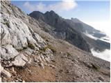 68
68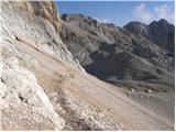 69
69 70
70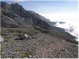 71
71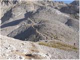 72
72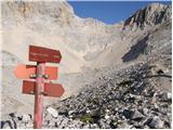 73
73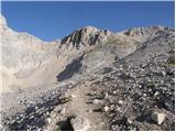 74
74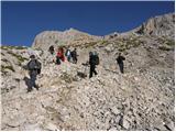 75
75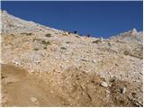 76
76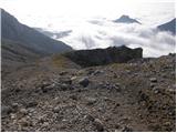 77
77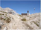 78
78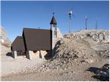 79
79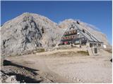 80
80
Discussion about the trip Zadnjica - Triglavski dom na Kredarici
To post a comment you must log in:
If you do not yet have a username, you must first
register.