Starting point: Zalahaláp (245 m)
| Latitude/Longitude: | 46,92230°N 17,45770°E |
| |
Walking time: 30 min
Difficulty: partly demanding unmarked way
Elevation gain: 113 m
Elevation difference along the route: 113 m
Map:
Recommended equipment (summer):
Recommended equipment (winter):
Views: 194
 | 1 person like this post |
Access to starting point:
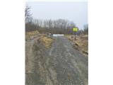
From the Pomurska motorway, we take the Dolga vas exit, then we continue driving towards Hungary. The route then leads us through the town of Redics, then we follow the signs for the city of Zalaegerszeg, from there we continue driving in the direction of Blatno Lake / Balaton, Heviz and Keszthely. When we arrive in the town of Keszthely, we turn onto the bypass and then we follow the signs for Balatonfuered (there are roundabouts along the bypass). When the road to the town of Sopron branches off at the end of Keszthely, we continue east, but only 2 km, then we turn right towards the village of Badacsonytördemic. We continue through the village (the road in the middle of the village is cobblestoned) and drive to the settlement of Tapolca. In Tapolca, we turn in the direction of Devecser and drive to the town of Zalahaláp. In the town, we drive almost to the exit where we will spot the cemetery. By the cemetery, we turn right onto the poorer road and drive uphill to the parking lot where we leave the vehicle.
We can also reach the town of Keszthely via the Pince-Nagykanizsa-Budimpešta motorway, which we leave at the Balatonkeresztur exit and continue to the town. The motorway currently brings us within one kilometer of the town (status 2026).
Route description:
From the parking lot, we head uphill past the barrier. We continue left, then after about a minute of walking we turn right, reaching the first summit plateau. The path then gently descends, leading us to a second, much larger plateau. From there, we already spot the summit and continue straight towards it.
Just below the summit section, the path passes by an open-air museum with stone sculptures. From the museum, about five minutes of ascent on constructed steps equipped with railings separate us from the top. Although the steps and handholds are very helpful, this final section of the path remains partially demanding.
From the summit, despite the relatively low elevation, a beautiful view of the surroundings opens up to us.
Recommendation: In wet weather, the path is quite slippery, so extra caution is required.
Photos:
 1
1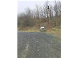 2
2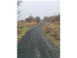 3
3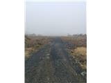 4
4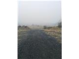 5
5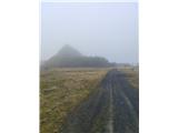 6
6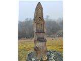 7
7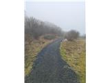 8
8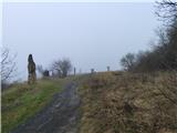 9
9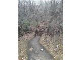 10
10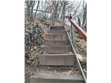 11
11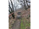 12
12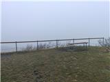 13
13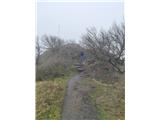 14
14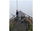 15
15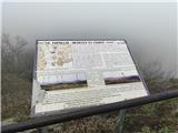 16
16
Discussion about the trip Zalahaláp - Haláp hegy
|
| antik24. 02. 2026 18:49:14 |
Bravo! Nice! This is a familiar route for me...
|
|
|
To post a comment you must log in:
If you do not yet have a username, you must first
register.