Zalog - Velika Poljana (via Mala Poljana)
Starting point: Zalog (600 m)
| Latitude/Longitude: | 46,32810°N 14,36300°E |
| |
Route name: via Mala Poljana
Walking time: 2 h 20 min
Difficulty: easy marked way
Elevation gain: 785 m
Elevation difference along the route: 810 m
Map: Karavanke - osrednji del 1:50.000
Recommended equipment (summer): helmet
Recommended equipment (winter): helmet, ice axe, crampons
Views: 7.705
 | 1 person like this post |
Access to starting point:
From the Ljubljana - Jesenice motorway, take the Kranj west exit and continue following the road towards Golnik. Shortly after the village of Tenetiše, we will notice signs for the village of Goriče, directing us right onto a local road. A little further ahead, we reach the next junction, where we continue right towards the villages of Trstenik and Preddvor. We do not follow this road for long either, as after just a few metres we will notice a sign reading Zalog, directing us left onto an ascending road, which we then follow to the mentioned village. In the middle of the village, slightly before the church, we will notice a road branching off to the right from the main road. Head onto this road, along which we soon spot the markings. Follow this road for another approximately 1 km, then park at one of the parking areas along the road.
Route description:
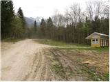
From the starting point we continue along the road where we parked; it becomes progressively worse and leads us higher to the NOB monument, where we leave it and continue the ascent to the right along an ascending cart track. At the spot where the cart track along which we are ascending turns left, we will notice a small path on the right that begins to climb more steeply through the forest (the start is unmarked).
The path, along which we see occasional markings, then takes us past a small chapel to a poorly marked junction, beside which on a scenic rise we notice a pleasant bench.
We continue slightly left towards Mala Poljana (the direction sign is a little further ahead from the junction) along a path that brings us after a few more steps into a forest-covered valley. The increasingly faintly visible little path ascends further up this valley, which becomes narrower and gradually turns into a gully. We continue ascending along a barely visible path that climbs between two steep slopes. The path, mainly covered with leaves and exposed to falling rocks in places, leads us higher to an initially quite eroded cart track, along which we exit the forest in a few minutes onto the lower part of Mala Poljana. The cart track along which we continue ascending then takes us after a few more minutes of walking to the Lovska koča na Mali Poljani.
From Mala Poljana, where the path from Doma pod Storžičem joins us, we continue right towards Velika Poljana. The path, which continues along the cart track, quickly enters the forest, where it then ascends across the slope. After a few minutes of walking we reach a scenic slope from which we get a nice view of the surrounding mountains. A little further on the cart track turns right and after a short ascent brings us to the upper edge of Velika Poljana, from where we descend to the hut in a few minutes.
Starting point - Gmajna 0:45, Gmajna - Mala Poljana 1:20, Mala Poljana - Velika Poljana 0:15.

Photos:
 1
1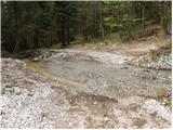 2
2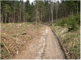 3
3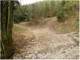 4
4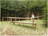 5
5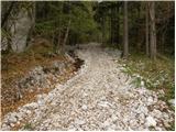 6
6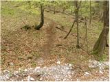 7
7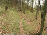 8
8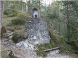 9
9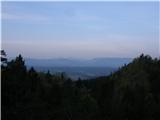 10
10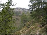 11
11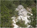 12
12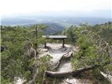 13
13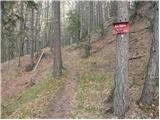 14
14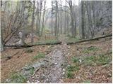 15
15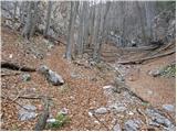 16
16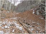 17
17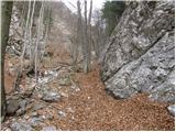 18
18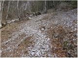 19
19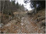 20
20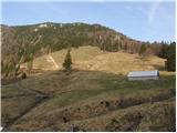 21
21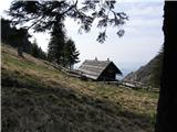 22
22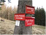 23
23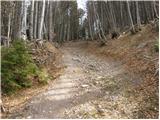 24
24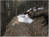 25
25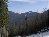 26
26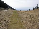 27
27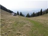 28
28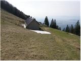 29
29
Discussion about the trip Zalog - Velika Poljana (via Mala Poljana)
|
| SunBurned20. 04. 2014 |
The section of the trail between the junction (fig.14) and almost all the way to Mala Poljana is very difficult to pass due to fallen trees, so for Velika Poljana I recommend the direct path. You will also get to Mala Poljana faster via V. Poljana, although the trail is otherwise a bit longer.
|
|
|
|
| Loni28. 05. 2014 |
This weekend the farmers will clear this part from the junction towards Mala Poljana, at least that's what the temporary caretaker at V. Poljana said. Next weekend the summer visitors will already come up. The pastures beckon  . .
|
|
|
|
| Loni28. 05. 2014 |
Aja, the bench from picture no. 13 is gone, the tooth of time took it.
|
|
|
To post a comment you must log in:
If you do not yet have a username, you must first
register.