Zidani Most - Kum (through Škratova dolina (new path))
Starting point: Zidani Most (201 m)
| Latitude/Longitude: | 46,09020°N 15,15760°E |
| |
Route name: through Škratova dolina (new path)
Walking time: 3 h 5 min
Difficulty: easy marked way
Elevation gain: 1019 m
Elevation difference along the route: 1050 m
Map:
Recommended equipment (summer):
Recommended equipment (winter): ice axe, crampons
Views: 25.360
 | 4 people like this post |
Access to starting point:
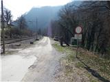
A) From Litija or Zagorje ob Savi we drive to Hrastnik, and from there we continue driving in the direction of Zidani Most. After the settlement Suhadol the road passes to the right side of the railway, and when a little further it again crosses the track, already behind the ramp but still before crossing the track, a macadam road branches off to the right, beside which the described path begins.
B) From Rimske Toplice or Radeče we drive to Zidani Most, from there we continue driving towards Hrastnik. When a little after the turn-off for Širje the road first crosses the railway track, immediately after it a macadam road branches off to the left, beside which the described path begins.
Route description:
Near the passage across the railway track we notice signs for Kum, which point us to Cicka (Cicka is a manual cableway with the help of which we get to the other side of the river Sava). When we get to the other side of Sava we first get out of Cicka, then we continue in the direction of the signs for Kum. Only a little after Cicka the path leads us past the farm Trbežnik, which we bypass on the right side. Above the farm over a small bridge we cross the stream Suhi graben, then only a little further we again cross the stream, this time without a bridge. When a little higher we again cross the stream, we step onto one of the larger Slovenian islets, because higher the stream splits into two parts and thus flows on both sides of the islet (in dry periods one part of the stream dries up, so then there is no island). We walk for a few minutes on the islet, then we leave it and continue for some time to the left of the stream. There follows a steep ascent up a steep slope, which leads us steeply above the stream. When we ascend diagonally across the mentioned slope, where especially when wet greater caution is needed so that we do not slip, we enter the less steep Škratova dolina. Further on the path leads us past an old mill, then we cross the stream a few more times. A little further the path leads us past several smaller springs, above them we soon reach a poor macadam road. There follows an ascent along the road, which leads us through Škratova dolina, most of the time ascending through the forest. Higher the forest ends and a moderately steep path brings us past the abandoned farm to an asphalt road, where we join the path from Radeče.
We follow the road to the right, from it soon a path to Nebeška gora branches off to the left. When after a further short ascent we reach the road junction, we continue sharply right (straight the old path, which leads under the overhang of the nearby homestead) in the direction of Kum. From the junction we walk for a few more minutes along the road, then the signs for Kum direct us left onto a footpath, along which we continue the ascent. There follow a few junctions, where we follow the blazes, then we step onto a macadam road, which we follow to the left. After a short ascent along the road we arrive at some kind of clearing, where we continue left in the direction of Kum (right Mežnarija and the church of St. Mary on Ključavica).
The path ahead leads us past a chapel, then only a little after it we continue right onto a poorer road, from it a few steps further left onto a cart track. With a view of the elevation Ključavica we ascend the grassy slope, then the path levels out and crosses a belt of scrub. On the other side of the scrub we descend close to the nearby house, which we bypass on the right side, then we continue the path along a poorer road, which leads us to the left of the second house. Behind the house the road widens, then we quickly arrive in the forest, where there is a marked junction.
We continue straight (left Mali Kum and Podkum) in the direction of Kum, along a path that first ascends gently, then more steeply. Higher the forest ends and the path brings us right below the summit of Kum, where we join the road that leads to the mountain hut. Along the road in a few steps we arrive at the mountain hut, a few meters further also at the church of St. Neža on the summit of Kum.
Description and pictures refer to the condition in 2016 (March).

Photos:
 1
1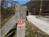 2
2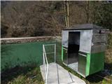 3
3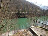 4
4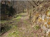 5
5 6
6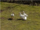 7
7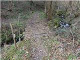 8
8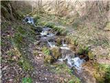 9
9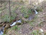 10
10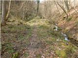 11
11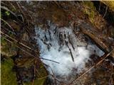 12
12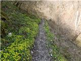 13
13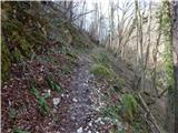 14
14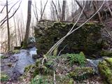 15
15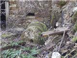 16
16 17
17 18
18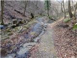 19
19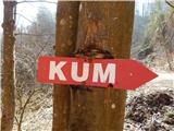 20
20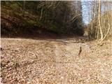 21
21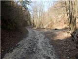 22
22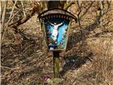 23
23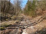 24
24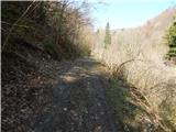 25
25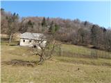 26
26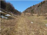 27
27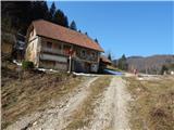 28
28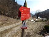 29
29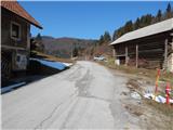 30
30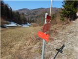 31
31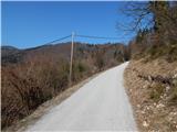 32
32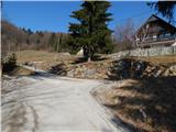 33
33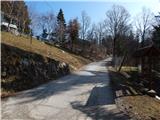 34
34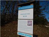 35
35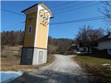 36
36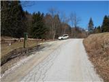 37
37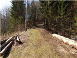 38
38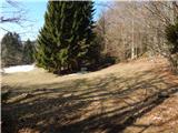 39
39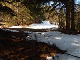 40
40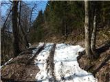 41
41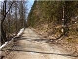 42
42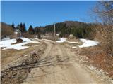 43
43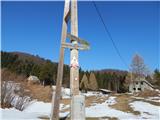 44
44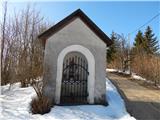 45
45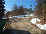 46
46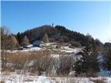 47
47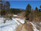 48
48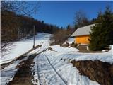 49
49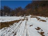 50
50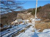 51
51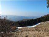 52
52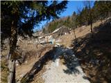 53
53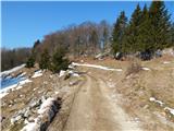 54
54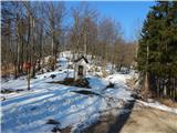 55
55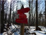 56
56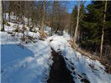 57
57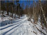 58
58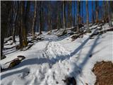 59
59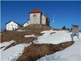 60
60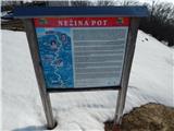 61
61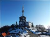 62
62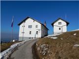 63
63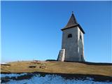 64
64 65
65
Discussion about the trip Zidani Most - Kum (through Škratova dolina (new path))
|
| PlaRinka19. 03. 2017 |
Very nice trail. Very steep at the beginning, but then it flattens out considerably. You can even encounter geese on the trail. 
|
|
|
|
| garmont19. 03. 2017 |
Since you posted your question under the trail description from Zidani Most, you naturally have to get off the train at Zidani Most. 
But of course you can go to Kum even if you get off the train at Zagorje, Trbovlje, Hrastnik or Radeče.
|
|
|
|
| docepe220. 03. 2017 |
Not new, just the direction has changed a bit so as not to go through house yards.
|
|
|
|
| N3bULA23. 08. 2017 |
Did the hike today.
Times in the title hold true, up a little less than 3 hours, down 1.5 hours (I hurried a bit downhill).
The trail is excellent for hot summer days, I went this afternoon when it was very hot, but the trail mostly runs through the forest, a good part along the stream, so it's nicely cool.
Markings are OK at the very beginning, then they somehow disappear, at the intersection where the new route goes right, old left, there is no marking for the new trail at all, so I followed the old trail, also downhill when following markings I ended up on the old and not the new trail  , if the old trail is being discontinued, the markings should be removed and made for the new one. , if the old trail is being discontinued, the markings should be removed and made for the new one.
Well, the best thing on the trail is the village Ključevica, right below the Kum summit, a true idyllic mountain village with an exceptional view.
cheers
|
|
|
|
| piotr11. 03. 2019 |
I descended here alone 11 weeks ago and there are no peculiarities when crossing with the cicka either. But now you can pull yourself across more easily compared to the former one.
|
|
|
|
| modrook125. 01. 2020 |
Can the car be parked on the other side of the Sava to avoid the cicka?
|
|
|
|
| docepe26. 01. 2020 |
Yes, from Hrastniška and Radeška directions, but the road is very narrow.
|
|
|
|
| Enka6. 01. 2020 |
I parked right at the old bridge in Radeče, then rather walked about 2.5 km along that narrow road to the starting point. In this case you can return in a loop via the path to Radeče (recommend a side trip to Nebeška gora) and at the end it's just a minute's walk to the car.
|
|
|
|
| Skala7712. 03. 2020 |
I'm interested in the "cicka" condition March 2020
|
|
|
|
| ejti13. 02. 2021 |
Does anyone maybe have fresh information if the cicka is functioning?
|
|
|
|
| lencad15. 03. 2021 |
The cicka works. We used it today.
|
|
|
|
| ejti16. 03. 2021 |
Nice, thanks for the information.
|
|
|
|
| Mara6625. 06. 2021 21:05:21 |
Today the "cicka" was not working. On the other side we saw that the cicka is wrapped in a small chain and locked with a padlock. The cicka is a bit in poor condition. Vandalism at work.
|
|
|
|
| navdušena11. 01. 2022 08:53:26 |
Does anyone know how "cicka" is now?
|
|
|
|
| Marusaorel24. 10. 2022 19:15:36 |
Today I crossed the Sava with the cicka, it works. Crazy experience!
|
|
|
|
| marepn95525. 10. 2022 12:57:52 |
I agree, this cicka is a great thing and I hope the Radeče tourist association (big thanks to T. Association Radeče) will manage to maintain the cicka in the future too, because I usually come by train to Z. Most and then via Kum in Zagorje back to the train, if I have a good day then from Kum I continue to Podkum, Rodež and in Renke over the bridge (closed bridge, adrenaline crossing ) to Zasavska gora and Vač to Zgornja Slivna and from there to Kresnice, then usually the day runs out, energy even earlier.
|
|
|
|
| Resevna17. 02. 2024 11:02:13 |
I was asking about current conditions; maybe more luck here: has anyone crossed with the cicka in the last month? What's the condition?
I know how to swim, but still ...
Thanks for info.
|
|
|
|
| babica 517. 02. 2024 15:58:09 |
On the Alpine Association website - trail conditions, I read that Cicka is closed due to wear and tear.
|
|
|
|
| Brave6617. 02. 2024 16:16:19 |
I went across with Cicka last November and no problem...
|
|
|
|
| rok.si21. 04. 2024 18:38:06 |
Cicka was operational today, 21.4.2024.
|
|
|
|
| Tbs11. 05. 2024 17:51:03 |
What is the current condition of Cicka and how do you even work with it?
|
|
|
|
| ločanka12. 05. 2024 13:27:24 |
See current conditions for Kum
|
|
|
|
| bongo13. 05. 2024 16:39:35 |
Cicka "works". If there are two, one goes first and the other pulls him across the Sava with the winch and they switch roles, so that with the help of the cable he can pull himself to the exit point, but it's quite difficult.
|
|
|
|
| andi213. 05. 2024 18:01:49 |
If there are two of you, it's really easy. You basically have to stop pushing towards the end, otherwise the one in Cicka flies right into your butt at speed all the way to the end. My brother was cursing when I teased him on purpose and for her, that famous joke doesn't apply - does the wire ever break? Yeah, rarely, but here and there it does. Yeah, when do you replace it then? Well, when it breaks
|
|
|
To post a comment you must log in:
If you do not yet have a username, you must first
register.