Hike.uno
Hike.uno
Login
Login
Username:
Password:
Login
Not registered yet? Registration.
Forgot password?
Jereka

Jereka

Country: Slovenia
Mountain range: Julian Alps
Latitude/Longitude: 46,2967526°N 13,9625912°E
Altitude: 634 m
Type: Village
Weather forecast:
Th
Fr
Sa
Su
Mo
Description:
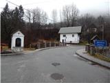
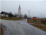
Jereka is a village in the Julian Alps mountain range at an altitude of 634 meters. The village is located in country Slovenia 1. 4 km east from the center of Bohinjska Češnjica and 1. 5 km north from the center of Bitnje Jereka has 212 inhabitants.
Images:
Jereka Jereka
Show map
Points in the vicinity:
Detailed descriptions
Vodnikov razglednik (1017m)
1,3 km east-northeasterly
Ajdovski gradec (580m)
1,9 km southerly
Planina Zajamniki (1280m)
2,9 km northwesterly
Grmečica waterfall (510m)
3,2 km east-southeasterly
Javorov vrh (Pokljuka) (1482m)
3,3 km north-northwesterly
Webcams
Bohinjska Bistrica
2,2 km south-southwesterly
Smučišče Kozji hrbet
3,3 km southerly
Kobla
4,0 km southerly
Pokljuka
6,1 km north-northwesterly
Panoramas
Planina Zajamniki (1280m)
2,9 km northwesterly
Javorov vrh (Pokljuka) (1482m)
3,3 km north-northwesterly
Rudnica (946m)
3,5 km west-southwesterly
Mesnovec (1538m)
4,8 km north-northwesterly
Koča na Uskovnici (1154m)
4,9 km west-northwesterly
Starting points
Bohinjska Češnjica
1,6 km westerly
Log v Bohinju
1,7 km southeasterly
Koprivnik v Bohinju
1,9 km east-northeasterly
         
Copyright © 2026 Hike.uno, Terms of use, Privacy and cookies