Kozje - Grad Kozje (Drachenburg) (strma pot)
Starting point: Kozje (270 m)
| Latitude/Longitude: | 46,07288°N 15,55377°E |
| |
Route name: strma pot
Walking time: 20 min
Difficulty: easy marked way
Elevation gain: 90 m
Elevation difference along the route: 90 m
Map:
Recommended equipment (summer):
Recommended equipment (winter): ice axe, crampons
Views: 24
 | 0 people like this post |
Access to starting point:
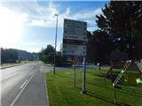
a) We drive to Šentjur, then follow the signs for Podsreda and Planina pri Sevnici. At the end of Šentjur we turn left towards Podsreda, then continue on a rather winding road to the settlement of Kozje, where we park at one of the arranged parking lots in the center of the settlement.
b) From the Brežice - Podčetrtek road at the edge of the settlement Bistrica ob Sotli we turn left (from the direction of Podčetrtek right) towards Podsreda. We bypass the center of Podsreda on the right side, then drive to the settlement of Kozje, where we park at one of the parking lots in the center of the settlement.
c) From the direction of Sevnica and Krško we drive to Brestanica, then follow the signs for Podsreda. This is followed by some ascent, then a descent into Podsreda, where at the end of the settlement we turn left towards Šentjur and Kozje. When we arrive in Kozje we park at an arranged parking lot in the center of the settlement.
Route description:
From the parking lot we walk to the western side of the Kozje pond, where the signs for Grad Kozje direct us onto a poorer road that ascends transversely to the left to a narrower asphalt road leading to a nearby house; we merely cross this road and follow the signs for the old castle. The path ahead turns into a strip of shrubbery and higher up forest, through which we begin to ascend steeply; on steeper sections we climb wooden stairs, and in places some protection also helps us. During the ascent we also pass several informational boards of the educational trail, and we ascend quite steeply all the way to the registration box on the hill where Grad Kozje once stood.
The description and photos refer to the situation in May 2026.
Photos:
 1
1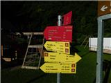 2
2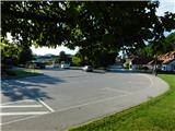 3
3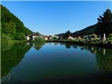 4
4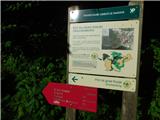 5
5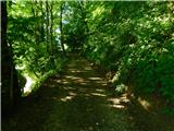 6
6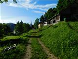 7
7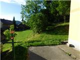 8
8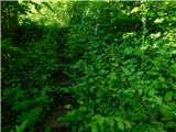 9
9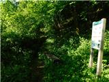 10
10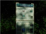 11
11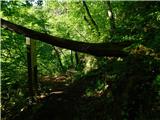 12
12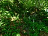 13
13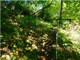 14
14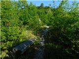 15
15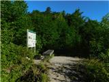 16
16
Discussion about the trip Kozje - Grad Kozje (Drachenburg) (strma pot)
To post a comment you must log in:
If you do not yet have a username, you must first
register.