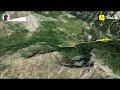
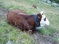
 | Lac des pisses (Prapic Orcières)
23. 05. 2022 14:07:32
Champsaur massif, departure from the hamlet of Prapic (Orcières)elevation gain 1000m... |
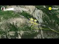
 | Col des Tourettes from Prapic
27. 05. 2022 17:37:37
Hike in Champsaur, start from Prapic (Orsières)elevation gain 1000 m, distance 17 km... |
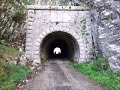
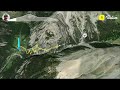
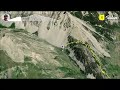
 | Pas de la Clé, Mortier Tunnel
3. 06. 2022 19:55:24
start Les Coings, northern VercorsPas de la Clé, La Buffe, Mortier tunneldistance 13 kmelevation gain 850 m... |
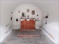
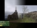
 | Mont Gerbier de Jonc
13. 06. 2022 08:14:44
Short visit to Mont Gerbier de Jonc (Ardèche/Haute Loire) and the former 12th-century Bonnefoy charterhouse... |
 | Suc de Sara (Gerbier de Jonc)
13. 06. 2022 08:22:12
hike to Suc de Sara, distance 10 km, elevation gain 850 m... |
 | Suc de Montfol (Gerbier de Jonc)
13. 06. 2022 17:28:36
hike to Mont Gerbier de Jonc, Haute Ardèche/Haute Loiredistance 14.2 km, elevation gain 850 m... |
 | Dôme de Bellefont (Chartreuse)
18. 06. 2022 09:50:09
Dôme and Col de Bellefont via Colonel trailloop return via Col de la Saulcestart from Perquelin, distance 13.8 km, elevation gain 1150 m16 June 2022... |
 | Currière Tour du Charmant Som
25. 06. 2022 16:32:09
23 June 2022 Chartreuse massif, start from Currière charterhouse,Col de la Cochette, Col du Collet, Charmant Som farm, Col de la Charmettedistance 22 km, elevation gain 1320 m... |
 | Refuge Adèle Plachard (Ecrins Massif) Round Trip 11 July 2022
28. 07. 2022 16:33:41
start from Arsine bridge (Villar d'Arène)return climbing to Villar d'Arène refuge, then weather station1600 m elevation gain by A-GPS Tracker (1850 by Relive), and 24 km (21.1 by Relive)... |
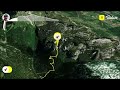
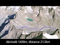 | Col du Clot des Cavales
29. 07. 2022 23:27:05
from Arsine bridge (Villar d'Arène)round trip: 21.5 km, elevation gain 1400 m25 July 2022... |
 | Col de Granon
30. 07. 2022 17:46:32
Col de Granon from Val des Prés (Clarée Valley) on 13 July 2022distance 20 km, elevation gain 1100 mat the summit finish of the Tour de France stage... |
 | Fort de l'Olive and Fort de Lenlon
1. 08. 2022 20:49:07
Hike in Vallée de la Clarée, departure from Plampinet towards Fort de l'Olive and Fort de Lenlondistance 14.2 km, elevation gain 1140 m... |
 | Col des Acles (Vallée de la Clarée)
2. 08. 2022 22:10:20
Col des Acles from Plampinet (Vallée de la Clarée)distance 15.1 km, elevation gain 900 mruins of the customs quartersHameau des Acles... |
 | Lac Noir (Névache)
4. 08. 2022 18:38:50
Hike to Lac Noir starting from Névache (upper town) via Creux des Souches and return via the valley streamdistance 13 km, elevation gain 1000 m... |
 | Pic du Lac Blanc (Névache)
5. 08. 2022 20:43:35
Departure from Fontcouverte (Névache) on 17 July 2022distance 15 km, elevation gain 1200 m... |
 | Col du Chardonnet (Névache)
6. 08. 2022 21:16:17
Hike in Névache: Col du Chardonnet and towards Tête de la Cassille from Fontcouverteelevation gain 1000 m, distance 14.5 km... |
 | Roche du Chardonnet (Névache)
7. 08. 2022 20:45:36
Roche du Chardonnet, start from Laval parking at the end of Vallée de la Clarée roaddistance 15 km, elevation gain 1000 m... |
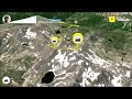
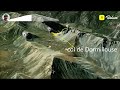 | Col de Dormillouse and Col de la Lauze
14. 08. 2022 15:47:24
Hike on 16 July 2022: in Vallée de la ClaréeCol de Dormillouse and Col de la Lauzedeparture from Val des Prés, Draye parkingdistance 13.3 kmelevation gain 1220 m... |
 | Col de Buffere and Porte de Cristol (Névache)
15. 08. 2022 18:32:37
Col de Buffere and Porte de Cristol (Névache) on 20 July 2022distance 19.2 km, elevation gain 1100 mstart from Rately bridge near Névache... |
 | Col du Loup, Petite Lance de Crozet, Col de la Sitre (loop)
12. 09. 2022 08:57:14
Belledonne massif, loop from Pré-Raymond parkingLac Crozet, Col du loup, petite lance de Crozet, col de la sitre, Mont St Mury, col du pré du Molard,distance 16 km, elevation gain 1250 m... |
 | Col de Freydane (to Lac Blanc) Belledonne
12. 09. 2022 19:51:03
Belledonne massif, start from Pré-Raymond parking towards Col de Freydane (passage to Lac Blanc)distance 18.5 km, elevation gain 1465m10 September 2022... |
 | Lac Blanc (Belledonne)
23. 09. 2022 14:46:05
start from Pré-long parking (La Souille), Lac Blanc then return via Refuge Jean Colletdistance 13 km, elevation gain 1100m21 September 2022, Belledonne massif... |
 | Great Loop in Belledonne 8/07/2018
7. 10. 2022 16:23:12
Hike done by Christian L. on 8 July 2018 during the daydistance 28.6 km, elevation gain 2830m, time 12h40departure parking Pré-Raymond, le grand Colon, col de la Pra, la Croix de Belledonne, le col de Freydane, le lac Blanc, le col de la Sitre, le col du loup, le lac Crozet... |
 | Grand Colon (Belledonne)
12. 11. 2022 23:18:04
elevation gain 960m, distance 8.6 km, start Les Quatre Chemins, Baraque du Colon... |
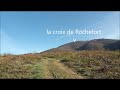 | Croix de Rochefort Col Avenas - Beaujeu
18. 12. 2022 20:54:44
Start from the church parking in Beaujeu (Haut Beaujolais): croix de Rochefort, wolf trap, croix Callet, col du fût d'Avenas, orientation table, les grandes terres, le Charnay, Beaujeu station... |
 | Le Petit Som via the west chimney
4. 02. 2023 16:34:53
Chartreuse: elevation gain 950m, distance 12.7 kmstart from La Correrie, the Abbey, Notre Dame de Casalibus, Col de la Ruchère, the couloir, Le Petit Som, Col d'Echaud, Habert de Bovinant... |
 | Vaux en Beaujolais (loop)
27. 02. 2023 17:59:54
Hike starting from Vaux en Beaujolais (Clochemerle)distance 19 kmelevation gain 760 mphotos of the village's humorous frescoes... |
 | Rochers de Chalves via Namières
7. 04. 2023 09:22:46
Chartreuse Massif, Rochers de Chalves via Namières (Mont Saint-Martin) elevation gain 1000m, distance 12kmhike stopped 100m below the summit due to excessive snow cover... |
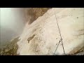
 | Col de Chalance 3012m
18. 06. 2014 21:59:49
great day with Badaber... |
 | Merca Via Alpina 03 to 06/14
10. 07. 2014 18:40:23
via Questa and Fremamort... |
 | Grand Paradis 4061m
19. 07. 2014 15:16:54
Mich/Fred/DéDé... |
 | Bocchettes via Furax
17. 11. 2014 01:03:37
Dolomites... |
 | MTB Snow Marseille 2017
3. 12. 2017 19:15:40
3 Dec 2017It snowed yesterday in L'Etoile... |
 | Snow in Marseille L'Étoile 2 Dec 2017
3. 12. 2017 19:47:06
... |
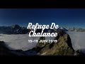 | Refuge de Chalance 15-16 June 2019
17. 06. 2019 09:54:40
... |
 | BIKEPACKING 01
29. 05. 2020 18:48:25
Bikepacking a 150 km loop in the French CountrysideMore videos coming up... |
 | BIKEPACKING 02
2. 07. 2020 17:08:18
Vercors is a part of the French Alps . I took this trail in July 2020 for an off road expedition.Here is the link for the trail map : http://www.vercors-gtv.com/traversee-chemins-du-soleil-vtt.html... |
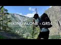 | HIKING 01. ÉCRINS
17. 07. 2020 23:58:35
A solo hike in the Alps on a part of the GR54 trail. Lake of La Muzelle and Lauvitel Lake.Shoot on IPhone XR.... |
 | HIKING 02. ÉCRINS
10. 09. 2020 11:10:20
Overnight hiking in the alps with my mom. We set up the tent next to the glacier de la Pilatte.... |
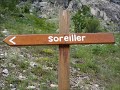 | Hike to Refuge du Soreiller
3. 10. 2016 19:37:32
Hike to Refuge du Soreiller... |
 | Ascent of Grand Galibier 3228 m
4. 10. 2016 12:14:00
Ascent of Grand Galibier 3228 m... |
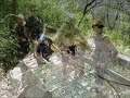 | Via ferrata du Grand Dièdre
4. 10. 2016 22:06:10
Via ferrata du Grand Dièdre... |
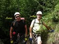 | Via ferrata l'intégrale des Lavandières
4. 10. 2016 22:06:30
Via ferrata l'intégrale des Lavandières... |
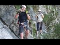 | Via ferrata de la Bastille
4. 10. 2016 22:52:33
Via ferrata de la Bastille... |
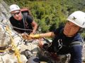 | Via ferrata Grotte Jules Carret
4. 10. 2016 23:57:12
Via ferrata Grotte Jules Carret... |
 | Hike to Mont Rachais and Tête Pelouse
28. 11. 2016 14:00:32
Hike to Mont Rachais and Tête Pelouse... |
 | Hike to Lac Bramant and Lac Noir
28. 11. 2016 20:17:56
Hike to Lac Bramant and Lac Noir... |
 | Slideshow Lac Noir from Besse
28. 11. 2016 20:18:10
Slideshow Lac Noir from the start at Besse... |
 | Walk to 7 Laux
28. 11. 2016 20:47:18
Walk to 7 Laux... |
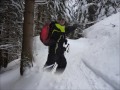 | Snowshoe hike to Tête du Danay
28. 11. 2016 22:42:42
Snowshoe hike to Tête du Danay... |