Hike.uno
Hike.uno
Login
Login
Username:
Password:
Login
Not registered yet? Registration.
Forgot password?
      

Pasja ravan 1019m

Print
viharnik10. 05. 2009 14:56:20
Today I spent a nice day four meters higher than Aljažev dom in Vrata, which is on Pasja ravan. Route led from Pržan, over Sedlo to before Dobrava, then to Polhov Gradec, towards Črni vrh, below at the bridge turned left to lonely Božna valley. Roads now all asphalt, leading to high-mountain lonely farms, not far path to pre-ridge Sivka 934m, where little rest. All around meadows of flowers and grass, above breeze pleasant cool. Along ridge continued to road branching all sides (Lučine, Poljane, Črni vrh), I headed to Pasja ravan. Up on log in shade tuna with tomato went well. Time riding: Sivka 30km-2:15h, Pasja ravan 38km-2:45h. Down 55km/h. From top Pasja ravan to valley, in 15min rode 11km, to home another 45min. Passed some cycling club with specialke, when behind me almost 70km. Home lunch just fell in. Blister says already quite good, so next time report from some peak. L MTB P-Rok.
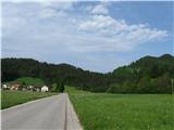
Pasja ravan 1019m Polhov Gradec with St. Lovrenc1
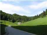
Pasja ravan 1019m 2
Pasja ravan 1019m 3
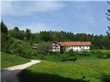
Pasja ravan 1019m Last farms above Božna valley at 800m4
Pasja ravan 1019m 5
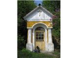
Pasja ravan 1019m One of the nicer chapels with Jesus6
Pasja ravan 1019m 7
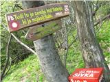
Pasja ravan 1019m Sivka, where does the name come from?8
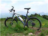
Pasja ravan 1019m Gary Fisher (Hoo Koo E Koo), Blegoš in between9
Pasja ravan 1019m Tošč and Grmada10
Pasja ravan 1019m Pasja ravan11
Pasja ravan 1019m Črni vrh with church of St. Lenart12
Pasja ravan 1019m Kanjavec in the distance13
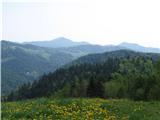
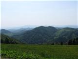
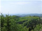
Pasja ravan 1019m View to the south14
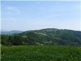
Pasja ravan 1019m Small hut of Sivka opposite Grmada, which is 35m lower15
Pasja ravan 1019m Continuation of Sivka ridge hides blueberry meadow16
Pasja ravan 1019m 17
Pasja ravan 1019m Krim in the background to the left, below Koreno above Horjul 721m18
Pasja ravan 1019m With bike on paths at the foot of Pasja ravan19
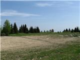
Pasja ravan 1019m Pasja ravan - summit20
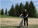
Pasja ravan 1019m After 38 km and 2.45h, happy at the top!21
Pasja ravan 1019m Saddle at 950m - highest parts of Polhograjci22
Pasja ravan 1019m 23
Pasja ravan 1019m 24
Pasja ravan 1019m 25
Pasja ravan 1019m Rest in the shade on a log and enjoying the whisper of the wind and play of clouds26
Pasja ravan 1019m Črni vrh and Sv. Lenart 861m27
(+1)like
LidijaJesih5. 02. 2012 19:07:09
Sometimes it really surprises me that there are practically no descriptions of certain conditions. For example, about Pasja ravan. The mountain was once the champion of the Polhograjski Dolomites, but JLA with its interventions in the mid-seventies brought it to the edge and lowered it by 10m, so now it lags 1m behind Tošč (1021). They built a rocket base on the mountain, remains of the infrastructure still stand on top today. Today to the top in somewhat colder weather from Hotovlja village (description on this site). No problems walking, but you cool down almost the instant you stop. A bit windy too and new snow up to 30 cm. The path can be a riddle for a newbie in snow here and there if not trodden, but today someone had already tramped ahead of us, so we believed it was the right way. It was. For such a day as today, an ideal goal, a bit less than 800m ascent and four hours, red ears and nose. We'll warm up. And everything else too.velik nasmeh
Rarely seen snow-covered starting point this year (Hotovlja village).1
Today a snowy idyll, it snowed gently overnight too.2
This one is still quite naked at -10; but they gave him food and drink, that's true.3
Clear, or not quite. :)4
One is behind me... the sun says.5
Unknown beasts; most similar to llamas; but seems a bit unlikely. Well, not horses.6
Little church on Bukov vrh, about halfway on the path to Pasja ravan.7
That should be right.8
Illegal building? No, the army had a missile base here on Pasja ravan summit (don't quote me).9
Summit plateau, artificially levelled.10
He was looking for the summit but didn't find it.11
The descent was childlike joy.12
Here other children were playing. Snowman for farewell.13
(+2)like
viharnik4. 01. 2016 19:45:01
Several times I visit this highest plateau of the Polhograjci with MTB, this time due to lots of snow for the first time with skis.
I approached Pasja ravan via the long valley V. Božne via the Potrebuješ gully, so the tour lasted from noon to first dusk.
More description on TK gora, here I attach some pics from the nice tournasmeh.
Here too we find Mary with Jesus above the road1
There was quite a lot of snow on the grass2
This half dog half bear growled like the devil in a cage3
Vast white expanses4
5
At Logar 610 m at the end of the valley6
7
Here I step out onto the clearing8
In the background Sivka 934m9
On the ridge road with a view of Poljane10
Omejc farm at 960 m11
At the Črni vrh - Poljane pass12
Knežji kamen of Pasja ravan13
14
It went pretty well!15
At Ogrin I almost plunged into the ditch (path cut by the house for direct ascent)16
Off-road enjoyment!17
18
(+7)like
lino4. 01. 2016 20:30:30
Viharnik, you find many nice tours. From the pics it seems you didn't meet many ski enthusiasts. Polhograjci are beautiful every season. And here is the kingdom of LG. Wonderful places!
like
viharnik4. 01. 2016 20:34:22
During the tour I met only one annoying dog that looked like a bear and rabbit tracks, people zerovelik nasmeh.From the top pass at Omejec there were muddled old tracks to Pasja ravan.If someone repeats the tour, on TK gora I made a mistake or more mistakes, not everything goes together, food and showering...Gully is called Potrebuježev V. Božne.Now even -13°C on Pasja ravan.
like
Am Shagar4. 01. 2016 22:14:35
How much snow is there?
(+1)like
ljubitelj gora5. 01. 2016 00:27:17
At our place a bit over 20cm
(+1)like
viharnik5. 01. 2016 06:08:27
Up above 900m there was about 30cm there.
(+1)like
velkavrh14. 03. 2019 18:10:42
Today we retirees of the better group -Četrkovci PD Škofja Loka headed on a five-hour path from Hotovlja village to Bukov vrh to the chapel of the Sorrowful Mother of God, then to the main goal on Pasja ravan. They allowed us a visit to the meteorological tower. We climbed to the top of the tower. Views far around. We continued to the hill Sivko and to Planina village, where they have an ethnological collection. We ended in the hamlet Suhi Dol.
Start in Hotavlja village.1
Over the footbridge up the slope.2
Heading to Bukov vrh.3
The path winds in zigzags.4
The path is well marked.5
We are already out of the forest.6
Views like this - KSA.7
At Bukov vrh.8
Church of the Sorrowful Mother of God.9
Here the fire brigade was founded.10
Down to Bukov vrh village.11
Continuing to Pasja ravan.12
The last breath of winter.13
Meteorological tower on Pasja ravan.14
We climbed to the top.15
At the top.16
Let's go on.17
Across the village Zadobje.18
We arrived at Sivka hill.19
20
21
Across the village Planina nad Horjulom.22
23
To the church of St. Andrew on Planina-798m.24
In the village below there is an ethnological collection.25
26
Across the village Goli vrh.27
The final goal was the hamlet Suhi Dol.28
(+3)like
julika14. 03. 2019 19:56:02
Hotovlja not Hotavljamežikanje
(+3)like
jaz14. 03. 2019 20:11:00
Your Hotavlje, Lp!
(+1)like
Fikret14. 03. 2019 20:25:24

Hey, how to put it. I would join Julika too and say your Hotovlja. Lp
(+1)like
ločanka14. 03. 2019 20:34:19
I, Hotavlje is the next village after Gorenja vas towards Trebija, Julika is rightnasmeh
(+1)like
julika14. 03. 2019 20:38:43
On the first photo on the sign it nicely says Hotovlja, that's the village next to Poljane. Hotavlje is the settlement under Blegoš, or on the path that Ločanka wrote
(+1)like
ljubitelj gora14. 03. 2019 21:01:16
ooo my home area, especially Planina nad Horjulom is very nice.
(+3)like
velkavrh15. 03. 2019 06:44:16
Thanks! I'm so fast at ten-finger blind typing that I miss letters. Consequence of economics school from over fifty years ago. Glasses I also forget to put on up there.
(+2)like
ločanka15. 03. 2019 19:49:08
Sure, sure, if you're not as busy as Velkavrh. Look what all he does: photographs, walks, sometimes leads too, and writes. Describes mountains, chapels, little flowers, NOB monuments, waterfalls. And how is all that supposed to be correct, without mistakesnasmeh? Good thing there aren't even morenasmeh
(+3)like
Fikret16. 03. 2019 20:12:17

Hey, hats off to Velkavrh. That guy is a workaholic and with him we really can't nitpick.
(+2)like
ločanka17. 11. 2020 07:50:11
Judging by the posts, Pasja ravan doesn't seem to have many admirers. The name used to put me off sometimes, so it took quite a while for me to climb it at all. Well, this year already the second time. That's what measures do when you don't have much choice. But you still have a choice. You choose between different access routes and on Sunday we chose one that had intrigued me for quite some time and where the paths weren't quite clear to me. We've gotten lost on them before, but also found our waynasmeh.

So, on Sunday, when fog lingered in the valleys, we headed in that direction before the village of Selo, where the parking lot used to be deserted sometimes. First into the village, then left towards Črni vrh, Pasja ravan. Sv. Ožbolt is also reachable in this direction, I figured along a nice, lesser-known variant. At the third intersection we chose the upper path over the top of Mlake (Prosenov grič) for the ascent, and returned via the lower path. Nice loop where you don't meet many people. The path is interesting, in the first part I'd say even solitary, where you hear the whistling of the wind and the chirping of birds. The markers are old, from some previous era, a bit misleading too, as they offer variants to the right that are already overgrown.

Really beautiful trip, worth repeating, I'd say in some other time or anytime, as soon as possiblenasmeh. I recommend!

view from the parking lot, the ridge of Osolnik from Kožuhov vrh onwards1
view to sv. Ožbolt2
towards the village Selo3
mists towards Polhograjska gora4
we ascended along the right edge5
you start on this path6
road to Polhov Gradec7
on soft foliage8
9
the rowans flew to the tree by the path10
male with females11
before the junction with the path to sv. Ožbolt12
towards the homestead Vrbanček13
beautiful scenery14
awaiting renovation15
on this path into the forest16
if you trust all the markers17
you reach this view, homestead Kartel with idyllic background18
and forward19
saddle Predole presumably, there are two options, we chose the right variant, but returned via the left20
21
here we returned22
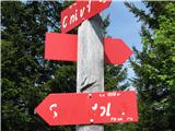
All the signposts are here.23
Beautiful grassy ridge where one would like to stay longer.24
and look back25
Pasja ravan is already visible.26
Towards Novi breg, a bit off the path.27
Towards Valterski vrh.28
Grintovci in the background.29
Towards Črni vrh on Sunday.30
Selfie, LOL.31
on the return32
In the embrace of golden grasses.33
View towards sv. Ožbolt in the afternoon sun.34
And closer.35
Towards Tošec, parking lot below.36
37
(+12)like
ločanka17. 11. 2020 18:52:36
Thanks to everyone who participated in this transfer and explanationnasmeh, I actually suggested to Tadej myself to move it under hiking, it didn't seem sensible to me for the record to stay under mountain biking.
Majda, and thanks to you for praising what was writtennasmeh.
(+4)like
Page:12
You must log in to post a comment:
Username:
Password:
Login
If you do not yet have a username, you must first register.
         
Copyright © 2026 Hike.uno, Terms of use, Privacy and cookies