Hike.uno
Hike.uno
Login
Login
Username:
Password:
Login
Not registered yet? Registration.
Forgot password?
      

Zagorelec -2090m

Print
lynx26. 08. 2020 23:12:37
I removed it from OSM because it was a misunderstanding (although the summit part was well drawn). My track was added for viewing to more easily solve the puzzle with the poorly drawn transverse path to Jalovec. Then one Italian took it for gospel and drew it straight onto the map without checking or repeating. zavijanje z očmi

The short rocky section is really enjoyable, say I-II.
(+3)like
djimuzl27. 08. 2020 08:52:55
Uh, even that can happen... nasmeh
like
darinka43. 09. 2021 08:57:57
2. 9. 2021. From Zapodno we went. Cold morning. Only seven degrees. But it warmed up during the day. At the top we were an hour and a half in calm air and summer warmth. We met hardly anyone. The path below Kanski preval to Zagorelec we found easily. Viewed Šmihelovec from the top and guessed where it would be possible to go up. Had no intention. There was plenty of walking for old age. The three upright peaks Trentski Pelc sedlo Ribežni, Srebrnjak and Zapotoški vrh were nicely visible, where a pathlet was visible. Which then got lost. Also the path coming from Špička is nicely visible. At least in the last part. We descended the same path.
morning view of Bavški Grintavec1
we go this way2
past the chapel3
view up there4
and from below5
secured sections of the path to Zapotok6
waterfall visible from the path7
across here.8
on the pasture9
they bothered to write on the ceiling.10
we continue.11
all three visible throughout12
Zapotoški vrh.13
we go across scree14
Bellflowers15
really nice day16
all already high up17
To the other side18
below the summit of Zagorelec.19
interesting world here.20
Šmihelovec.21
view up there.22
the last part along the ridge23
is panoramic.24
we are at the top.25
in the silence of the sky.26
with beautiful views27
Bavški Grintavec behind me28
Marijan for the first time on this side.29
Trentski Pelc, Srebrnjak and Zapotoški vrh30
očak has revealed itself.31
and descent along the ascent path.32
past the Zapotok pasture into the valley.33
(+8)like
ločanka3. 09. 2021 12:45:39
Darinka, this about old years is something new from your side. Doesn't really suit you somehownasmehnasmeh.
(+1)like
ločanka3. 09. 2021 12:53:47
Maybe yeah, she thought for a moment but it was already writtennasmehnasmeh
(+1)like
Majdag3. 09. 2021 14:28:30
Darinka, given the feats you post alone or with company - old doesn't fit in. Even after years many on this forum keep you company. True, the body needs a bit more time, but for you that doesn't count, it doesn't get the chance.nasmeh
(+3)like
skala12316. 07. 2022 20:42:26
Today hikers in the organization of GK Karavanke walked the nice path to Zagorelec. The path itself without features. Starting point in Zadnja Trenta.

Nice hiking greeting.
1
2
3
4
5
6
7
8
9
10
11
12
13
14
15
16
17
18
19
20
21
22
23
24
25
26
27
28
(+4)like
darinka412. 09. 2024 10:03:34
(10.9.2024) In this quiet valley only memories remain for us. That's what it says on the board by the path from Zapodno, from where we went in the morning. Familiar path. Nothing difficult. Just a bit cold when we walked the dry streambed. Eight degrees. Then it warmed up. Not quite for short sleeves. This time the nice forecast held. Though rain was forecast for afternoon. It poured like from a bucket when we returned home. On top wind cooled unpleasantly. Then on descent warmer and warmer. Since we had time we decided for Zapotoški waterfalls visit, as we were close. Didn't reach the last highest one. Need to go steep. The other three now beautiful with more water. Clock showed 15, 4 km, 1344 elevation gain and 10.36 hours walking. For such nice day quite enough. Met no one.
morning view of Bavški Grintavec1
and Pelc above Klonicami.2
even Prisank does not stand out.3
Chapel along the path.4
another view of BG.5
have to cross the water.6
at Zapotok. Water is plentiful here.7
nice.8
we continue.9
along the familiar path.10
11
View back.12
everything familiar here.13
have to cross the scree.14
more and more clouds.15
16
17
18
three in a row.19
20
21
like a snowball.22
Šmihelovec in view.23
24
25
26
towards the summit27
It is a long ridge.28
Behind us BG.29
Descending.30
Flowers can still be found.31
Such a view on the descent.32
We go along the ascent path.33
Edelweiss are beautiful.34
And the day too.35
Descent below kanskim sedlom.36
Peaks for climbers.37
Here you have them right close.38
View into the valley.39
Also viewing the Zapotoški waterfalls.40
41
42
43
44
45
46
47
48
(+3)like
simon161. 11. 2024 20:53:34
Yesterday 31.10. at 7am I started from Zadnja Trenta and first went to see Zapotoški waterfalls. Then continued to Planina Zapotok, there I decided to climb to the marked path leading from the direction of Zavetišče pod Špičkom to sedlo Kanja. Need to hit the right start of the trail and then follow it somehow, also spotted a couple of cairns along the way. Probably harder in summer when more overgrown. Higher up I joined the marked path which is poorly trodden. As I said before, walking here in summer would be even harder. But nice views around from the path so walking is pleasant. Two weeks ago it could have been even nicer as I think larches were still yellow then, now more brownish or already lost many needles. There's also some wire rope in between, welcome for crossing a gully. From afar I heard some human voices and drone buzzing over Bavški Grintavec, up close I met no one all day nasmeh. Last part of ascent to Zagorelec is pathless but fairly easy. Sun warmed well so I was on top in short t-shirt. Then circled the path to sedlo Kanja and continued descent on more usual path to Planina Zapotok and valley. It was a wonderful autumn day in mountains.
At the starting point (Flori)1
Easy walk through the valley with a view of Bavški Grintavec2
First I go to look left towards Zapotoški slapovi3
First (lower) waterfall4
5
6
I notice a nice roe deer in the forest7
Chapel on the path to Planina Zapotok8
Over a few ledges9
Planina Zapotok10
artwork11
The path by which I came up. The pasture is bottom left.12
To the notch and across13
View back towards the starting point. The hut on Zapotoška planina is also visible.14
Memorial marker by the path15
Zagorelec16
At the top of Zagorelec17
Šmihelovec on the other side of the saddle Čez lužo18
Bavški Grintavec19
Descent into the valley along the usual path from the Kanja saddle20
Another view of Zagorelec21
Back on the pasture22
23
(+5)like
Jernej9686. 05. 2026 16:53:18
With my nephew we visited Zagorelec on 3.5.2026.
We started in Zadnja Trenta on the normal path towards the Kanja saddle. Shortly above the Zapotok pasture we stepped onto snow. The compacted snow cover extends further to the Kanjski preval. This northern side of Bavški Grintavec is still completely wintry. Here and there it sinks to the knees, otherwise the snow holds the hiker's weight quite well. Below the Kanjski preval we freely cross the snow fields towards Zagorelec and the Čez Lužo pass. The final approach to Zagorelec is steep. On the return we go along the path towards Špička to the "Nebeške poljane" (Za Razorcem). On this section we crossed some snow-covered gullies. An ice axe is sufficient. We branched off the main path at the end of this beautiful grassy valley (Za Razorcem), where the path rises a bit. At this point the path to Špička gets closest to the Zapotok pasture (air distance). Soon we spotted an abandoned trail, which is not hard to follow as it leads through a nicely passable grassy valley and is directed south. When it reaches the gully, it turns decisively left along the gully towards the pasture (northeast direction). Since the gully was snow-covered and not too steep, we used it nicely for a comfortable descent to the pasture. On the tour we met only chamois and enjoyed a beautiful corner of our Julian Alps.
Bavški Grintavec and Zagorelec (right)1
Planina Zapotok2
View back to Zadnja Trento3
Green beech forest4
Three guardians of Trenta5
Zapotoški vrh and Velika vrata saddle6
View opens from Prisojnik to Triglav7
Little valley towards Čez lužo saddle8
Just below the summit of Zagorelec9
View back to Bavški Grintavec10
11
View towards Bavšica and Bovec12
View across Srebrnjak to Triglav13
Traversing towards Špiček below the walls of Zagorelec14
Behind Razor. At the end of the valley we turned right towards Zapotok15
Descent south to the characteristic gully16
Descent down the snowy gully towards Zapotok.17
Towards the starting point in Zadnja Trenta.18
(+12)like
ločanka6. 05. 2026 18:29:57
Wonderful!
like
darinka420. 06. 2026 20:48:04
I'm interested if anyone has walked to Zagorelec from the direction of Bavšica? Namely there is one path marked right after the junction for the ridge to Grintavec. . But there is also another pathless route that goes left behind the peak of Kanja. And it joins the usual path under Šmihelovec. I'm interested in that path.
like
mirank20. 06. 2026 21:57:31
About 10 years ago when we crossed the SW slopes of Šmihelovec above pl Bukovec and there it was possible to see here and there some dwarf pine cut some time ago. Well then we climbed from the cirque to Jelenk and then Zagorelec and from there to Kanja saddle. I don't remember that in this part where there are no markings we walked on any visible path; typical Trenta tourmežikanje
(+1)like
darinka421. 06. 2026 10:28:29
If it is possible to find some trace by navigation, it will be quite fine. Well-known Trenta solitary ends. Thanks mirank.
like
darinka423. 06. 2026 10:04:50
22. 06. 2026. We went. From Bavšica along a traceable path to the junction for Vrh Brda and for Kanja saddle. We turned left, where there should at least still be a visible junction for the path I was asking about. Marijan had the path drawn in the navigation. But there were no passages there. We went to look a bit higher. Also there wasn't. We descended a bit lower and found some once sawn shrubbery and path. But this path led somewhere upwards. The navigation showed that one shouldn't go there. We descended lower again and went somehow in the right direction into the Trentarska off-path areas. Further on in high grasses, on a steep slope, we went more by feel. When you think you come to the right saddle, a path opens across the scree to the next saddle. Then over boulders. Where we knew we were on the right path. And saw the Šmihelovec wall after hours of walking. To the top of Zgorelca it wasn't far anymore. The weather served quite well. Windy on the ridge to the top. Descent via Kanja saddle. The descent from the saddle is quite demanding. It's loaded with gravel. When we got out of the scree we looked for shade and ate something. Only the descent to Bavšica was left. It was very muggy on the path. From the Bukovec hunting lodge dark clouds started gathering. Thunder could also be heard in the direction of Bovec. And a little after 17.30, when we quickly changed clothes and shoes at the vehicle, it started raining heavily. Yeah, it happens that the sky waited until we returned dry to the car. Otherwise we would have been soaked. We were the only hikers. There were enough ticks and nettles on the path. Also forest berries. There were no snakes. Not even in the high grasses. It's too hot for them too. nasmeh
here there is no lack of greenery. Whatever the heart desires.1
below the hunting lodge there is water.2
I filled some for myself.3
past the hunting lodge.4
the path ahead.5
known.6
we search and we find.7
here the path should have been according to navigation. But it was not.8
but here is the real one.9
we are going in the right direction.10
into the Trentarske slopes.11
we knew what the paths would be like12
that no longer exist.13
the slope is quite demanding.14
terrain of this and that kind.15
here everything is different.16
left or right.17
there are quite a few scree fields.18
we had to go over boulders.19
we are closer.20
we're going to Zagorelec.21
with views.22
happy.23
both.24
Bavški Grintavec.25
the highest in the background.26
supposedly Jelenk.27
thank heaven for the unknown path.28
descending.29
now everything is known.30
we're going over the Kanja saddle.31
into the steepness.32
someone lost it a long time ago.33
there's no more snow here.34
such views.35
near the Kanja saddle.36
when you stop a bit.37
this part is gravelly.38
during descent still blue sky.39
July poppy in the wind.40
below at the junction they put up new tabs last year. 41
left or right. 42
view where we went off-trail. 43
preparing for a storm. 44
(+11)like
ppegan23. 06. 2026 10:56:45
Darinka, super tour, also nicely documented nasmeh They are good, no doubt. Bravo.
(+2)like
dleskovec23. 06. 2026 13:44:14
Darinka; I really like watching your tours and recordings, which are nicely and clearly equipped with captions. I'm not from your area (Styrian), but I still enjoy every one of your contributions. Especially close to my heart are the recordings of mountain flowers; you know how to beautifully capture the beauty that covers the mountain slopes. Continue and make us happy!! Greetings!
(+3)like
mirank23. 06. 2026 14:48:14
Nice, but isn't there water also before the hut? The turnoffmežikanje is quite soon above the hut, that long-ago pruned dwarf pine was crucial for us. If I remember correctly, that depression under Zagorelec is called Čez lužo. Under Kanja we had an extensive snowfield, so the descent was easier. As for me, I know that not even with a weapon would you get me into such vegetation in shortsvelik nasmeh. Good luck further on such paths
(+1)like
darinka423. 06. 2026 16:55:15
Thanks, Polona. These lonely ends really pull you in. Especially with someone you trust regarding the path. Thanks, Dleskovec. The flowers here are quite unusual. Nice. They even invite you to photograph them. Thanks, Mirank. This place was unknown to us. Regarding the off-trail section I was asking about. We were quite surprised, because we found more paths there where we went at that junction where the dwarf pine is cut. When you're there you see the real conditions. Water flows at the hunting lodge. I don't trust it. I'd rather fill up where there's more. The stream is quite full down there, before the path takes you past the hunting lodge. There was no snow left anywhere now. You get used to nettles. They don't do anything to you. To tall grasses too. They are Trentar law. Not to forget also thanks to Bojan for help in finding those once visible paths.
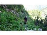
this is that path among the eagles, where we have already ascended. It was necessary to descend and find another lower path.1
water at the hut.2
like
S.Maja5. 08. 2026 11:23:08
On Monday 3.8.2026 the plan was Nizki vrh from planina Bukovec, but we didn't find good passages (now I know that we were looking quite a bit higher; we should have looked lower, where we were looking everything ended with a cliff), so after searching we went towards the Kanja saddle and continued in the direction of Zagorelec. There the orientation is not difficult, and the ridge to Zagorelec is not difficult either, as it is wide. The most annoying spot is the descent from the Kanja saddle back to Bavšica, where there is quite a bit of "scree". There is no water at the hunting lodge, but it flows a little lower down. The path is mowed, so no major problems with nettles. nasmeh It was a nice exploration; in the whole day we didn't meet anyone.nasmeh
Morning greeting1
The path is mown2
View back towards Bavšica3
No water4
Hunting hut5
Here it won't work...6
Already on the other side, view into Trento, Zapotoški vrh, Srebrnjak, Trentski Pelc...7
8
Šmihelovec9
Bavški Grintovec10
Wonderful views, Prisojnik, Razor...11
Summit12
Ridge to Zagorelec13
View back14
Nicely visible Kanja saddle and Šmihelovec15
Peak of Kanj and below Bavšica16
From there we came17
18
(+3)like
Page:123
You must log in to post a comment:
Username:
Password:
Login
If you do not yet have a username, you must first register.
         
Copyright © 2026 Hike.uno, Terms of use, Privacy and cookies