Bohinjsko sedlo - Črna prst
Starting point: Bohinjsko sedlo (1277 m)
| Latitude/Longitude: | 46,24090°N 14,01010°E |
| |
Walking time: 5 h
Difficulty: easy marked way
Elevation gain: 567 m
Elevation difference along the route: 1050 m
Map: Škofjeloško in Cerkljansko hribovje 1:50.000
Recommended equipment (summer): helmet
Recommended equipment (winter): helmet, ice axe, crampons
Views: 16.913
 | 1 person like this post |
Access to starting point:
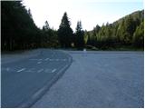
A) From the highway Ljubljana - Jesenice, take the Lesce exit and follow the road towards Bled and then towards Bohinjska Bistrica. From Bohinjska Bistrica, continue left in the direction of Tolmin and Soriška planina. Follow this road to a large parking lot near the ski center Soriška planina.
B) From Železniki, drive towards Podbrdo or vice versa, but only to the spot where signs for Soriška planina direct us onto an ascending road. Follow this road to a large parking lot at the foot of the ski area Soriška planina.
Route description:
From the parking lot, we continue west on a gentle macadam road towards the Litostrojska koča hut on Soriška planina. Further on, the road ascends moderately and quickly brings us to the mentioned hut.
From the hut, we continue straight on the marked path towards Lajnar, Možic and Šavnik. The path first ascends for some time parallel to the ski lift, then splits into two parts. We continue on the right path, beside which we notice the sign Možic (straight to Lajnar), which gradually begins to ascend more steeply. Higher up, we cross a belt of low forest, then gradually arrive in a small valley. From the valley, we head slightly right, then along the path that ascends transversely across the grassy slope, and in a few minutes reach the old Italian karavla.
From the karavla, beside which there is also a nicely arranged small shepherd hut, we ascend in a few steps onto the grassy ridge, where the path from Lajnar and Petrovo Brdo joins us. Here, we first continue right, then after a few steps left downhill (sharply left to Slatnik peak 3 minutes). A short descent follows and the path brings us to the next junction, where we again continue slightly left (straight to Možic 10 minutes). We continue towards Šavnik and Črna prst, and the path quickly descends into the forest. A short somewhat steeper descent through the forest follows, then the path levels out and brings us to the grassy hollow named Na Poljani. Here we continue left (right downhill to the mountain pasture Planina za Šavnikom) and ascend across the meadow to a small saddle between Slatnik on the left and Šavnik on the right.
From the saddle, from which the path to Šavnik branches right, we continue straight and then immediately left into the forest through which we begin to descend. During the descent, we can notice a renovated old military bunker on the right side; we follow the path, from which we occasionally get some views towards Porezen and Baška grapa, to the saddle Vrh Bače.
From the saddle, we first go right, then at the marked junction at the end of the road left into the forest. A few minutes of ascent through the forest follow, then the path levels out and brings us to the GRS hut. Further on, a short descent follows, and the path from the slopes of Šanc gradually transitions to the less overgrown slopes of Kobla. Here we first ascend through sparse forest, then the path brings us to a slightly exposed ridge along which we begin to ascend steeply (in wet conditions there is a risk of slipping in some places). Higher up, the ridge flattens, the path turns right, and after one more minute of walking brings us to the indistinct summit of Kobla.
From Kobla, a slight descent follows, then the path continues along a less steep ridge towards the neighbouring Krevl. Towards the summit of Krevl, a marked path branches somewhat further left towards "Kobla žig" (stamp); we continue straight and bypass the summit on the right side, which is otherwise only a few dozen paces away.
On the other side of Krevl, the path begins to descend again, this time to the nearby ski area. When we reach the edge of the ski run, we notice signs for Črna prst directing us left downhill. Some more descent follows, then we arrive at the small marsh Na Kalu, where there is also a less noticeable junction. We continue on the right path (left over a small saddle leads the old shepherd path crossing the southern slopes of the lower Bohinj mountains, which later joins the path from Podbrdo to Črna prst), which continues gently descending and a bit lower brings us to a marked junction where the path from the mountain pasture Za Črno goro joins from the right.
At the mentioned junction, we continue slightly left, then begin moderately ascending through the forest. Higher up, the trail makes a few long switchbacks, then from the increasingly sparse forest or belt of shrubs brings us to the screes below Rušni vrh. Here the path temporarily flattens, then on the other side of the scree steeply ascends along the grassy gully below the Home ridge. On this section, in late spring there is increased danger of falling rocks. Higher up, the gully ends, and the path crosses a short steep slope where snow can persist until early summer. Above the steep section, we join the path from Orožnova koča, and just a few meters higher we step onto the ridge at the saddle Čez Suho.
Here we continue right and, with views of Baška grapa, Bohinj and the highest peaks of the Julian Alps, ascend in a few minutes to the Dom na Črni prsti hut, located just a few meters below the summit.
We bypass the Dom Zorka Jelinčiča hut on the left side and over a short steep slope ascend in a few steps to the panoramic summit.

Photos:
 1
1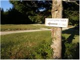 2
2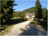 3
3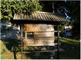 4
4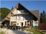 5
5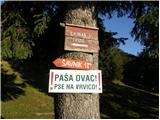 6
6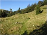 7
7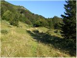 8
8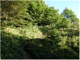 9
9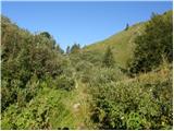 10
10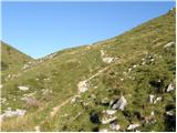 11
11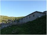 12
12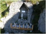 13
13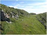 14
14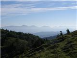 15
15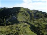 16
16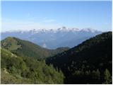 17
17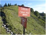 18
18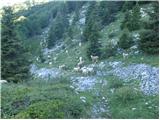 19
19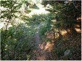 20
20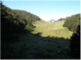 21
21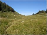 22
22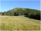 23
23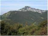 24
24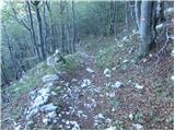 25
25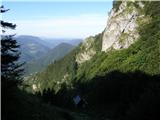 26
26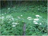 27
27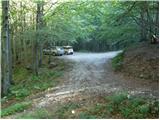 28
28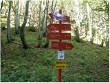 29
29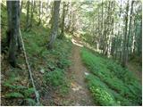 30
30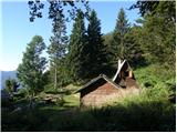 31
31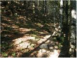 32
32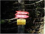 33
33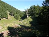 34
34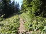 35
35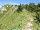 36
36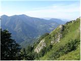 37
37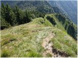 38
38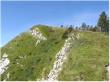 39
39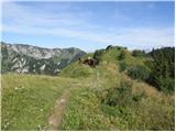 40
40 41
41 42
42 43
43 44
44 45
45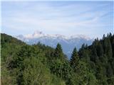 46
46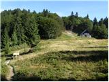 47
47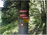 48
48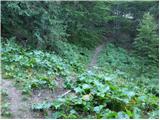 49
49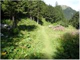 50
50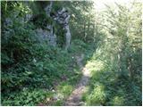 51
51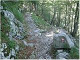 52
52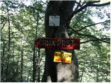 53
53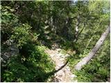 54
54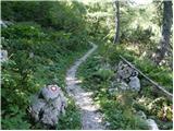 55
55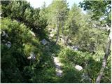 56
56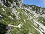 57
57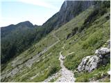 58
58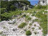 59
59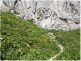 60
60 61
61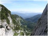 62
62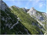 63
63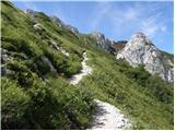 64
64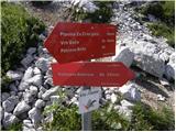 65
65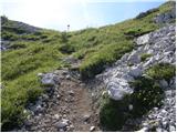 66
66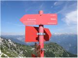 67
67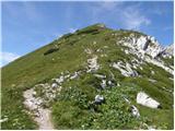 68
68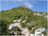 69
69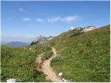 70
70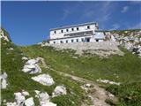 71
71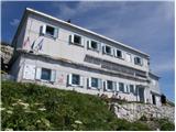 72
72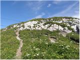 73
73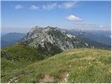 74
74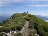 75
75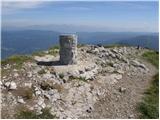 76
76 77
77
Discussion about the trip Bohinjsko sedlo - Črna prst
To post a comment you must log in:
If you do not yet have a username, you must first
register.