Starting point: Bučan (1010 m)
| Latitude/Longitude: | 46,44630°N 14,25640°E |
| |
Walking time: 1 h 30 min
Difficulty: easy marked way
Elevation gain: 493 m
Elevation difference along the route: 510 m
Map: Karavanke - osrednji del 1:50.000
Recommended equipment (summer):
Recommended equipment (winter): ice axe, crampons
Views: 5.469
 | 1 person like this post |
Access to starting point:
From the Ljubljana - Jesenice highway we take the Ljubelj (Tržič) exit, then continue driving in the direction of Celovec / Klagenfurt. After the Ljubelj tunnel the road starts descending, and on the Austrian side we follow it to the first left turn, where the old Ljubelj road branches off to the right. We park at an appropriate place by the crossroads, or we can also park higher on the Austrian side of the former border crossing Ljubelj.
Route description:
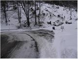
From the starting point, we go on the old Ljubelj road which is closed to public traffic by a traffic sign. The road at first moderately ascends over two zig-zags, and then continues along the stream to the ruins of former church of St. Lenart, by which stands a somewhat larger sign. Here the road turns to the left and gradually goes away from the valley. From the road then nice views start opening on Palec and other surrounding peaks. The road ahead leads past a smaller crossroad, where we continue sharply right on "main" road, and then in a moderate ascent we cross steep slopes (danger of falling stones, or in the winter time avalanche and slipping). Higher, the road makes a few hairpin turns, and then it brings us to the marked junction, where a marked footpath towards Košutica / Loibler Baba branches off to the left. We continue on a wider road and in 10 minutes of additional walking, we get to an old border crossing, after which stands a mountain hut Koča na Ljubelju.
From the mountain hut, we continue right in the direction of Zelenica and Povna peč (Polna peč). The path ahead goes past the mountain hut and immediately behind it starts ascending. The steepness soon decreases and the path brings us to a mostly vegetated ridge, from which occasionally some views open up. After additional few minutes we already notice in front of us the peak Polna peč, which the path bypasses on its northern side on steep slopes. The path which almost circles the peak brings us to the next junction only a few steps below the summit. Here we continue left in the direction of Povna peč (Polna peč) on the path which in a few steps brings us to a panoramic peak (right Zelenica on the ridge of Ljubeljščica).

Photos:
 1
1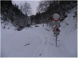 2
2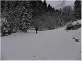 3
3 4
4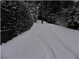 5
5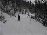 6
6 7
7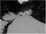 8
8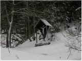 9
9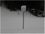 10
10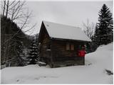 11
11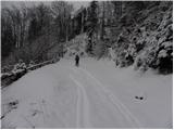 12
12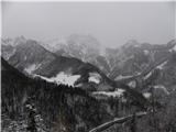 13
13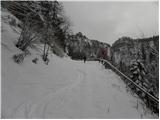 14
14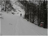 15
15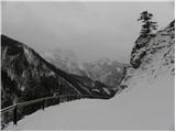 16
16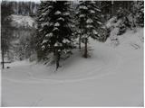 17
17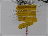 18
18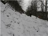 19
19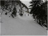 20
20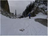 21
21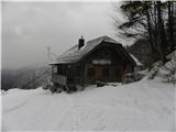 22
22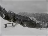 23
23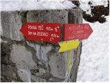 24
24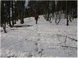 25
25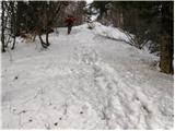 26
26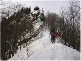 27
27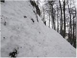 28
28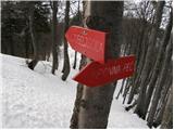 29
29 30
30
Discussion about the trip Bučan - Polna peč
To post a comment you must log in:
If you do not yet have a username, you must first
register.