Collina - Monte Volaia / Wolayer Kopf (path 141)
Starting point: Collina (1255 m)
| Latitude/Longitude: | 46,58689°N 12,84349°E |
| |
Route name: path 141
Walking time: 4 h
Difficulty: very difficult marked way
Elevation gain: 1215 m
Elevation difference along the route: 1230 m
Map: Tabacco 01 1:25.000
Recommended equipment (summer): helmet
Recommended equipment (winter): helmet, ice axe, crampons
Views: 962
 | 2 people like this post |
Access to starting point:
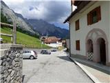
From Trbiž/Tarvisio we head onto the motorway towards Videm/Udine. We leave the motorway at the exit for Tolmezzo. At Tolmezzo we then also leave the road which leads towards the pass Passo di Croce Carnico / Plöckenpass and head towards Villa Santina. In Villa Santina at the roundabout we go straight following the signs for Ovaro, Sappada. We follow this road all the way to Forni Avoltri, where we turn right following the signs for Collina. We then follow the asphalt road to the settlement Collina. In the settlement Collina we then continue on the left upper road which leads towards the centre of the village. The road then leads us through the nicely arranged centre of the village paved with cobblestones. Immediately after that we turn left uphill onto the narrow street Via del Leone. At the first crossroads we again turn left and continue a few tens of metres more to the parking lot by the retaining wall.
Route description:
From the parking lot, we continue on the road past the last houses, and then the road turns into a cart track. For some time we then walk on the mentioned cart track which crosses panoramic slopes by the pastures, then a little before the right turn we come to a junction.
On the left side, we will notice a bench, but we head right uphill on a worse, slightly overgrown cart track where a wooden signpost with the inscription Forcella Ombladet 141 also directs us. On the cart track, we ascend past a smaller structure with a transmitter, then the cart track brings us into the forest. Here the cart track turns into a footpath on which we then ascend through the forest for quite some time. The footpath through the forest is still quite nice, but when a little higher we cross some clearings we will quickly notice that the path is very poorly visited and quite overgrown. While walking through the forest we otherwise follow mostly damaged signposts with the inscription »Forcella Ombladet« and wooden plaques with the marking »141«.
Higher when we come out of the forest onto grassy terrain the footpath starts to disappear. The path otherwise runs towards the north parallel with the valley of the stream Rio Collinetta, which is located on our left deep below us. Further on we then ascend grassy slopes for some time on a hardly traceable footpath, and from the path increasingly beautiful views open up on the surrounding peaks and on the already mentioned valley of the stream Rio Collinetta. At an altitude of approximately 1700m a red plaque with the marking »141« then directs us right towards the mountain pasture Casera Chiampei. Here we walk on overgrown grassy slopes, and for orientation we are helped by some wooden stakes with blazes. We continue past some ruins on the mountain pasture, then we will notice a plaque in front of us which again directs us left.
Next follows traversing grassy slopes and the footpath occasionally becomes somewhat more visible. Here a better view also opens up towards the notch Forcella Ombladet. The relatively flat path further runs towards the north and brings us to the bed of a torrent under steeper rocky slopes. Further on we then start to ascend more steeply up the small valley along the mentioned torrent bed. A relatively steep path, which runs mostly on grassy terrain, then brings us to the notch Forcella Ombladet, where there is also a marked junction.
Left the path leads towards the summit Cima Ombladet, straight down leads the path towards the place Pierabech, but we continue right on path 176A towards the summit Monte Volaia. From the junction we then ascend on grassy terrain towards the northeast. This is followed by an ascent over a short scree slope, then the path turns right and after crossing grassy slopes brings us to a junction.
Here path 176 from the Edelweiss hut joins us from the right, which is slightly better trodden compared to ours. At the junction we head left, then the path turns right and then ascends in zigzags for quite some time on the increasingly panoramic slope. The grass then ends and we ascend on a rocky slope all the way to the military ruins from the time of the First World War, which are located along the ridge below the summit Sasso Nero. From the ridge a magnificent view also opens up on the Austrian side towards Monte Coglians and other nearby peaks in the mountain group.
Here the path turns left and becomes more demanding. Further the path runs on the left side of the ridge and on a ledge crosses exposed slopes. The path is not secured so even more caution is needed. We continue crossing the exposed slope, along the path we will notice a few more military trenches and ruins then the path brings us to a smaller notch and a tunnel where the secured climbing path from the Austrian side used to end. The mentioned path is now closed, as the signs also warn.
For some time we still cross steep slopes on the western side of the ridge, then the path turns slightly right and starts ascending more steeply. The ascent is relatively steep and we must also use our hands. We ascend like this for some time then the path turns left and another crossing follows. The path here is very narrow in places, and occasionally there is quite a lot of scree on the path so caution is still needed. The path then starts ascending again and at the last steeper ascent we must again use our hands. When we reach the ridge we continue right and quickly reach the panoramic summit.
We can descend by the ascent path or by path 176 past the mountain pasture Casera Chianaletta towards the Edelweiss hut. From the mentioned hut we then have another good 10 minutes of walking on the road back to the starting point in Collina.

Along the route: Casera Chiampei (1761m), Forcella Ombladet (2060m), Tacca del Sasso Nero (2351m)
Photos:
 1
1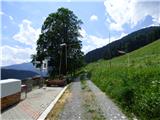 2
2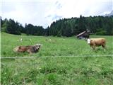 3
3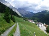 4
4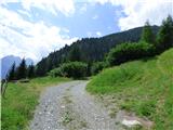 5
5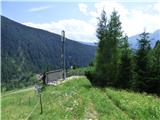 6
6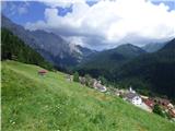 7
7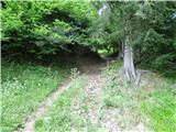 8
8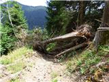 9
9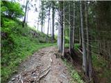 10
10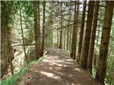 11
11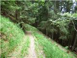 12
12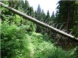 13
13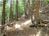 14
14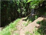 15
15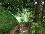 16
16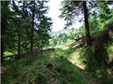 17
17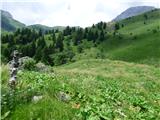 18
18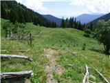 19
19 20
20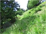 21
21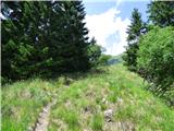 22
22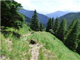 23
23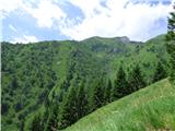 24
24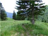 25
25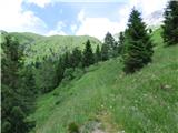 26
26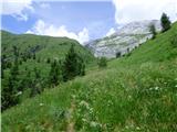 27
27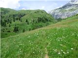 28
28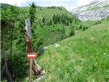 29
29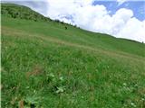 30
30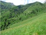 31
31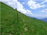 32
32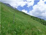 33
33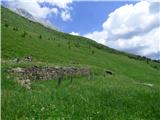 34
34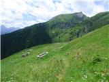 35
35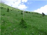 36
36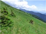 37
37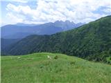 38
38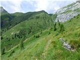 39
39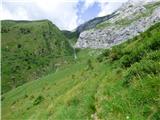 40
40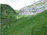 41
41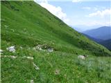 42
42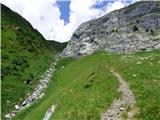 43
43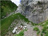 44
44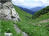 45
45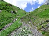 46
46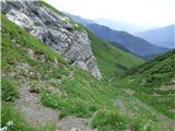 47
47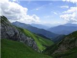 48
48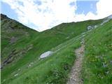 49
49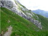 50
50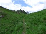 51
51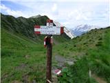 52
52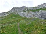 53
53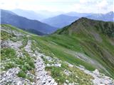 54
54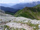 55
55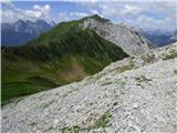 56
56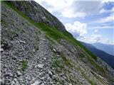 57
57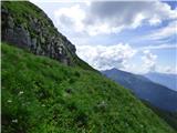 58
58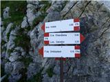 59
59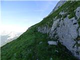 60
60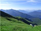 61
61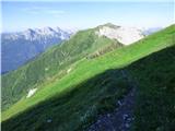 62
62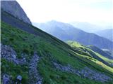 63
63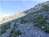 64
64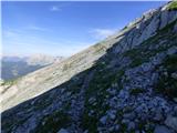 65
65 66
66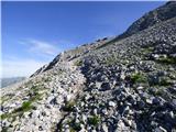 67
67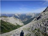 68
68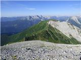 69
69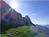 70
70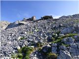 71
71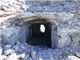 72
72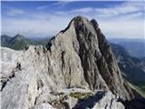 73
73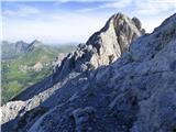 74
74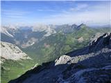 75
75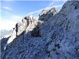 76
76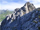 77
77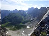 78
78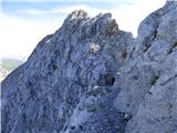 79
79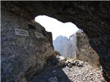 80
80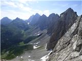 81
81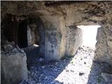 82
82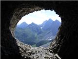 83
83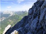 84
84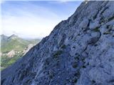 85
85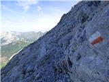 86
86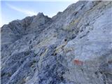 87
87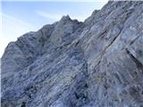 88
88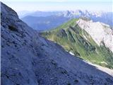 89
89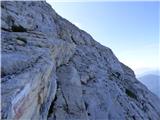 90
90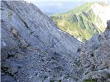 91
91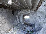 92
92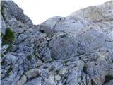 93
93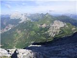 94
94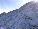 95
95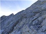 96
96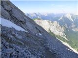 97
97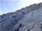 98
98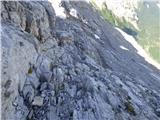 99
99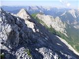 100
100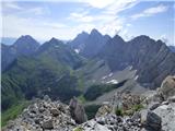 101
101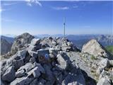 102
102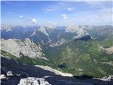 103
103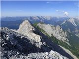 104
104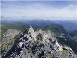 105
105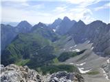 106
106
Discussion about the trip Collina - Monte Volaia / Wolayer Kopf (path 141)
|
| mirank19. 01. 2026 20:43:02 |
We descended here this year, on picture 34 there's a change, the alpine pasture is partially emergency renovated. For accommodation they probably brought a trailer with a helicopter. Two black men were guarding the herd of sheep
|
|
|
To post a comment you must log in:
If you do not yet have a username, you must first
register.