Dom v Lepeni - Batognica (via Krnska škrbina)
Starting point: Dom v Lepeni (700 m)
| Latitude/Longitude: | 46,30370°N 13,68140°E |
| |
Route name: via Krnska škrbina
Walking time: 4 h 50 min
Difficulty: partly demanding marked way
Elevation gain: 1464 m
Elevation difference along the route: 1464 m
Map: Julijske Alpe - zahodni del 1:50.000
Recommended equipment (summer):
Recommended equipment (winter): ice axe, crampons
Views: 17.395
 | 3 people like this post |
Access to starting point:
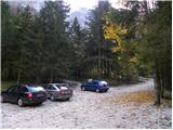
Between Trenta and Bovec, at the village of Soča, a road branches off to Lepena. We follow this fully asphalted road to the parking lot at the Dom v Lepeni mountain hut.
Route description:
From the Dom dr. Klementa Juga in Lepena we continue on a wide marked path in the direction of the Krn Lakes. The wide and not too steep path splits into two parts after a few minutes of walking. The left one, which is somewhat steeper, is the usual one, the right one, gentler and somewhat longer, is suitable for small children and the elderly. Both paths mostly ascend through the forest to the upper station of the cableway and cross each other several times on the way. From the upper station of the cargo cableway we continue on the same path, which gently ascends along a wide transport road that quickly brings us to the snow height measurement (every year in April). From here the road starts to descend and takes us past the turn-off to Velika Baba quickly to the next junction, where we leave the road and continue left downhill on the footpath, which brings us to the Dom pri Krnskih jezerih in a few minutes (if we continue on the road we bypass the mountain hut).
From the hut we continue straight in the direction of Krn and Krnsko jezero on a gentle path to which soon joins the path that bypasses the mountain hut. We continue past the shepherd's hut, behind which we reach the next junction, where we again continue in the direction of Krn (left Bogatin, Mali Šmohor and Dom na Komni).
The gentle path then brings us after a further few minutes to the pearl of the Krn mountain range. In front of us we see Krnsko jezero and beside it inviting meadows for resting. The marked path then leads us along the left side of the lake at the foot of the scree of Mali Šmohor. On the other side of the lake the path turns slightly to the left and then ascends a somewhat steeper slope, where somewhat higher an unmarked (upper) path joins us, which crosses the screes above Krnsko jezero in a traverse ascent (this path is somewhat shorter but exposed to falling rocks). The path then turns somewhat to the right and brings us to extensive deposits of torrential debris, which end on the Planina na Polju.
With wonderful views of the surrounding peaks we cross the grassy Planina na Polju (on the right side, somewhat off the marked path we will notice a hunting hut) and behind it we begin to ascend a small valley. The path then ascends somewhat more steeply and soon brings us to an unmarked junction. The marked path leading towards Krnska škrbina turns right here (straight unmarked path towards the saddle Prag (2068m)) and begins to ascend more steeply. The path then goes over steep slopes across which we ascend in a traverse to Krnska škrbina (on this section we may encounter snow patches in early summer).
From Škrbina we continue left (sharply left Preval Prag, straight downhill Planina Kuhinja and right Krn) on the path that begins to ascend steeply on the south side of Batognica. The path, which becomes technically demanding, leads us over an exposed section across which we ascend with the aid of relatively narrow steps. In wet or snow there is a high risk of slipping. Higher up the path levels out and brings us to the summit without major difficulties.
Dom v Lepeni - Krnsko jezero 2:15, Krnsko jezero - Batognica 2:35.

The trip can be extended to the following destinations: Krn
Photos:
 1
1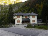 2
2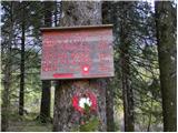 3
3 4
4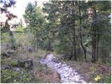 5
5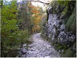 6
6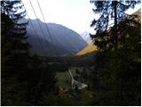 7
7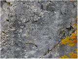 8
8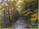 9
9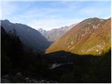 10
10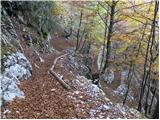 11
11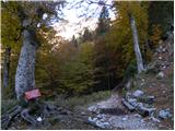 12
12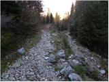 13
13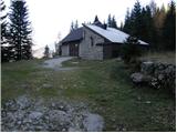 14
14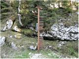 15
15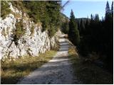 16
16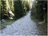 17
17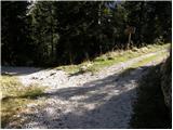 18
18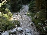 19
19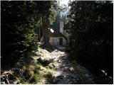 20
20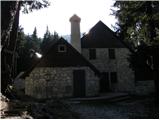 21
21 22
22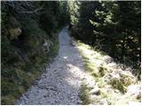 23
23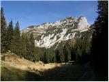 24
24 25
25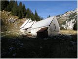 26
26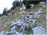 27
27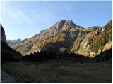 28
28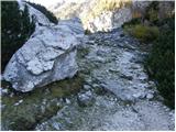 29
29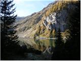 30
30 31
31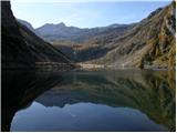 32
32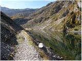 33
33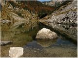 34
34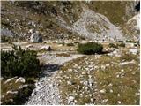 35
35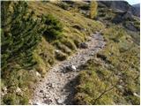 36
36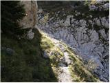 37
37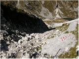 38
38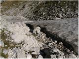 39
39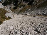 40
40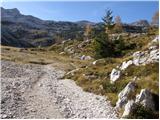 41
41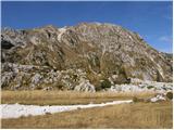 42
42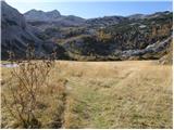 43
43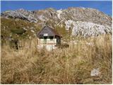 44
44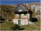 45
45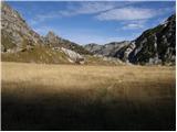 46
46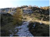 47
47 48
48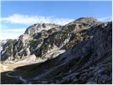 49
49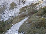 50
50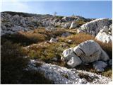 51
51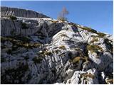 52
52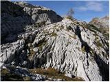 53
53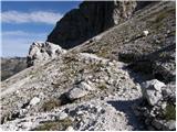 54
54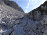 55
55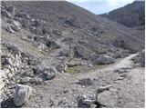 56
56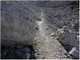 57
57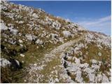 58
58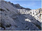 59
59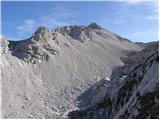 60
60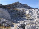 61
61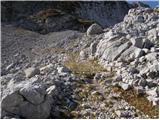 62
62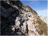 63
63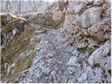 64
64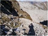 65
65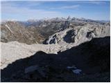 66
66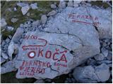 67
67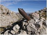 68
68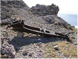 69
69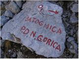 70
70 71
71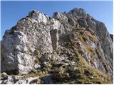 72
72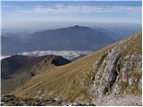 73
73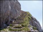 74
74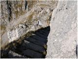 75
75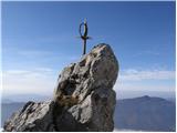 76
76 77
77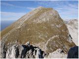 78
78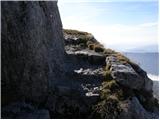 79
79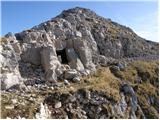 80
80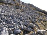 81
81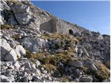 82
82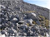 83
83 84
84 85
85
Discussion about the trip Dom v Lepeni - Batognica (via Krnska škrbina)
|
| ROBERT18. 08. 2006 |
The stairs are super, only at the top the stamp is missing!!! I would like to know who is responsible for that!! ps. the weather was excellent.
|
|
|
|
| kamchatka30. 06. 2010 |
Hi, can I ask if anyone went to Batognica from Dom v Lepeni via Prehodci saddle and Malen peak (1758 m)? I would like to ask what this path is like and how long it might take.. I would like to do a circular route, but I'm not sure if it's not too long for one day.. Thanks! K.
|
|
|
|
| ales502. 09. 2011 |
I went to Batognica from Dom v Lepeni, not from Lepinja, because Lepinja doesn't help you to the top, ,the path is demanding even for the best hikers, it all depends on fitness, for such a path one day is too little, better overnight at Gomiščikovo zavetišče, because you can't elsewhere, you can't on Batognica and there's no place either, so head on the path, lp ,the path is demanding even for the best hikers, it all depends on fitness, for such a path one day is too little, better overnight at Gomiščikovo zavetišče, because you can't elsewhere, you can't on Batognica and there's no place either, so head on the path, lp
|
|
|
|
| EUGEN12. 09. 2011 |
A flatbread would be nice along the way, I also hiked this trail yesterday. However, bad luck at the top with no view, delayed by an hour because after 12 o'clock the summit is often in fog.
|
|
|
|
| ales5012. 09. 2011 |
I had total bad luck with the weather up there, thunderstorm like being in the middle of artillery bombardment, mix of rain and 130 km/h wind, you really have to catch good weather and the right day, but I still took a few photos.
|
|
|
|
| panda25. 07. 2014 |
Yesterday (24.07.) on the way back from Krn, I also visited Batognica (slept in the shelter). The ascent is quite adrenaline-pumping (initial entry and steps - especially on the way back you need a cool head). View super, a bit windy.....return to Lepena over three snowfields - two quite extensive, requiring considerable caution (quite hard in the morning - crampons recommended - ordinary ones suffice).
|
|
|
|
| Lazo14. 07. 2020 |
Another successful mountain trip.
This video shows the entire partially difficult marked trail from Dom v Lepeni (Dom Dr. Klementa Juga) to Batognica and Krn. The trail was without issues. Suitable for all age groups, just needs a bit more fitness if you want to do it all in one day. I definitely recommend the trail, as it rewards us with numerous views and also remnants from the First or Second World War.
Here is the entire trail if anyone is interested in more detail.
https://www.youtube.com/watch?v=VCS8_VWOTCU&list=PLCxvFZAu2k7ZlICujW4asZmxFO7md7THq&index=9&t=0s
|
|
|
To post a comment you must log in:
If you do not yet have a username, you must first
register.