Dom v Lepeni - Koča pod Bogatinom
Starting point: Dom v Lepeni (700 m)
| Latitude/Longitude: | 46,30370°N 13,68140°E |
| |
Walking time: 5 h
Difficulty: easy marked way
Elevation gain: 813 m
Elevation difference along the route: 1130 m
Map: TNP 1:50.000
Recommended equipment (summer):
Recommended equipment (winter): ice axe, crampons
Views: 4.742
 | 2 people like this post |
Access to starting point:
Between Trenta and Bovec, at the village of Soča, a road to Lepena branches off. We follow this fully asphalted road to the parking lot at the Dom dr. Klementa Juga in Lepena.
Route description:
From the Dom dr. Klementa Juga in Lepena we head onto the path in the direction of the Dom pri Krnskih jezerih, Gomiščkovo zavetišče na Krnu and Dom na Komni. Already immediately from the parking lot the path enters the forest, through which it ascends on a wide mule track. Along the mule track we mostly ascend moderately (the steep variant of the ascent in the lower part has not been in use for some time) through the forest, only occasionally opening up some views towards the valley and surrounding mountains. During the ascent we several times also cross the route of the cargo cableway, whose crossing is forbidden during the operation of the cableway. After a good hour and a half of walking the path flattens and a little further brings us to the upper station of the cargo cableway.
From here the path leads along the edge of a smaller valley, quickly bringing us to the spot where every year in April they measure the height of the snow cover. A short descent follows, then we arrive at a marked junction where the path to Velika Baba branches off to the left. We continue straight ahead, and the path soon splits again.
We can continue on the left path, which leads past the Planinski dom pri Krnskih jezerih, or on the right, only slightly shorter path, which bypasses the mountain hut. Both paths join before the mountain dairy on Planina Duplje, and after the mountain dairy we arrive at the next junction.
We continue left in the direction of Dom na Komni (straight to Krn and Krnsko jezero) on the path from which soon to the right branches off the path to Veliki Šmohor, after a shorter ascent at the beginning of the depression Doliči, also to the right the path to Prehodci. In both cases we continue straight, then after a temporary flattening, the path starts to ascend more steeply again. When the path flattens again, we arrive in the small valley Za Lepočami, where the path leads past several buildings from the time of the Rapallo border, which the Italians built for the needs of protecting the state border. After Za Lepočami another path from Prehodci joins from the right, and we continue in a moderate ascent, with occasional completely flat sections, all the way to Bogatinsko sedlo, where there is the next marked junction.
From Bogatinsko sedlo, where the path to Lanževica branches off to the left and to the right the path to Bogatin, we continue straight in the direction of Koča pod Bogatinom and Dom na Komni and begin to descend towards the Planina na Kraju. With nice views we first descend moderately, lower only gently. When we reach the mountain pasture, at the junction we continue right and walk to the nearby Koča pod Bogatinom.
Lepena - Dom pri Krnskih jezerih 2:00, Dom pri Krnskih jezerih - Bogatinsko sedlo 2:00, Bogatinsko sedlo - Koča pod Bogatinom 1:00.
The description refers to the condition in August and September 2018, and the pictures are from various periods.

The trip can be extended to the following destinations: The lake Krnsko jezero,
Dom na Komni ( 15 min),
Mali Šmohor,
Bogatin,
Kal,
Lanževica,
Mahavšček,
Velika Baba,
Batognica,
Vrh nad Peski,
Krn
Photos:
 1
1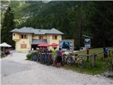 2
2 3
3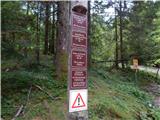 4
4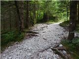 5
5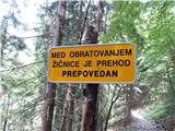 6
6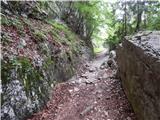 7
7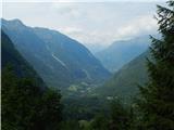 8
8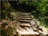 9
9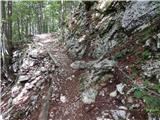 10
10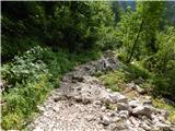 11
11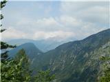 12
12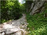 13
13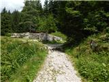 14
14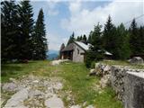 15
15 16
16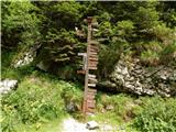 17
17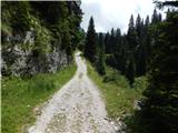 18
18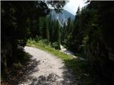 19
19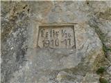 20
20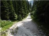 21
21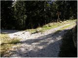 22
22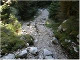 23
23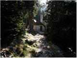 24
24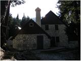 25
25 26
26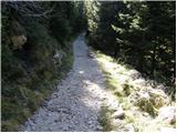 27
27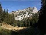 28
28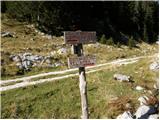 29
29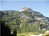 30
30 31
31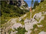 32
32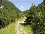 33
33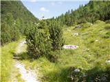 34
34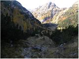 35
35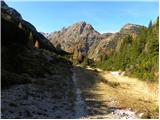 36
36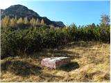 37
37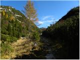 38
38 39
39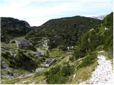 40
40 41
41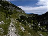 42
42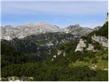 43
43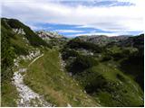 44
44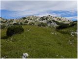 45
45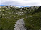 46
46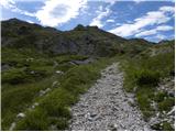 47
47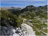 48
48 49
49 50
50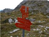 51
51 52
52 53
53 54
54 55
55 56
56 57
57 58
58 59
59 60
60 61
61 62
62 63
63 64
64 65
65 66
66 67
67
Discussion about the trip Dom v Lepeni - Koča pod Bogatinom
To post a comment you must log in:
If you do not yet have a username, you must first
register.