Draßnitz - Hochkreuz (via Oberdraßnitzer Alm)
Starting point: Draßnitz (1300 m)
Route name: via Oberdraßnitzer Alm
Walking time: 5 h 15 min
Difficulty: easy marked way
Elevation gain: 1409 m
Elevation difference along the route: 1409 m
Map:
Recommended equipment (summer):
Recommended equipment (winter): ice axe, crampons
Views: 3.391
 | 1 person like this post |
Access to starting point:
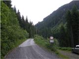
From Spittal we drive towards Lienz or vice versa, but only to the village Dellach. In the middle of the village we notice signs, which direct us to the right (from the direction of Spittal, from Lienz to the left) in the direction of Oberdraßnitzer Alm. At the crossroads we follow the ascending road in the mentioned direction, and then we drive along it to the barrier (approx. 1300 m) beyond which further driving is also forbidden.
Route description:
From the barrier we continue on the road which through two successive sharp turns quickly brings us to a crossroads of two roads. We continue on the right lower road in the direction of the mountain pasture Obere Draßnitzalm. The slightly ascending road then past a cross brings us to the next poorly marked junction, where we continue on the left side of the stream on a wide cart track (ascent possible also on the road). The cart track then past the cultural monument and higher across the grazing fence brings us to the lower part of the mountain pasture. Through the mountain pasture leads a nice panoramic path, which in a few minutes brings us to the huts on the mountain pasture.
From the mountain pasture we continue on the left side of the stream for approximately another 15 minutes, then across a small wooden bridge we cross the scenic stream. The path then retreats from the stream for a short time and goes into the larch forest, after which we arrive at a smaller wooden hut. Further ahead the last trees slowly disappear and the path for a short time again approaches the stream along which we can admire numerous rapids and smaller waterfalls. The increasingly poorly visible but marked path retreats from the stream again to the right and approaches it again only shortly before we step onto the high-alpine plain, where we notice a smaller wooden hut (emergency bivouac). Further we ascend through the marshy terrain along the edge of the valley, which starts turning to the left. The increasingly panoramic path then with the help of the marks brings us to the next junction, where we continue left in the direction of Hochkreuz (right Feldnerhütte). The path ahead crosses the high-alpine plateau and after a few minutes brings us below the summit slope of Hochkreuz. Further the path starts to ascend more steeply on the increasingly rocky slope, which remains covered with snow well into summer. After a half-hour ascent the path brings us to the ridge, where we continue right. Only 10 minutes of walking remain on the panoramic not too steep ridge (in snow and ice danger of slipping, on dry ground the path is easy).

Photos:
 1
1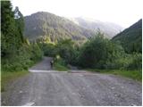 2
2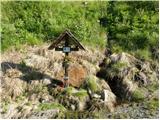 3
3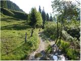 4
4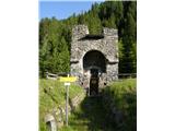 5
5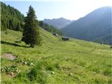 6
6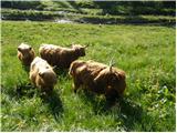 7
7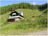 8
8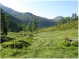 9
9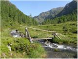 10
10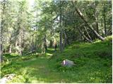 11
11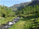 12
12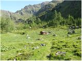 13
13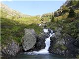 14
14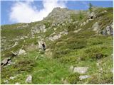 15
15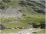 16
16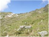 17
17 18
18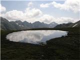 19
19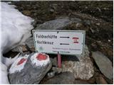 20
20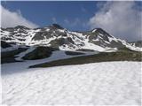 21
21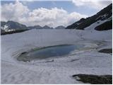 22
22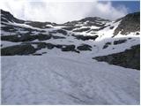 23
23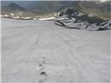 24
24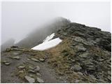 25
25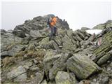 26
26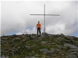 27
27
Discussion about the trip Draßnitz - Hochkreuz (via Oberdraßnitzer Alm)
To post a comment you must log in:
If you do not yet have a username, you must first
register.