Eko koča Nanos (Lovska koča Vojkovo) - Grmada (Nanos)
Starting point: Eko koča Nanos (Lovska koča Vojkovo) (805 m)
| Latitude/Longitude: | 45,79630°N 14,00960°E |
| |
Walking time: 1 h 45 min
Difficulty: easy unmarked way
Elevation gain: 404 m
Elevation difference along the route: 450 m
Map: Nanos 1:50.000
Recommended equipment (summer):
Recommended equipment (winter):
Views: 20.128
 | 2 people like this post |
Access to starting point:
a) From the Ljubljana - Koper motorway, take the Razdrto exit and continue on the old road through Razdrto towards the Vipava Valley. After a few km of descent on a rather winding road, we reach a junction where the road to Nanos branches off to the right. We take this road, which starts to climb more steeply and, higher up where the road levels out, leads to a small junction where a gravel road branches off to the right leading to the nearby hunting lodge. We continue towards the hunting lodge and park there in the large gravel parking area.
b) From the Nova Gorica - Ljubljana motorway, take the Vipava exit and continue on the road towards Podnanos. From Podnanos, continue on the old road towards Razdrto. Soon we reach a junction where the road to Nanos branches off sharply to the left. Continue following the description above.
Route description:
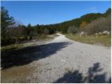
From the parking lot, we first walk to the Eko koča Nanos (former Lovska koča Vojkovo), then continue on the path in the direction of the signs for St. Jerome and Vojkova koča on Nanos. The traceable trail enters the forest after a few steps, where it begins to ascend gently. After a short climb, it leads us to the indistinct, forest-covered peak of Strmec, from which a short descent follows.
A little further on, we step out of the forest onto the vast and scenic grassy slopes, occasionally overgrown with shrubs and individual pines. The easy and barely noticeably ascending path then joins the gravel road for a short time, but leaves it again after a few steps. The trail moves slightly more to the right of the road and begins to ascend moderately across the increasingly scenic slopes of Nanos. Here, an unmarked path joins from the right, which branched off a little lower. The path ahead becomes noticeably steeper and after a few more minutes of walking leads us to the church of St. Jerome, visible from afar.
From the church we continue slightly to the right on the beaten path, which a little higher is joined from the right by the gentle path from Razdrto. In the direction of Vojkova koča we continue on the path, which after a few steps leads us to a less noticeable junction, where an unmarked trail to Grmada branches off to the left.
We take this initially less visible path, which climbs more steeply and soon leads us to a forest road, which we merely cross. We continue the ascent on a relatively steep path that climbs across the increasingly scenic grassy slope. Higher up, the path levels out somewhat, turns to the right and gradually leads onto an indistinct ridge, along which after a few more minutes of walking we reach the summit of Grmada.
Eko koča Nanos - sv. Hieronim 1:15, sv. Hieronim - Grmada 0:30.

Photos:
 1
1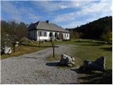 2
2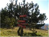 3
3 4
4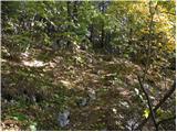 5
5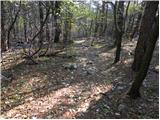 6
6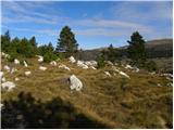 7
7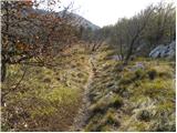 8
8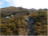 9
9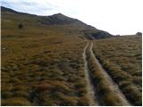 10
10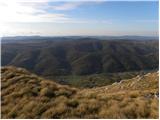 11
11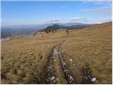 12
12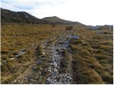 13
13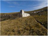 14
14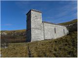 15
15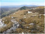 16
16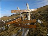 17
17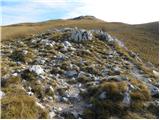 18
18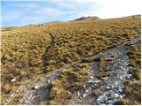 19
19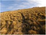 20
20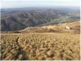 21
21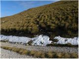 22
22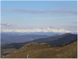 23
23 24
24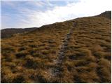 25
25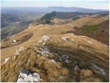 26
26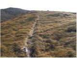 27
27 28
28
Discussion about the trip Eko koča Nanos (Lovska koča Vojkovo) - Grmada (Nanos)
|
| avtobivak22. 03. 2011 |
On Saturday, we lunar hikers set off exactly on this path. We had nice weather. A strong northerly wind was blowing, so we had a bit of fog at Vojkova koča. We stopped and sunbathed at the church of St. Hieronimus.
Magnificent view over the valley and the sea clearly visible.
|
|
|
|
| Balky7927. 09. 2011 |
Super!
On Saturday my wife and I went, Hunters' hut Vojkovo St. Jerome - Grmada - Vojkova hut - Pleša. Wind was very strong on Grmada especially, but gorgeous weather!
Trail (Track)
Pictures
|
|
|
To post a comment you must log in:
If you do not yet have a username, you must first
register.