Konec ceste na Vogar - Planina Ovčarija
Starting point: Konec ceste na Vogar (1350 m)
| Latitude/Longitude: | 46,29560°N 13,84120°E |
| |
Walking time: 2 h 10 min
Difficulty: easy marked way
Elevation gain: 310 m
Elevation difference along the route: 475 m
Map: Triglav 1:25.000
Recommended equipment (summer):
Recommended equipment (winter): ice axe, crampons
Views: 11.444
 | 1 person like this post |
Access to starting point:
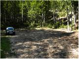
From the Ljubljana - Jesenice motorway, take the Lesce exit and follow the road towards Bled and further towards Bohinjska Bistrica. Continue driving towards Lake Bohinj (Ribčev laz), where you reach a junction and continue right towards Stara Fužina. In Stara Fužina, at the junction by the chapel, turn sharply left onto the ascending road towards planina Blato, planina Vogar and Voje valley. The road then brings us to the toll and parking fee collection point, follow it further to the next junction, where continue left (right Voje). Follow the road to the next junction (drive for quite some time), where continue straight (sharply right planina Blato). Follow the road past planina Vogar and drive along it to the parking lot at the end of the road.
From the toll collection point to the starting point is less than 11 km of driving, the last half or slightly less is entirely gravel.
Route description:
At the parking lot notice the signs for Planina Viševnik, which direct right onto a wide and initially quite steep tractor track. After a few minutes of steep ascent the track levels out, then continues without major elevation changes further through the forest. When the track turns right, continue straight on the marked footpath, which initially ascends gently for a short time. When the path steepens, notice a cairn on the left and a path beside it to Pršivec (it later joins the usual path from Vogar), continue straight on the steep mountain path. The path ascends steeply through forest for some time, then temporarily levels and leads to Brezno pit at Gamsova glavica (explored to 817 m depth). Above the pit the path enters an indistinct and upper steeper valleyette, ascend to small saddle between Pršivec (1761 m) left and Gornji Viševnik (1722 m) right. Here path levels completely, then continues across pastures of Gornji Viševnik. On other side returns to forest and descends in minutes to Planina Viševnik, where Bregarjevo shelter stands in the middle.
From Planina Viševnik continue slightly left (sharply left Pršivec, left Črno jezero, slightly right Planina pri Jezeru past Krištofojca, right Planina pri Jezeru) towards Planina Ovčarija and Triglav Lakes. Path first traverses up left across steeper slope, then gradually levels into plateau terrain. Continue southwest of Griva (1758 m) without major elevation changes for some time. Further on at direction signs unmarked pathlet continues straight to planina Dedno polje, turn sharply left to Planina Ovčarija. From signs path descends slightly, turns right continuing along sort of ledge or cirque. On other side moderately ascends again, then levels to shepherds' huts on Planina Ovčarija.
Hebed parking - Brezno pri Gamsovi glavici 0:55, Brezno pri Gamsovi glavici - Gornji Viševnik 0:10, Gornji Viševnik - Planina Viševnik 0:15, Planina Viševnik - Planina Ovčarija 0:50.

Along the route: Brezno pri gamsovi glavici (1608m), Gornji Viševnik (1680m),
Planina Viševnik (1625m), Smodlakov brlog (1714m)
The trip can be extended to the following destinations: Planina Blato,
Dom na Komni,
Planina Lopučnica,
Koča pri Triglavskih jezerih,
Rigeljc,
Stadorski Orliči,
Vrtec,
The lake Jezero v Ledvicah,
Rušnata glava,
The lake Zeleno jezero,
The lake Rjavo jezero,
Zasavska koča na Prehodavcih,
Mala Tičarica (1 h 25 min),
Velika Tičarica (1 h 35 min),
Kopica (2 h 25 min),
Čelo,
Mala Zelnarica,
Velika Zelnarica,
Veliko Špičje
Photos:
 1
1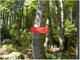 2
2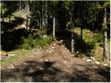 3
3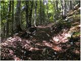 4
4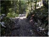 5
5 6
6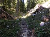 7
7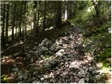 8
8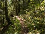 9
9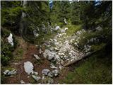 10
10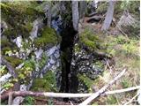 11
11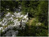 12
12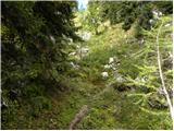 13
13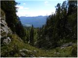 14
14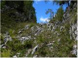 15
15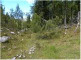 16
16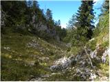 17
17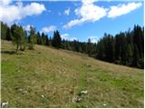 18
18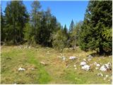 19
19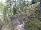 20
20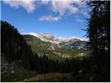 21
21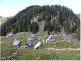 22
22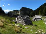 23
23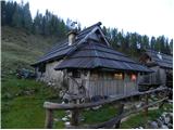 24
24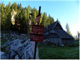 25
25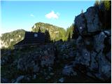 26
26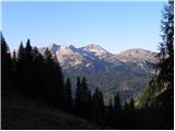 27
27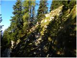 28
28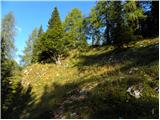 29
29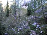 30
30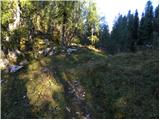 31
31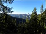 32
32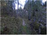 33
33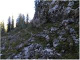 34
34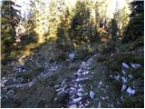 35
35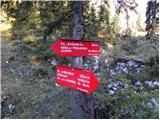 36
36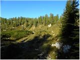 37
37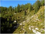 38
38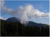 39
39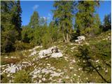 40
40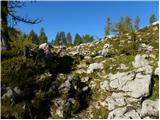 41
41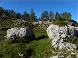 42
42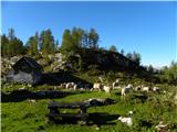 43
43
Discussion about the trip Konec ceste na Vogar - Planina Ovčarija
To post a comment you must log in:
If you do not yet have a username, you must first
register.