Erschbaum - Pfannspitze / Cima Vanscuro
Starting point: Erschbaum (1392 m)
| Latitude/Longitude: | 46,72111°N 12,50989°E |
| |
Walking time: 4 h 45 min
Difficulty: easy marked way
Elevation gain: 1286 m
Elevation difference along the route: 1480 m
Map:
Recommended equipment (summer):
Recommended equipment (winter):
Views: 4.036
 | 3 people like this post |
Access to starting point:
From Kranjska Gora over Korensko sedlo to Austria, where at the first major crossroad we continue left towards Podklošter / Arnoldstein and Trbiž / Tarvisio. At the end of the settlement Podklošter, signs for Šmohor / Hermagor direct us to the right onto a regional road, along which, past the mentioned settlement, we drive to the end of the Gailtal valley, or more precisely to the settlement Kötschach-Mauthen, where we turn right towards the settlement Oberdrauburg. The route ahead leads us over the Alpine pass Gailbergsattel (982 m), after which we descend into the mentioned settlement. After crossing the bridge over the river Drau, we continue left towards the settlement Lienz. In the main roundabout in Lienz, we continue "left" in the direction of the settlement Sillian and Italy. A few kilometers before Sillian, in the settlement Tassenbach, we turn left in the direction of the settlement Kartitsch into the Tiroler Gailtal valley. We continue through the settlement Kartitsch, and then in the settlement Erschbaum we turn right downhill onto a narrow road, which after a short descent crosses a wooden bridge and brings us to a crossroad of forest roads. In front of the crossroad near the sawmill there is also a parking lot where we park.
Route description:
From the starting point, we continue on the road and at the crossroad continue left following the signs »Erschbaumertal, Zum Klettersteig Gr. Kinigat«. The road is officially closed to traffic (traffic prohibited in both directions – forest road), but the vast majority continues driving and thus saves a good hour of walking.
The road is initially relatively flat and runs through the forest towards the east. At the crossroads, we follow the signs for Erschbaumertal and Große Kinigat. The road later turns right towards the south and runs mostly along the stream upwards. Higher up, the forest becomes sparser and a view towards the peaks Kleine and Große Kinigat begins to open up.
At the end of the Erschbaumertal valley, where there is also a small parking lot, the road ends and we continue slightly left onto a footpath. The path here begins to ascend somewhat more steeply through larch forest and brings us to a junction at Tascharrhütte.
We continue right towards the Obstansersee Hütte hut; to the left lead the climbing and eastern path to Große Kinigat. Our path then leads through a short stretch of forest and crosses a stream. In continuation, the path runs along the left side of the valley towards the west and ascends below the slopes of the Kleine Kinigat peak. The path then brings us to grassy slopes on the eastern side of the Rosskopf peak and begins to ascend somewhat more steeply. To the left, a fairly unnoticeable, unmarked and fairly poorly trodden path branches off towards the ridge between the Kleine Kinigat and Pfannspitze peaks. We continue along the marked path, which brings us to the Rosskopftörl saddle.
From the saddle, where there is a beautiful view of the surrounding peaks, we descend to the western side towards the lake and the Obstansersee Hütte hut. The path here descends just under 200 meters and brings us to a junction just before the hut.
Straight ahead it is just a few minutes' walk to the hut and the lake, while we at the junction continue left following the signs »Pfannspitze, Große Kinigat«. From the junction, the path begins to ascend again towards the south and brings us to a junction on the border ridge.
At the junction, where a view towards the Dolomites opens up, we continue left, followed by the ascent along the panoramic ridge to the Pfannspitze summit.

Along the route: Tscharrhütte (1935m), Rosskopftörl (2493m)
Photos:
 1
1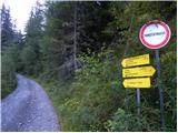 2
2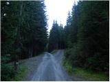 3
3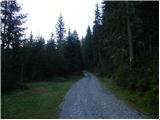 4
4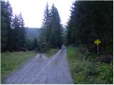 5
5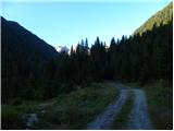 6
6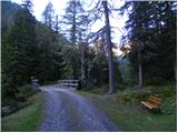 7
7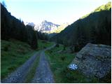 8
8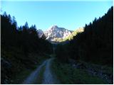 9
9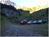 10
10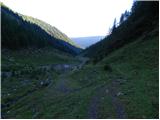 11
11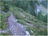 12
12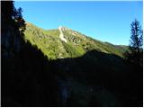 13
13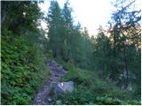 14
14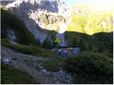 15
15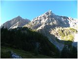 16
16 17
17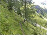 18
18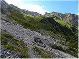 19
19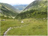 20
20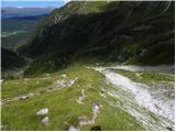 21
21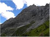 22
22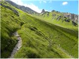 23
23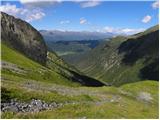 24
24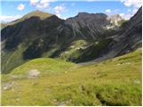 25
25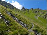 26
26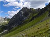 27
27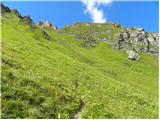 28
28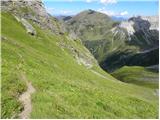 29
29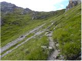 30
30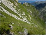 31
31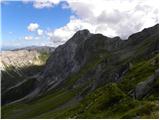 32
32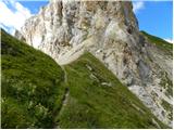 33
33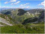 34
34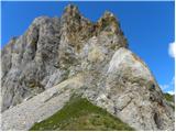 35
35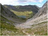 36
36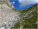 37
37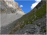 38
38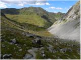 39
39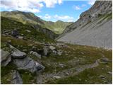 40
40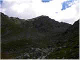 41
41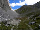 42
42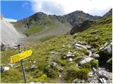 43
43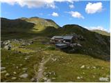 44
44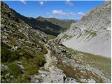 45
45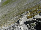 46
46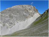 47
47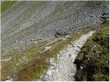 48
48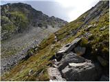 49
49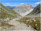 50
50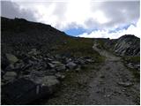 51
51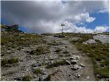 52
52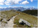 53
53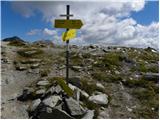 54
54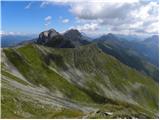 55
55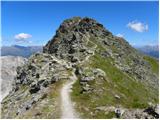 56
56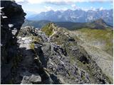 57
57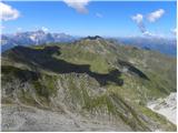 58
58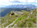 59
59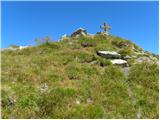 60
60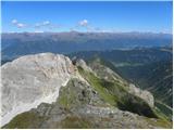 61
61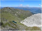 62
62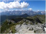 63
63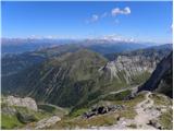 64
64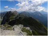 65
65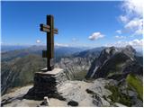 66
66
Discussion about the trip Erschbaum - Pfannspitze / Cima Vanscuro
|
| mirank18. 11. 2022 14:43:53 |
Like some other peaks in the border ridge, this one also has a description only from the Austrian side. From casere Silvella it is accessible via a nicer and more scenic path over the summit Cavallina-Grose Kinigat along the ridge path in one hour less time!
|
|
|
To post a comment you must log in:
If you do not yet have a username, you must first
register.