Gößgraben - Gießener Hütte
Starting point: Gößgraben (1600 m)
| Latitude/Longitude: | 46,98040°N 13,33510°E |
| |
Walking time: 1 h 30 min
Difficulty: easy marked way
Elevation gain: 615 m
Elevation difference along the route: 615 m
Map:
Recommended equipment (summer):
Recommended equipment (winter):
Views: 1.080
 | 2 people like this post |
Access to starting point:
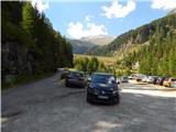
From the Karawanks Tunnel, we follow the highway towards Salzburg to exit Gmünd. We then follow the signs for the Maltatal valley. We follow the road that runs through the mentioned valley to the settlement Koschach. When we notice the Fallbach waterfall (highest waterfall in Koroška) on the right, we will soon come to a crossroad where we turn left over the bridge, which crosses the river Malta. Shortly thereafter, we again turn left onto a narrower road steeply upwards into the Gößgraben valley (signs for the mountain hut Gießener Hütte). We follow the road all the way to a large parking lot below the Goskarspeicher dam. The last few kilometers of the road are open only in the summer months when the mountain hut Gießener Hütte is open (from the beginning of July to the end of September).
Route description:
From the parking lot, we continue on the asphalt road which is closed to traffic. After a few minutes of ascent, we come to a crossroad where we continue right on a macadam road where a sign with the caption »Gießener Hütte« directs us. To the left is only a short ascent to the Gößkarspeicher lake.
At the junction, we also enter the National Park Hohe Tauern (Nationalpark Hohe Tauern). The road ascends continuously and increasingly beautiful views open up towards the mountain group Reißeck. During the ascent, we also cross grazing fences several times, as livestock grazes along the road in the summer months. Further on, we can walk along the road the whole time or take marked shortcuts. The forest becomes sparser and in the last part of the path towards the mountain hut we walk along rocky terrain. Here a nice view also opens up towards the summit Hochalmspitze and numerous streams that flow down the slope. We continue on the road and soon come to the Gießener Hütte hut.

The trip can be extended to the following destinations: Hochalmspitze
Photos:
 1
1 2
2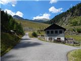 3
3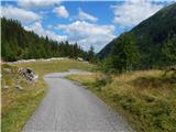 4
4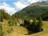 5
5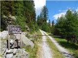 6
6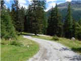 7
7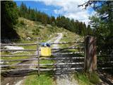 8
8 9
9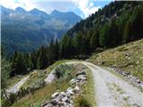 10
10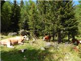 11
11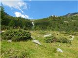 12
12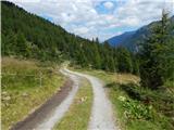 13
13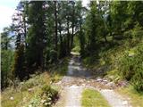 14
14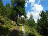 15
15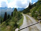 16
16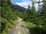 17
17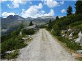 18
18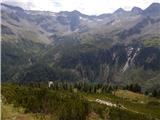 19
19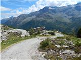 20
20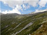 21
21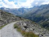 22
22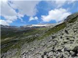 23
23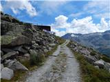 24
24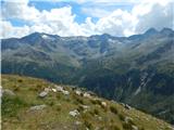 25
25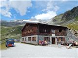 26
26
Discussion about the trip Gößgraben - Gießener Hütte
To post a comment you must log in:
If you do not yet have a username, you must first
register.