Gößgraben - Hochalmspitze (Detmolder Grat)
Starting point: Gößgraben (1600 m)
| Latitude/Longitude: | 46,98040°N 13,33510°E |
| |
Route name: Detmolder Grat
Walking time: 5 h 30 min
Difficulty: very difficult marked way
Elevation gain: 1760 m
Elevation difference along the route: 1770 m
Map:
Recommended equipment (summer): helmet, self belay set, ice axe, crampons
Recommended equipment (winter): helmet, self belay set, ice axe, crampons
Views: 15.976
 | 5 people like this post |
Access to starting point:
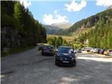
From the Karawanks Tunnel, we follow the highway towards Salzburg to the Gmünd exit. We then follow the signs for the Maltatal valley. We follow the road that runs through the mentioned valley to the settlement Koschach. When we notice the Fallbach waterfall (the highest waterfall in Carinthia) on the right, we will soon come to a crossroads where we turn left over the bridge that crosses the Malta River. Shortly after, we turn left again onto a narrower road steeply uphill into the Gossgraben valley (signs for the Gießener Hütte hut). We follow the road all the way to the large parking lot below the Goskarspeicher dam. The last few kilometers of the road are open only in the summer months when the Gießener Hütte hut is open (from the beginning of July to the end of September).
Route description:
From the parking lot, we continue on the asphalt road which is closed to traffic. After a few minutes of ascent, we come to a crossroads where we continue right onto the macadam road indicated by a sign reading »Gießener Hütte«. To the left is only a short ascent to Gößkarspeicher lake.
At the junction, we also enter the Hohe Tauern National Park (Nationalpark Hohe Tauern). The road ascends continuously and increasingly beautiful views open towards the Reißeck mountain group. During the ascent, we cross pasture fences several times, as livestock grazes along the road in summer months. Further on, we can walk along the road the whole time or take marked shortcuts. The forest becomes sparser and in the last part of the path to the hut, we walk beside rocky terrain. Here a nice view opens towards the summit Hochalmspitze and numerous streams flowing down the slope. We continue along the road and soon reach the Gießener Hütte hut.
From the hut, we continue on a footpath that immediately above the hut leads us to a junction. To the left, the path leads to the Mallnitzer Scharte notch and Arthur von Schmid Haus hut; we continue slightly right following the signs »Hochalmspitze«. Shortly after, an easy path to the nearby Winterleitenkopf peak branches off to the right.
The path further mostly runs over rock slabs that are initially nicely arranged so the ascent causes no problems. Here we enter the core area of the Hohe Tauern National Park and after a short ascent reach another junction.
To the right leads the path along the eastern ridge to Hochalmspitze; we continue left along path 519, the Schwarzenburger Weg. From the junction, the path crosses the slopes westwards for a while, crossing a few streams. Later it turns slightly right and begins to ascend somewhat steeper. The path, mostly over rock slabs, then brings us to a marked junction.
To the left leads the path to Schneewinkel Spitze summit and further to Säuleck; we continue right to the Lassacher Winklscharte notch. From the junction, the path runs northwards, ascending continuously over rocky terrain. Soon the view towards Hochalmspitze summit opens again from the path. The path then turns slightly left and follows the final ascent to the Lassacher Winklscharte notch. On the way to the notch, snow patches may still be present even in late summer, but they are not overly steep or can be bypassed.
At the notch, where there is a junction, we continue right following the signs »Hochalmspitze, Detmolder Grat«. From the notch, the path first crosses the slope to the right, then begins to ascend more steeply. Here we ascend over granite slabs where the trail is not visible. While walking, we must therefore pay more attention to the markers and be careful as some slabs are not stable. The path here runs northeast to the glacier edge. The markers then direct us slightly left from the glacier and an ascent to the ridge follows. Upon reaching the ridge, we continue right, ascending along the ridge above the glacier. On the ridge, a very short descent follows, bringing us to the smaller Obere Winkelscharte notch. Here we briefly continue along the ridge, then the path turns right towards the glacier edge. A short crossing above the glacier edge follows, where snow may still be present even in late summer. In this case, winter equipment is required. After the short crossing, we reach a steel cable, using which we ascend steeply leftwards towards the ridge. If the cable is still under snow, we continue crossing the glacier and join the ridge slightly later where the slope is less steep. The first cable ascending from the glacier edge is very rarely attached to a piton, so extra caution is needed. A potential fall would be very long even with self-belaying. As we approach the ridge, the path becomes better secured. Further on, the path mostly traverses in a gentle ascent the exposed slope beside the ridge, then brings us onto the ridge where the view to the north side opens.
We quickly leave the ridge and continue on the right side again. Initially we even descend slightly, then the path becomes more demanding and several times ascends very steeply alongside the steel cable to the ridge (difficulty up to C). The path then runs for a while along the well-secured ridge; in the final part, we again withdraw to the right side of the ridge. Further on, we steeply ascend alongside the steel cable for some time (difficulty up to C). This continues all the way to the summit where a wonderful panoramic view opens in all directions.
We can descend via the ascent path or along the eastern ridge to the Steinerne Mandln towers and from there across the Trippkees glacier back to the Gießener Hütte hut. For descent over the glacier, winter equipment is essential. Before choosing this descent, it is advisable to check the current glacier conditions in advance.

Photos:
 1
1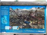 2
2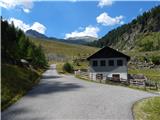 3
3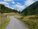 4
4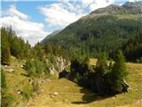 5
5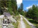 6
6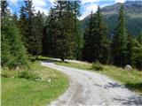 7
7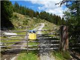 8
8 9
9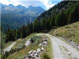 10
10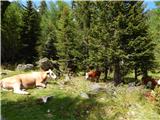 11
11 12
12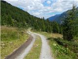 13
13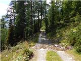 14
14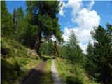 15
15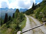 16
16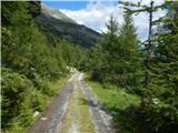 17
17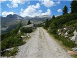 18
18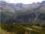 19
19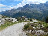 20
20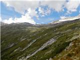 21
21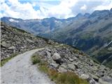 22
22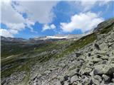 23
23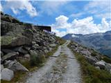 24
24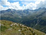 25
25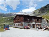 26
26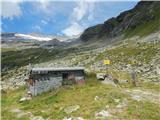 27
27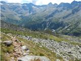 28
28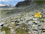 29
29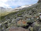 30
30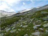 31
31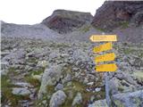 32
32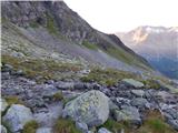 33
33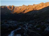 34
34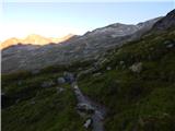 35
35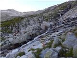 36
36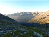 37
37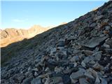 38
38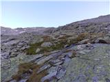 39
39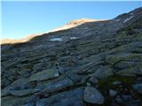 40
40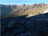 41
41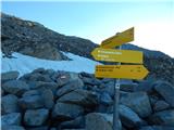 42
42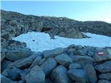 43
43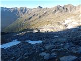 44
44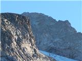 45
45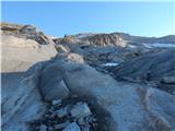 46
46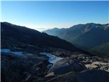 47
47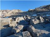 48
48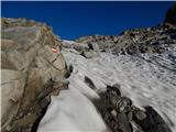 49
49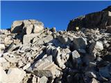 50
50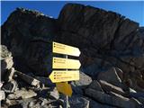 51
51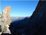 52
52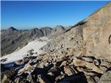 53
53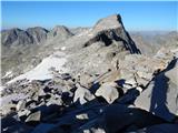 54
54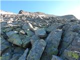 55
55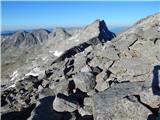 56
56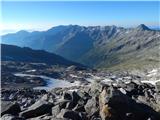 57
57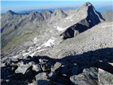 58
58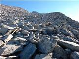 59
59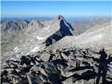 60
60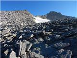 61
61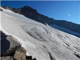 62
62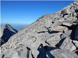 63
63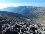 64
64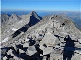 65
65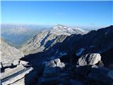 66
66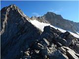 67
67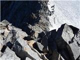 68
68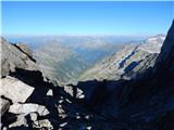 69
69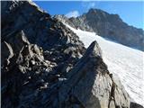 70
70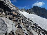 71
71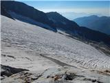 72
72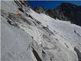 73
73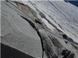 74
74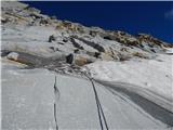 75
75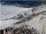 76
76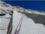 77
77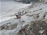 78
78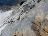 79
79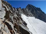 80
80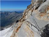 81
81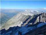 82
82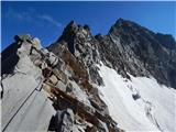 83
83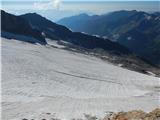 84
84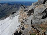 85
85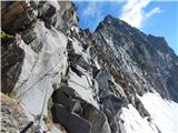 86
86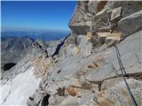 87
87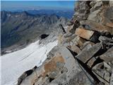 88
88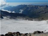 89
89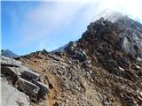 90
90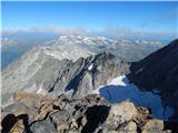 91
91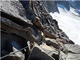 92
92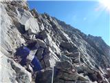 93
93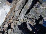 94
94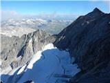 95
95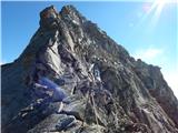 96
96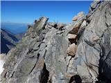 97
97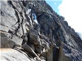 98
98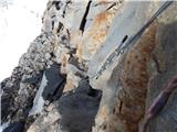 99
99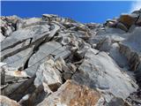 100
100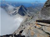 101
101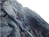 102
102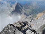 103
103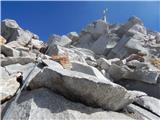 104
104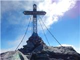 105
105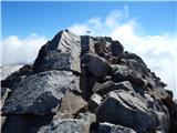 106
106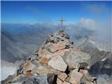 107
107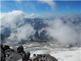 108
108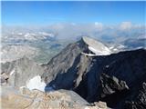 109
109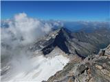 110
110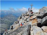 111
111
Discussion about the trip Gößgraben - Hochalmspitze (Detmolder Grat)
|
| mukica16. 08. 2015 |
Some time ago I hiked this path and must say it's very nicely routed and worth every step. The path enchants you in good weather with views all around, our Alps were as if on the palm of the hand. We returned over the glacier and then no crampons were needed, but ice axe is essential.
|
|
|
|
| ninooos16. 08. 2015 |
Is winter gear (this year) needed on the mentioned path? (description assumes possible snow crossing above glacier rim)
Thanks, regards
|
|
|
|
| Rok16. 08. 2015 |
I went on this path on 6.8.2015. Needed to cross only a few meters of snowfield (pic 73). Then it was possible without crampons. Possibly now even those few meters of snow are gone.
|
|
|
|
| mpp16. 08. 2015 |
This is a real high alpine tour and winter gear belongs in the backpack!
For Detmolder Grat winter gear probably won't really be used, but say in the case of descent via Steinernen-Mandln it will be necessary.
|
|
|
|
| felix11. 08. 2018 |
Which path is usually used for ascent and which for descent? Lp
|
|
|
|
| lazo16. 05. 2019 |
Usually ascent via Detmolder Grat, descent via Steinerne Mandln.
|
|
|
|
| lzakelj30. 07. 2019 |
Is it possible to go solo on the mentioned ascent and descent regarding the glacier?
|
|
|
|
| Pi_is_exactly_330. 07. 2019 |
@lzakelj: There is no glacier on this path. The described path runs above the glacier (from picture 73 onwards).
|
|
|
|
| lzakelj31. 07. 2019 |
What about the Steinernen Mandln trail?
|
|
|
|
| J.P.11. 08. 2019 |
On the Steinernen Mandln path there is a glacier. The surface is currently very soft but winter gear is necessary, if nothing else due to the last few meters at the top and the descent back. Lp
|
|
|
|
| ssimon15. 08. 2020 |
Hi, which path do you recommend and I'm wondering if glacier rope is needed across the glacier. And regarding the starting point, I'm curious if the Gießener Hütte hut has perhaps been renamed to Giessener hutte.
Thanks for the reply.
Best regards,
Simon
|
|
|
|
| Janiel7415. 08. 2020 |
Unfortunately I don't know the path, but as for the naming of the hut, it's one and the same.
|
|
|
|
| felix17. 08. 2020 |
The path along the Detmolder Grat ridge is very demanding, requires a lot of arm strength. The glacier below Steinernen Mandln has a slope of about 50 degrees, ice axe and crampons mandatory. Last year up the ridge and down the glacier. If going again, I'd choose the reverse direction mainly due to the glacier. Best regards.
|
|
|
To post a comment you must log in:
If you do not yet have a username, you must first
register.