Koča pod slapom Rinka - Vellacher Turm / Storžek
Starting point: Koča pod slapom Rinka (1010 m)
| Latitude/Longitude: | 46,36960°N 14,59860°E |
| |
Walking time: 3 h 45 min
Difficulty: very difficult marked way
Via ferrata: B
Elevation gain: 1100 m
Elevation difference along the route: 1204 m
Map: Kamniške in Savinjske Alpe 1:50.000
Recommended equipment (summer): helmet, self belay set
Recommended equipment (winter): helmet, self belay set, ice axe, crampons
Views: 23.006
 | 3 people like this post |
Access to starting point:
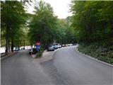
We drive into the Logar Valley, then follow the main road towards the head of the valley, where we park at the parking lot at the turning point near the Bar Pod slapom, also known as Koča pod slapom Rinka.
Entry by motor vehicle into the Logar Valley Landscape Park requires payment of an entry fee or ecological tax, which amounts to 10 € for a passenger car (7 € for motorcycles, 20 € for vans). The fee is collected during the tourist season (from spring to the end of October) and also applies to electric vehicles. Payment of the tax includes the use of all parking lots within the valley. Entry is free for pedestrians and cyclists.
The current price list is available on the official website of the Logar Valley Landscape Park.
Route description:
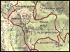
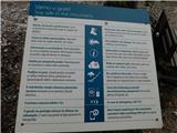
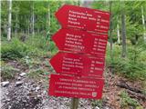
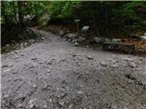
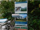
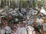
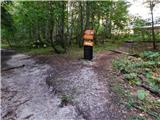
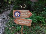
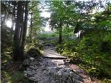
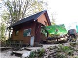
From the place where we parked, we first walk to the Bar Pod slapom, then head onto the marked path, along which numerous mountain destinations are indicated. We continue along the mountain trail through the forest (a slightly less steep tourist path leads a little more to the left), which after a few minutes of ascent joins the tourist path, and along it we continue with an easy ascent to the junction near the Slap Rinka.
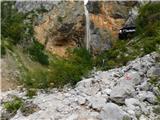
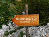
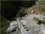
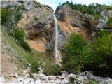
We continue slightly left towards Frischaufov dom na Okrešlju (straight ahead the foot of Slap Rinka and Orlovo gnezdo), where a little further we cross the Savinja over a wooden bridge. It then sinks into the gravel bed, and immediately after the bridge, looking to the right, a beautiful view of Slap Rinka opens up.
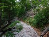
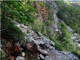
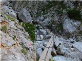
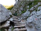
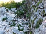
We then begin a steep ascent along a well-maintained and cared-for path, which higher up turns right and passes under the rock faces, where there is a risk of falling rocks. Here, with the help of protections, we ascend transversely to the right, then cross the Savinja over a footbridge just above the mouth of Slap Rinka.
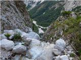
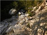
The path then leads for some time along the picturesque Savinja, where a few protections help us for easier progress, and higher up the slope levels out. Next follows crossing the Savinja riverbed, which at this point has almost no water, and then we reach the marked source of the Savinja.
After the source the path enters the forest, through which we ascend moderately to steeply, higher up it levels out and forks.
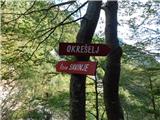
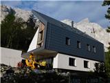
We continue right towards Kamniško sedlo, Turski žleb, Savinjsko sedlo and Mrzla gora (straight ahead leads the path to Frischaufov dom na Okrešlju – two minutes, from where all the mentioned paths also lead). From the forest we then step onto the grassy plain of Okrešelj, from which a magnificent view of the surrounding mountains and their rock faces opens up.
Here a path quickly joins from the left, leading past Frischaufov dom, and slightly to the left branches off the demanding mountain path towards Kamniško sedlo. We continue right towards Turski žleb, Savinjsko sedlo and Mrzla gora. The path returns to the forest again and a little further crosses a regulated torrent, then brings us to a second torrent. We walk along it for a short time, then continue the path beside it, where we encounter the next junction.
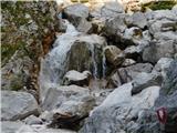
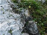
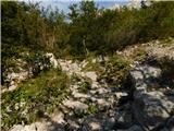
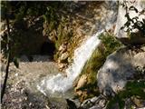
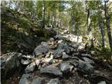
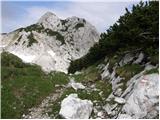
We head slightly right towards Mrzla gora and Savinjsko sedlo. To the left branches off the path towards Turski žleb, beside which stands a boulder with memorial plaques to rescuers who perished in a tragic accident during a rescue exercise in June 1997, as well as others who died in the surrounding mountains (it is only a minute's walk to the boulder). We then ascend through a picturesque landscape surrounded by sparse larch forest, called Mrzli dol. Higher up we leave the small valley and head slightly left onto the scree slopes below the Rinke. Here we ascend transversely to the right, then cross a mighty torrent gully behind boulders. On the other side of the gully we see a large marking showing the correct direction. At the foot of the wall we then ascend transversely along a steep and in some parts slippery slope. When the terrain levels out, we cross to the right over another torrent, then through a belt of sparse dwarf pine we ascend to the next junction.
We continue left towards Savinjsko sedlo (slightly right branches off the path to Mrzla gora) and from a short grassy section we again enter the scree.
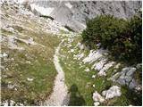
Here the path forks once more, and we choose the right direction, which leads towards Savinjsko sedlo (left Češka koča and Kranjska koča via Križ and the climbing path to the Rinke). For a few minutes we ascend transversely across the scree, then enter steeper slopes covered with dwarf pine. A few minutes of steep ascent await, after which we reach the place where Bivak pod Mrzlim vrhom once stood, of which today only the foundations are visible.
There follows a short steep ascent through dwarf pine, then the path levels out and brings us to the state border, which we reach at Savinjsko sedlo.
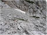
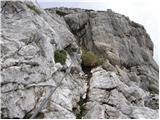
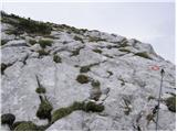
From Savinjsko sedlo we continue slightly right (left Jezersko sedlo) along a path that begins to descend towards the valley of Belske Kočne / Bad Vellach. After a few minutes of descent we see a large inscription on the rock on the left side “Klettersteig”. Here we leave the path leading towards the valley and head left uphill along a somewhat less trodden trail. The path, which is later marked with red dots, soon brings us to the entrance to the climbing section.
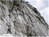
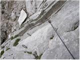
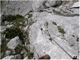
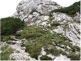
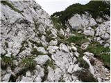
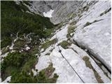
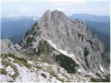
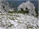
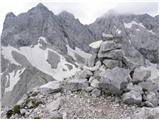
It should be noted that the protections on this path are in very poor condition, so extreme caution is required. The climbing path initially crosses the steep eastern slope of the mountain towards the north with the help of a cable and pegs. The path then turns left and ascends steeply along the cable. Later it brings us to a steep, partly grassy slope, where additional caution is needed as the trail is often slippery. In the final section we turn left, followed by only a short ascent along an unprotected slope to the summit.
Starting point - Slap Rinka 0:15, Slap Rinka - Izvir Savinje 0:35, Izvir Savinje - Frischaufov dom na Okrešlju 0:20, Frischaufov dom na Okrešlju - junction at the memorial 0:15, junction at the memorial - junction for Mrzla gora 1:00, junction for Mrzla gora - junction for Križ 0:05, junction for Križ - former bivouac 0:15, former bivouac - Savinjsko sedlo 0:05, Savinjsko sedlo - junction of the path to Storžek 0:05, junction of the path to Storžek - Storžek 0:35.
Photos:
 1
 2
 3
 4
 5
 6
 7
 8
 9
 10
 11
 12
 13
 14
 15
 16
 17
 18
 19
 20
 21
 22
 23
 24
 25
 26
 27
 28
 29
 30
 31
 32
 33
 34
 35
 36
 37
 38
 39
 40
 41
 42
 43
 44
 45
 46
 47
 48
 49
 50
 51
 52
 53
 54
 55
 56
 57
 58
 59
 60
 61
 62
 63
 64
 65
 66
 67
 68
 69
 70
 71
 72
 73
 74
 75
 76
 77
 78
 79
 80
 81
 82
 83
 84
 85
 86
 87
 88
 89
 90
Discussion about the trip Koča pod slapom Rinka - Vellacher Turm / Storžek
|
| EUGEN16. 03. 2010 |
Although a somewhat less visited mountain, it's worth the effort to visit it.
So far I've always been alone at the summit.
|
|
|
|
| kofetarca19. 03. 2010 |
My friend and I also visited Storžek in the autumn and were alone at the top. It's a nice peak where you feel like you're in the golden mean between more famous peaks. We started from Belska Kočna.
|
|
|
|
| panda20. 03. 2010 |
I was on Storžek three years ago. Nice hike, beautiful views...the last climbing part warms you up nicely. I'll go again this year...
|
|
|
|
| acjom20. 03. 2010 |
Last year I also wanted to visit Storžek from Belska Kočna, but I couldn't find the right starting point at all. Could someone describe the starting point (maybe there are signs), because I want to revisit this hike this year as soon as possible. Thanks
|
|
|
|
| acjom20. 03. 2010 |
Thanks for the detailed response, I hope it will serve me well in helping me visit Storžek too. It's true that this description doesn't belong here, since the starting point at the Rinka waterfall is familiar to me, thanks anyway
|
|
|
|
| Volk21. 03. 2010 |
You can beautifully reach the summit of Belski Turn also via the western ridge (easy II, exposed, excellent rock). Of course only for very experienced climbers!
|
|
|
|
| eka&me19. 07. 2010 |
On Saturday we visited Storžek from Okrešelj. Interesting and nice tour, although very hot that day, despite being in Logarska dolina before six. The climbing section is OK - watch out for rocks (the lower climber is in danger). Above all, it's a solitary mountain with beautiful views. I recommend it!
|
|
|
|
| lepenatka19. 07. 2010 |
Less hot is the ascent from the Belske Kočne valley.
Especially on the return, it's wise to descend in stages... then there's no danger for "the one below".
Safe steps to all
|
|
|
|
| SilvestrO25. 08. 2010 |
On Saturday I "incidentally" visited Storžek (main goal was Mrzla gora), via Savinjsko sedlo and Jezersko sedlo I approached its southern ridge with unease , then it turned out "short and sweet", at the top I silently shrieked twice..., and quickly (it really thundered towards Mrzla gora) descended the overly "chained" path..., then back to Savinjsko sedlo and...
|
|
|
|
| jvali6. 07. 2012 |
Recommended equipment is via ferrata set. Is it possible without? Thanks.
|
|
|
|
| pohodnik3818. 07. 2012 |
And some pictures and impressions from the completed trail yesterday
PICTURES
|
|
|
|
| mailman18. 07. 2012 |
Excellent hiker38, nice...exactly as you said, not only the top peaks, but also those next to them!!! I have it planned.
|
|
|
|
| jvali5. 09. 2013 |
pohodnik38: I really like taking photos myself. From every hike I return with a whole bunch of shots. Sometimes my husband scolds me for taking too many photos, as I often look back on the way. But I've already trained him to notice motifs himself. Whoever likes photography lives twice: when taking the shots and when viewing them. Every photo revives again, along with the memories.
your shots are exceptionally beautiful. Thanks for sharing them with us. On Saturday I'll visit this peak too.
|
|
|
|
| pohodnik385. 09. 2013 |
Thanks yes it's true I also like to photograph and by looking at the pictures at home I relive the tour again or every time I browse the archive. But go on the path I recommend it as it rewards with a wonderful view of the north faces of the central KSA.
Best! Tone
|
|
|
|
| ljubitelj gora20. 07. 2014 |
On this day I chose Jezersko, where I ascended Velika Baba via the Slovenian and climbing path, descended and ascended Ledinski vrh, then at the saddle just below Ledinski vrh went along the ridge to Storžek, the climbing is grade II, at least I think, the climbing goes slightly below the right ridge, along the ridge I went further to the cross and then back along the secured very demanding path. Around 12:00 it was too hot, so I descend to the valley along the hunting trail.
|
|
|
|
| Sini4. 08. 2014 |
Hi, is the secured path to Storžek dry? Thanks for reply - anyone.
|
|
|
|
| zipo15. 07. 2015 |
Hello! Today I tried to climb to Storžek, but had to turn back already in the initial part of the "Klettersteig". The pitons in the initial crossing are pulled out except for a few, so the cable hangs loose and is unusable, and you step on the iron footholds, but there are no handholds - the rock is smooth. Up might still be possible, but down... Too dangerous for me. For information to anyone who wants to go on this path.
|
|
|
|
| Parkeljc15. 07. 2015 |
The ironwork is maintained by the Austrian alpine club, well, actually not maintained. Last year I went to Storžek from the saddle between Ledinski vrh. Some scrambling is needed, but in a couple of minutes you're at the top, then descent past the ironwork to the pyramidal metal frame and back to the start of the ironwork and descent. Already last year the cables were in very poor condition.
This year I went again in the same direction, but soon after starting the descent I regretted not returning the way I came. The cable anchors are mostly pulled out or broken, although they hold at critical points. The path is actually neglected and it's only a matter of time before someone gets hurt, unless they officially close the path or refurbish it. The cable anchors in the lower part are completely broken, fortunately the first and last hold, so it's still possible to descend on the brackets and hold the cable more or less lightly. I have to admit, when I descended to "solid ground", I breathed a sigh of relief. In short, BIG MINUS to the path maintainer!
|
|
|
|
| franjo663. 06. 2016 |
Is the secured path to Storžek dry? Thanks for the answer - anyone
|
|
|
|
| rokjohan112. 06. 2016 |
I'm also interested if the path is snow-free? I'll probably try my luck on Sunday.
|
|
|
|
| rokjohan113. 06. 2016 |
Thanks for the info. Regards
|
|
|
|
| franjo668. 07. 2016 |
Is it possible by any chance to continue from the top of Storžek to Ledinski vrh?
|
|
|
|
| Lisa8. 07. 2016 |
Not directly, at least it didn't seem possible to me.
You need to descend back down to the start of the cable and pegs and then go directly up to Ledinski vrh from there (you can see where the direct and somewhat steep line to L.vrh is possible).
|
|
|
|
| franjo668. 07. 2016 |
Thanks for the reply
|
|
|
|
| franjo669. 07. 2016 |
I hiked it along the southwest ridge
|
|
|
|
| VanSims12. 07. 2016 |
Not as bad as @Parkeljc describes. The problem is only the pulled-out pegs at the beginning and even that is more problematic downhill than uphill. The rest is in solid condition. Assuming of course that you use the cable primarily for protection and not so much for pulling yourself along it.
|
|
|
|
| Parkeljc12. 07. 2016 |
I just stated the bare facts, so the protections were torn out or broken. If you take the indicated path, you presumably rely on the ironwork that should be in perfect condition. If the path is secured, we rely on it being secured. But if the ground is muddy, wet, pegs and cable damaged or otherwise, it's a fact that the difficulty is at least one grade harder. And the path to Storžek definitely is ;-)
|
|
|
|
| garmont4. 07. 2017 |
The starting point elevation is approx. 1020m not 930.
|
|
|
|
| veja59. 08. 2017 |
Yesterday on Storžek, via the via ferrata. The path is not in the best condition. While crossing the initial smooth wall, 1 bolt broke. Some were already missing before. The bolts made of threaded rods are critical. Further on, 3 to 4 medium-sized rocks are waiting to fall down. Otherwise it's a nice ascent and the summit was quite visited yesterday.
Best regards. Venčeslav.
|
|
|
|
| Marx28. 06. 2022 23:22:03 |
Since I'm planning a repeat ascent to Storžek (first time it didn't go due to a snow patch at the start of the climbing section) I'm wondering if the snow patch is still there and of course what condition the fixed protections are in,
|
|
|
|
| garmont29. 06. 2022 14:18:22 |
Snow is probably gone now.
The fixed protections are in very poor condition.  Descent can be quite tricky… Of course, you'll assess yourself on the ascent whether you can descend safely here.
|
|
|
|
| klace23. 07. 2025 08:28:57 |
Does anyone have fresh comments on the condition of the safety gear on Storžek?
|
|
|
|
| biba23. 07. 2025 09:21:37 |
|
|
|
To post a comment you must log in:
If you do not yet have a username, you must first
register.