Koča pri Savici - Koča pri Triglavskih jezerih (via Komna)
Starting point: Koča pri Savici (653 m)
| Latitude/Longitude: | 46,28960°N 13,80220°E |
| |
Route name: via Komna
Walking time: 5 h
Difficulty: easy marked way
Elevation gain: 1032 m
Elevation difference along the route: 1280 m
Map: Triglav 1:25.000
Recommended equipment (summer):
Recommended equipment (winter): ice axe, crampons
Views: 90.107
 | 5 people like this post |
Access to starting point:
From the Ljubljana - Jesenice motorway, take the Lesce exit and follow the road towards Bled and further towards Bohinjska Bistrica. Continue driving towards Bohinjsko jezero (Ribčev Laz), where you reach a crossroads and continue straight ahead on the left (southern) side of the lake in the direction of Ukanc and the Savica waterfall. Follow this increasingly narrow road to the large parking lot at Koča pri Savici. The parking lot is paid.
Route description:
From the parking lot, head onto the wide footpath in the direction of Slap Savica and Dom na Komni (right path via Komarča). After a short gentle ascent, the path reaches a marked junction where the tourist path to Slap Savica branches off to the right; continue slightly left or straight ahead on the wide footpath towards Komna. The path continues to climb for a short time along the Savica river, then reaches the first of the marked 48 switchbacks. After an hour and a half of moderate ascent through the forest, the path reaches the 48th switchback, offering a beautiful view of Bohinjsko jezero. Here the path turns slightly right and enters the valley called Pekel, where it climbs gently for a while before turning right and climbing steeper again. After a few dozen steps, the path turns left again and continues ascending parallel to the valley. The gentle to moderately steep path gradually enters sparser forest, and soon Dom na Komni comes into view. The path passes a small interesting cave, then higher reaches a junction where the path to Črno jezero branches off to the right; continue left on the wide path. A short traverse follows; at a natural abyss (fenced for safety), the path turns right and climbs to the next junction where the path from Črno jezero joins.
A little further ahead, the path forks again; take the right branch marked for Koča pod Bogatinom and Koča pri Triglavskih jezerih (left to Dom na Komni, 5 minutes), and after a few steps reach another junction.
Continue right towards Koča pri Triglavskih jezerih (straight to Koča pod Bogatinom, 15 minutes) on a slightly narrower but still well-trodden trail. The path ascends and descends several times, and after about 30 minutes reaches the point where the path from Koča pod Bogatinom joins from the left.
Ahead, almost imperceptibly cross the abandoned Planina Razor (some ruins visible), after which the path gradually begins a moderate ascent. After a while, the path turns right to an indistinct scenic saddle with old Triglavski narodni park signs.
A short descent follows to the marshy Planina na Kalu. The path then gradually enters sparse forest and continues with several short ascents and descents to Planina Lopučnica.
At Planina Lopučnica there is a marked junction; continue slightly right towards the Triglav Lakes (left to Velika vrata and Planina Za Skalo). On the other side of the pasture, the path re-enters forest and gradually begins a moderate to steep ascent. After about half an hour, the path levels out and turns sharply left. A few minutes of descent follow, and the path reaches Koča pri Triglavskih jezerih.
Starting point - junction to Črno jezero 2:15, junction to Črno jezero - Memorial plaque to Matej Koblar 0:10, Memorial plaque to Matej Koblar - Planina Razor 0:35, Planina Razor - Planina na Kalu 0:35, Planina na Kalu - Planina Lopučnica 0:50, Planina Lopučnica - Koča pri Triglavskih jezerih 0:35.

Along the route: Jama ob poti na Komno (1303m), Odcep k Črnemu jezeru (1411m), Brezno pod lovsko kočo na Komni (1430m), Spominska plošča Mateju Koblarju (1481m), Planina Razor (1550m), Planina na Kalu (1636m),
Planina Lopučnica (1558m) The trip can be extended to the following destinations: Planina Lopučnica,
The lake Jezero v Ledvicah,
Rušnata glava,
The lake Zeleno jezero,
The lake Rjavo jezero,
Zasavska koča na Prehodavcih (0 min),
Mala Tičarica,
Velika Tičarica,
Koča na Doliču (1 h 15 min),
Kopica (0 min),
Vodnikov Vršac (Vršac nad Zadnjico) ( 40 min),
Čelo (2 h),
Mala Zelnarica,
Malo Špičje,
Velika Zelnarica,
Vrh Hribaric (1 h),
Veliko Špičje,
Vršaki (Vzhodni vrh) (1 h),
Kanjavec (1 h),
Triglav (3 h 45 min)
Photos:
 1
1 2
2 3
3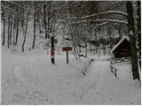 4
4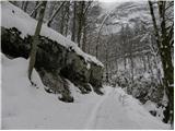 5
5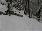 6
6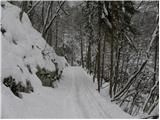 7
7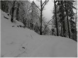 8
8 9
9 10
10 11
11 12
12 13
13 14
14 15
15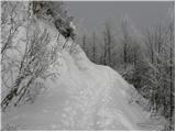 16
16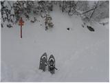 17
17 18
18 19
19 20
20 21
21 22
22 23
23 24
24 25
25 26
26 27
27 28
28 29
29 30
30 31
31 32
32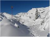 33
33 34
34 35
35 36
36 37
37 38
38 39
39 40
40 41
41 42
42 43
43 44
44 45
45 46
46 47
47 48
48 49
49 50
50 51
51 52
52 53
53 54
54 55
55 56
56 57
57 58
58 59
59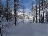 60
60 61
61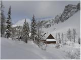 62
62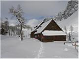 63
63
Discussion about the trip Koča pri Savici - Koča pri Triglavskih jezerih (via Komna)
|
| velkavrh25. 07. 2009 |
Yesterday I was here wandering in the valley of lakes. I went to Koča pod Bogatinom and from there towards the valley. This path soon joins the one from Koča na Komni. I returned to Koča pri Savici via Komarča. The path through the forest section to Komarča is almost impassable because fallen trees lie along the entire path and hikers crawl over them as best they can. I heard foreign hikers horrified by this and we really don't make a good impression. Call to those responsible in Triglav National Park to do something about it. They should at least!
|
|
|
|
| velkavrh3. 08. 2009 |
Today mountain guide and path marker G. Hace informed me that the path from Komarča to the Triglav Lakes valley is cleared. They worked a full four days. Bravo!
|
|
|
|
| gti22. 06. 2011 |
Path suitable also for descent with children, although it drags on, so the times (between huts) are quite realistic.
From the above description, which can mislead, there are actually 1355 vertical meters on the path and not 1032 v.m..
I suggest a correction.
|
|
|
|
| Alni21. 08. 2012 |
On Saturday we were at Triglav Lakes. The path drags on quite a bit.
Our total time was 9 hours (there and back). But we had an approximately 45-minute stop at Triglav Lakes 
|
|
|
|
| Alni21. 08. 2012 |
Addition: during this time we also visited the hut on Komna and had a stop of approximately 20 minutes.
We parked at the Savica waterfall approximately 15 minutes before seven in the morning and didn't have to pay for parking - there was no one anywhere.
|
|
|
|
| mkrasev14. 10. 2013 |
Yesterday via Komarča, hut at the seven lakes, hut under Bogatin, Komna and back Savica
|
|
|
|
| gorjanci5. 01. 2014 |
In February, when conditions are suitable, I plan to go past Komna to the hut at the seven lakes. Please provide some useful information for that time. How are the winter markers?
|
|
|
|
| jedriličar5. 01. 2014 |
Check pictures 33 and 34 for winter markers, there are no others in winter time unless you go through the forest. And if there is no trodden path, orientation is very demanding, especially if you don't know the summer variant or don't have GPS. And these areas are very demanding for walkers, a lot of snow that mostly doesn't settle and doesn't bear human weight, which means a better option is with touring skis or snowshoes ... cheers and stay safe ...
|
|
|
|
| srnica7520. 05. 2014 |
Good day, can anyone tell me what the conditions are like from the hut at Savica to the hut at Triglav Lakes?
|
|
|
|
| gorjanci27. 04. 2015 |
This weekend I plan to go via Komna to the Koča pri sedmerih, then to the Koča na Planini pri jezeru, Vogar, Stara Fužina (of course, if the weather allows). I'm curious how much snow is left between Komna and Koča pri sedmerih? Has anyone been up there recently? LP and safe steps.
|
|
|
|
| SunBurned17. 12. 2015 |
Has anyone walked recently between Komna and Koča pri Triglavskih jezerih? Any peculiarities? Is there still a lot of snow on the path, possibly problems with followability?
|
|
|
|
| Enka19. 08. 2019 |
The altitude difference data for the path is incorrect. The path between Dvojno jezero and Komna goes constantly up/down, roughly I would say at least 250 additional altitude meters are made.
|
|
|
|
| Tadej19. 08. 2019 |
Thanks for the notice, I have corrected it.
|
|
|
|
| m_b23. 12. 2019 |
Hi
Interested in snow conditions on the Komna - Koča pri Triglavskih jezerih route. Has anyone been?
|
|
|
To post a comment you must log in:
If you do not yet have a username, you must first
register.