Kokra (Podlebelca) - Kalški greben
Starting point: Kokra (Podlebelca) (559 m)
| Latitude/Longitude: | 46,31900°N 14,49860°E |
| |
Walking time: 4 h 45 min
Difficulty: partly demanding marked way
Elevation gain: 1665 m
Elevation difference along the route: 1665 m
Map: Kamniške in Savinjske Alpe 1:50.000
Recommended equipment (summer): helmet
Recommended equipment (winter): helmet, ice axe, crampons
Views: 22.402
 | 3 people like this post |
Access to starting point:
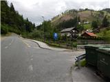
A) We drive to Preddvor or to the settlement Tupaliče, which is situated along the main road Kranj - Zgornje Jezersko, then we continue driving in the direction of Jezersko. When we arrive in the settlement Kokra, at the road sign between 8.5 km and 8 km, we turn right over the bridge to the hamlet Podlebelca, where the described path begins. At the starting point there are no arranged parking spots; we park at a suitable place nearby.
B) From Jezersko we drive towards Preddvor, at the road sign between 8 km and 8.5 km we turn left over the bridge to the hamlet Podlebelca, where the described path begins. At the starting point there are no arranged parking spots; we park at a suitable place nearby.
Route description:
After the bridge, we notice red hiking signposts that direct us to the road that ascends through the hamlet Podlebelca. Past the houses we follow the blazes, above the hamlet the asphalt ends. After a short ascent through the forest we arrive at a larger chapel, behind which we go left onto a marked cart track. The cart track splits immediately, and we choose the right one, along which the blazes continue. A little higher we reach an asphalt road that leads towards the farms Roblek, Pestotnik and Lovrin, and we walk along it to the first right turn. After the turn the footpath continues, which quickly ascends to the place where we cross the road that leads to the farm Lovrin. We continue through the forest, and the path gradually transitions to an indistinct forested ridge, along and beside which it then ascends. Higher we also cross an asphalt road that leads towards the farm Roblek, and we ascend more steeply for a few more minutes, then join the cart track that leads from the farm Roblek.
We continue straight ahead along the initially wide cart track, which we soon leave as the blazes direct us right onto the footpath. Further on, the not too steep path then brings us to a larger rock, where there is the next marked junction. We continue straight (right Krvavec) along the path that gradually begins to ascend more steeply and brings us higher below an extensive rocky scree that is visible already from the valley of the river Kokra. The path withdraws from the scree slightly to the left, then, when we are already somewhat higher, turns right and approaches the rocky cliffs on our right completely. The path ahead brings us in a moderate ascent to a short stretch of dwarf pines, behind which we reach Lojtra. Lojtra is a slightly exposed passage along a wide and well-secured ledge. After crossing this section, only a short traverse of the slopes follows (cable), after which the steepness of the slopes eases. Ahead we continue along the path that ascends through the dwarf pines. After 15 minutes the dwarf pines end and the path brings us to the expansive pastures of Dolga njiva, where we reach a junction. We continue straight (right Krvavec) and after a few more steps the path brings us to the old shepherd's hut on the mentioned pasture.
From the mentioned hut we continue along the left side of the pasture on a poorly visible trail that after 5 minutes of further walking brings us to the other, renovated hut. Again we keep slightly left and the still poorly visible path soon brings us into a stretch of dwarf pines, where it becomes more distinct. A traverse of a short steep gravelly slope follows, then a gentle path brings us in a few minutes of pleasant walking across meadows overgrown with dwarf pines to a junction at Škrbina.
Here we continue left in the direction of Kalški greben and Cojzova koča along the path that already after a few more steps brings us to the next junction. We continue slightly left (right Kalška gora and Cojzova koča) along the path that begins to ascend gently on increasingly panoramic slopes. The pleasant path, which can be very hot in the middle of the day, first leads near a smaller ridge, then gradually turns somewhat more to the left and brings us from the dwarf pines onto wonderful meadows where we will find various types of flowers. The wide slope along which we walk then narrows, and the meadows are gradually replaced by rocks. Higher the path brings us onto the panoramic main ridge, which we then follow to the summit, which is often full of sheep droppings.
Podlebelca - Dolga njiva 3:00, Dolga njiva - Škrbina 30 minutes, Škrbina - Kalški greben 1:15.

Photos:
 1
1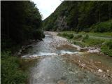 2
2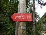 3
3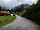 4
4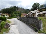 5
5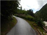 6
6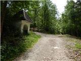 7
7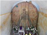 8
8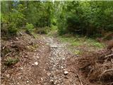 9
9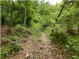 10
10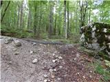 11
11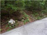 12
12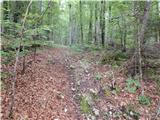 13
13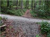 14
14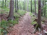 15
15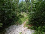 16
16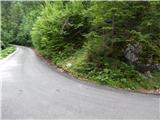 17
17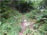 18
18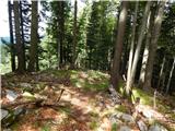 19
19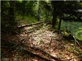 20
20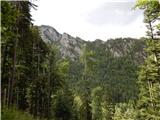 21
21 22
22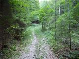 23
23 24
24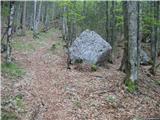 25
25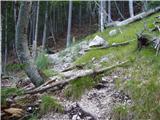 26
26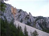 27
27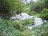 28
28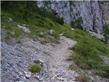 29
29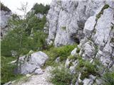 30
30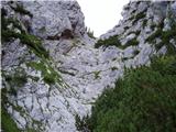 31
31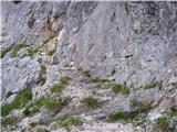 32
32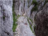 33
33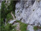 34
34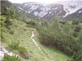 35
35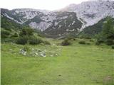 36
36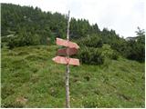 37
37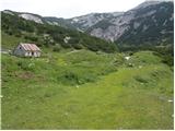 38
38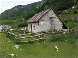 39
39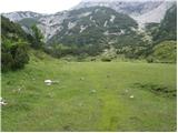 40
40 41
41 42
42 43
43 44
44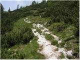 45
45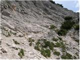 46
46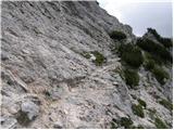 47
47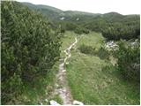 48
48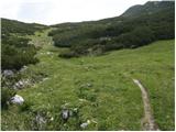 49
49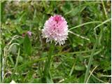 50
50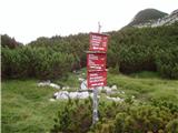 51
51 52
52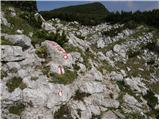 53
53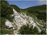 54
54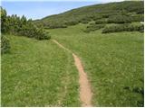 55
55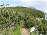 56
56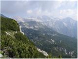 57
57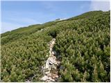 58
58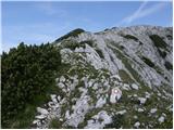 59
59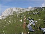 60
60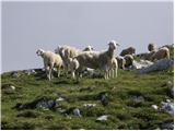 61
61 62
62 63
63 64
64 65
65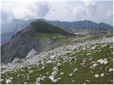 66
66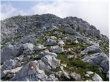 67
67 68
68
Discussion about the trip Kokra (Podlebelca) - Kalški greben
|
| mvolk24. 09. 2008 |
Super mountain trip. In my opinion, the path is not even partially demanding. The elevation gain is relatively easy to overcome, because, except for the initial ascent, we climb slowly, and especially in wonderful nature. Once we reach Dolge njive, the path to the summit is quite flat and scenic. On Saturday, 20.9., my colleague and I didn't meet any hikers on the entire path... only herds of chamois. I recommend it.
|
|
|
|
| anze r6. 09. 2010 |
How up-to-date is the information that the scree on the trail below Planina Dolga Njiva has grown over heavily?
Have the path markers fixed the situation already?
|
|
|
|
| Gorska rožica6. 09. 2010 |
5.9.2010 - yesterday we went there and the path is normal.
|
|
|
|
| roker62. 04. 2012 |
The trail is not demanding but in the lower part very time-consuming, especially on the scree. At the wire ropes it becomes interesting; from Dolge njive onwards mostly exposed with wonderful views. Almost always windy. A week ago in the lower part you sink in at the wire ropes; almost dry, no problems.
|
|
|
|
| nusa15. 11. 2012 |
Today I was on Kalški greben via the described path. The path is completely dry. It was a wonderful sunny day.
|
|
|
|
| vito635. 01. 2013 |
Today I headed to Kalški greben. I don't know the path ; the markings were snow-covered, strong wind was erasing the tracks of my predecessors on the way ; the markings were snow-covered, strong wind was erasing the tracks of my predecessors on the way  . I didn't make it up, as I got lost several times, which took a lot of time, so I turned back just below the summit to return safely and on time to the valley. Kalški greben will wait for me until spring . I didn't make it up, as I got lost several times, which took a lot of time, so I turned back just below the summit to return safely and on time to the valley. Kalški greben will wait for me until spring  . .
|
|
|
|
| alpin2. 10. 2013 |
I'm wondering if there's a possibility to switch from this path to the path leading to Kokrsko Sedlo or (pl. Suhadolnik).
Does anyone perhaps have a GPS track?
L.P.
|
|
|
|
| enjanez2. 10. 2013 |
A few years ago, my colleague and I walked this path. I don't remember where I got the description. The connection can be figured out on the map. Below the Roblek farm, a forest road branches off, leading almost horizontally northwards. At the end, the road turns into a cart track.
When it reaches Noškarjev graben, you need to turn uphill. After a full-day path, 150 meters of elevation gain is quite demanding. You proceed uphill until you see the road on the other side of the gully.
This road leads to the parking lot below the Suhadolnik farm, where we left the car.
I don't remember if there were any cairns along the path. We oriented ourselves without problems using the map.
My path description: http://www.enjanez.net/Hribi/H10/joHr100823.htm
|
|
|
|
| alpin3. 10. 2013 |
Thanks "enjanez" for the reply.
Yesterday I even cycled to the Kokra valley and asked some locals about this connection from the church in Kokra to the Suhadolnik farm, or to the path leading to Kokrsko sedlo. I got almost an identical answer to what you described.
Now the question is whether it's worth taking this path at all, or if it's faster to continue along the main road (3.7km) to the turn-off leading to the Suhadolnik farm.
Now I have to explain why I'm looking for this connection at all.
My colleague and I plan to go to Grintovec 3 times and paraglide from it to Kokra, Jezersko and finally to Kamniška Bistrica, with the starting points being the churches. Altogether it should take under (10h). That's why I'm looking for the fastest connection from the church in Kokra to the top of Grintovec.
|
|
|
|
| Marko Torelli31. 07. 2016 |
Yesterday, 30.7.2016 on this path. The path is still very uncrowded, as Stritar writes in Grintovci, Southern Approaches. Somewhat overgrown in places, but well traceable. Numerous markers, just somewhat faded; many cairns too. You get the feeling you'd meet a bear before a hiker. From Roblek to the alpine pasture nicely steep throughout. Spring at the pasture "works" to replenish supplies. Recommended for enjoying mountain peace. If not starting exactly at Podlebelca and driving towards farmer Roblek, you can "enter" it at the last bend before the meadow under the homestead starts. LP
|
|
|
|
| Tejama25. 12. 2023 12:09:19 |
Hi. Do you know what the conditions are like? Thanks for info.
|
|
|
|
| di10. 09. 2025 03:02:42 |
Conditions are ok, based on yesterday's hike. (There were also some freshly cut branches of brushwood.)
You can also reach picture 17 by car: a good part is asphalted road, in flatter sections it's gravel (which significantly shortens the tour and is time-competitive with tours under 4 hours. Additionally, the first part is shadier due to more walking through forest).
Parking for one car should be possible by the road at picture 17; for several cars a bit lower (a couple hundred meters) by the road.
|
|
|
To post a comment you must log in:
If you do not yet have a username, you must first
register.