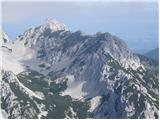
 | Dom v Dragi - Begunjščica (via Preval-a)
Begunjščica is a mountain range in the Karawanks east of Stol. Its highest peak is Veliki Vrh, which at over 2,000 m offers a fine view across ce...
3 h 30 min |
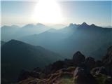 | Sele-Zvrhnji Kot (Male) / Zell-Oberwinkel (Male) - Loibler Baba/Košutica (over Dovjakovo sedlo)
Košutica (also known as Ljubeljska Baba) is a panoramic mountain north of the western ridge of Košuta. From the summit, marked by a small cross a...
4 h 45 min |
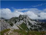 | Srednja vas - Viševnik (Za Ribnico and via Srenjski preval)
Viševnik is a 2050 m high mountain rising northwest of Rudno polje on Pokljuka. From the summit, where there is a stamp, a beautiful view opens o...
4 h 35 min |
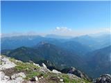 | Križe - Storžič (through southwest groove)
Storžič is a 2132 m high mountain located in the western part of the Kamnik-Savinja Alps. From the summit, where there is a cross, a beautiful vi...
6 h 10 min |
 | Rosenbach - Kahlkogel/Golica (via Medji dol)
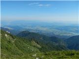
Golica is an unvegetated peak located north of Jesenice. From the summit, where a registration box is placed, there is a fine view of the western...
3 h 45 min |
| Rosenbach - Kahlkogel/Golica (via Quadiaalm)
Golica is an unvegetated peak located north of Jesenice. From the summit, where a registration box is placed, there is a fine view of the western...
3 h 35 min |
| Tallach - Kahlkogel/Golica (via Quadiaalm)
Golica is an unvegetated peak located north of Jesenice. From the summit, where a registration box is placed, there is a fine view of the western...
3 h 50 min |
 | Zadnjica - Križ (via Bovška vratica)
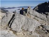
Križ is a 2,140 m high mountain located northeast of the Kriški Podi plateau. The summit, which has a registration box with a stamp, offers a bea...
5 h 30 min |
 | Koča pri Savici - Bogatin (via Bogatinsko sedlo)
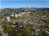
Bogatin, also known as Mali Bogatin, is the last or first peak in the chain of the Lower Bohinj Mountains. From the summit, where there is a summ...
4 h 30 min |
| Koča pri Savici - Bogatin (via planina Govnjač)
Bogatin, also known as Mali Bogatin, is the last or first peak in the chain of the Lower Bohinj Mountains. From the summit, where there is a summ...
5 h 25 min |
| Planina Polog - Bogatin (via Prehodci)
Bogatin, also known as Mali Bogatin, is the last or first peak in the chain of the Lower Bohinj Mountains. From the summit, where there is a summ...
5 h 45 min |
| Dom v Lepeni - Bogatin (via Bogatinsko sedlo)
Bogatin, also known as Mali Bogatin, is the last or first peak in the chain of the Lower Bohinj Mountains. From the summit, where there is a summ...
4 h 30 min |
 | Koča pri Savici - Mahavšček (via Bogatin)
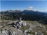
Mahavšček, or Veliki Bogatin, is a 2008 m high mountain on the northwestern edge of the Lower Bohinj Mountains. From the summit, with its somewha...
5 h |
| Dom v Lepeni - Mahavšček (via Bogatinsko sedlo)
Mahavšček, or Veliki Bogatin, is a 2008 m high mountain on the northwestern edge of the Lower Bohinj Mountains. From the summit, with its somewha...
5 h |
 | Povlje - Mali Grintovec (via Bašeljski vrh)
Mali Grintovec is a panoramic mountain located east of Storžič. From the summit, which has a summit register box, stamp, and a pleasant bench, th...
4 h 35 min |
| Bašelj - Mali Grintovec (via Sveti Lovrenc and over Bašeljski vrh)
Mali Grintovec is a panoramic mountain located east of Storžič. From the summit, which has a summit register box, stamp, and a pleasant bench, th...
5 h |
 | Bašelj - Mali Grintovec (via Sveti Lovrenc)
Mali Grintovec is a panoramic mountain located east of Storžič. From the summit, which has a summit register box, stamp, and a pleasant bench, th...
4 h 50 min |
| Povlje - Mali Grintovec
Mali Grintovec is a panoramic mountain located east of Storžič. From the summit, which has a summit register box, stamp, and a pleasant bench, th...
4 h 25 min |
 | Dom v Lepeni - Batognica (via Krnska škrbina)
Batognica is a 2164 m high mountain that was the site of the so-called mine warfare during World War I. Remnants of the fighting between Italian ...
4 h 50 min |
 | Koča pri Savici - Vrh Planje (via Kser)
The mountain is located between Tolminski Kuk and Mahavšček in the ridge of the Lower Bohinj Mountains. From the top, there is a nice view toward...
5 h 5 min |
 | Zauchen - Hochobir (Ojstrc) (via Božičev graben)
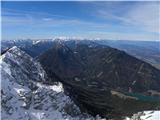
Ojstrc (Hochobir) is the highest peak of the smaller Obir range. It is located west of Železna Kapla (Eisenkappel) on the Austrian side of the Ka...
5 h 5 min |
 | Ferlach - Ferlacher Horn / Grlovec
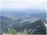
Grlovec/Ferlacher Horn is a panoramic mountain on which a large cross stands. From the top, there is a beautiful view of the Karawanks, parts of ...
4 h 15 min |
 | Ladina - Sart / Žrd (via Bivacco Marussich)
Žrd, or Monte Sart in Italian, is a panoramic mountain located on the northwestern ridge of the Kanin mountains. The summit, which has a logbook ...
6 h |
| Korito / Coritis - Sart / Žrd
Žrd, or Monte Sart in Italian, is a panoramic mountain located on the northwestern ridge of the Kanin mountains. The summit, which has a logbook ...
5 h 40 min |
 | Koča pri Savici - Zeleni vrh (via Dom na Komni and Škrbina)
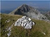
Zeleni vrh is a 2052-meter-high mountain located east of the highest peak of the Spodnje Bohinjske gore. From the grassy summit, which drops prec...
6 h 10 min |