Kosmačev preval - Črna gora
Starting point: Kosmačev preval (847 m)
| Latitude/Longitude: | 46,43690°N 13,93080°E |
| |
Walking time: 1 h 15 min
Difficulty: easy unmarked way
Elevation gain: 503 m
Elevation difference along the route: 503 m
Map: TNP 1:50.000
Recommended equipment (summer):
Recommended equipment (winter): ice axe, crampons
Views: 13.854
 | 2 people like this post |
Access to starting point:
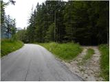
We leave the Gorenjska motorway at the Hrušica exit and follow the road ahead in the direction of Kranjska Gora. Just a little before the village of Dovje, the road to Mojstrana (Vrata, Kot and Krma) branches off to the left from the main road. We follow the road ahead in the direction of the village of Radovna and the valleys of Krma and Kot. The relatively steep road then passes the TNP sign, after which the road soon flattens and brings us to a junction, where the road into the Kot valley branches off to the right. We park on the parking lot by the road, which is located already about 20 m before the junction.
Route description:
From the parking lot, we head onto a cart track that runs parallel to the road in a gentle ascent. After two minutes of walking, another cart track branches off to the left, which we take. Smaller cairns are placed along the cart track. Further on, the cart track ascends straight up the slope. Then suddenly the cart track disappears, as it has been buried by fallen trees. Here we continue straight ahead and after a few metres we reach the cart track again. The cart track then turns into a footpath that begins to ascend steeply. The path is poorly visible, but smaller cairns help us. The path then turns slightly to the right and brings us to an indistinct little ridge. Here the path turns left and follows this little ridge straight upwards. The path soon leads us from the ridge to steep slopes and ascends in zigzags to the main ridge. Here the path turns left again and continues to ascend through the forest. The steepness eases for a short time, but the path soon ascends steeply again. The last part of the path runs mostly along slopes above the Vrata valley or along the ridge. The path then levels out and on the right side we spot a small hut. This is the bivouac on Črna gora.

Photos:
 1
1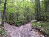 2
2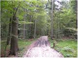 3
3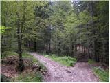 4
4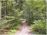 5
5 6
6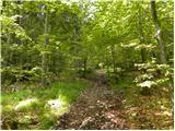 7
7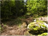 8
8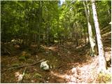 9
9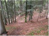 10
10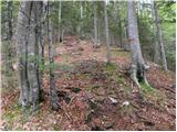 11
11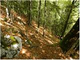 12
12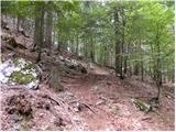 13
13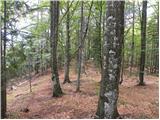 14
14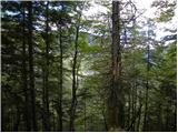 15
15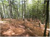 16
16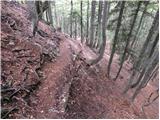 17
17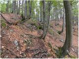 18
18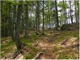 19
19 20
20
Discussion about the trip Kosmačev preval - Črna gora
|
| Parkeljc20. 12. 2010 |
Today I went along the mentioned "path". At first the forest road is still quite visible, in short the first 10 min still followed the description, then it was up to me. It was really impossible to orient by any landmark. Probably something was wrong, because I went along the right ridge, then had to detour two rocky ledges on a very very very steep slope once to the left, once to the right,... Well, after about 1 hour of going back and forth I finally spotted the bivouac. The view is really only towards Kukova Špica and Vrtaška planina. The interior of the bivouac is really carefully arranged and especially equipped. Some regular visitors really take good care of both the exterior and interior (gas cartridge, mushrooms, gas cylinders, glasses, lighter, toilet paper, candles, salt, sawn branches and firewood, old newspaper for kindling, broom, logbook, visitor book, stamp and even a bible). A table and extra bench are ingeniously built inside. Maybe just missing a mattress for the second bed. I think the bivouac is even more practical and romantic to visit in winter. So far I've seen many bivouacs, but if I had to overnight in one, it would be this one. Recommended.
|
|
|
|
| Janez Seliškar7. 07. 2014 |
Quite a bit of sense of orientation is needed so that in the middle part of the path we don't get lost in too steep slopes.
|
|
|
|
| tango5. 11. 2017 |
Although in the fog, we managed to follow the path quite easily according to the basic description. Orientation is tricky only in the section where the path turns right, but once we reach the little ridge, there are no more problems. Even the fog and almost no view are no hindrance, as a unique bivouac greets you at the top instead of a view. The logbook shows that visits are not too many.
|
|
|
|
| Jusk9. 02. 2020 |
You really need to look around carefully in the middle section of the path, the path is covered with leaves in places and disappears at times.. once the path to the summit appears, no more issues. The path is dry and clear, beyond the bivouac it's slightly icy in some sections, also some snow here and there.. great views, especially on Peričnik waterfall deep down in the valley Cheers Cheers
|
|
|
|
| VesnaM20. 10. 2024 19:52:48 |
The path is quite well traceable, 20min below the ridge there was extensive windthrow and consequently quite a bit of clambering over fallen trees and searching for passages. The bivouac is in poor condition, the path to Požar is mostly traceable. No views today. Still, it's good to have some sense of orientation. The path gets lost several times in between.
|
|
|
|
| grega_p20. 12. 2025 16:11:53 |
I'd say that for this "path" quite a bit of patience is needed, as besides getting quite lost under the leaves, it's also obscured by extensive windthrow on the upper clearing below the main ridge.
|
|
|
To post a comment you must log in:
If you do not yet have a username, you must first
register.