Starting point: Kosmačev preval (847 m)
| Latitude/Longitude: | 46,43690°N 13,93080°E |
| |
Walking time: 4 h
Difficulty: partly demanding unmarked way
Elevation gain: 696 m
Elevation difference along the route: 950 m
Map: Triglav 1:25.000
Recommended equipment (summer):
Recommended equipment (winter): ice axe, crampons
Views: 5.616
 | 2 people like this post |
Access to starting point:
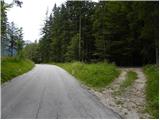
We leave the Gorenjska motorway at the Jesenice - west (Hrušica) exit and continue driving in the direction of Kranjska Gora. A little before the settlement Dovje, we leave the main road and continue driving left in the direction of Mojstrana and valleys Vrata, Kot and Krma. Still before we cross Triglavska Bistrica, signs for Radovna, Kot and Krma direct us to the left onto a somewhat narrower road, which ascends past a few houses. The road above the settlement Mojstrana starts to ascend more steeply and past the TNP sign brings us to Kosmačev preval, where the road branches off to the right into the valley Kot. Here we park in an appropriate place at the crossroads.
Route description:
From the parking lot, we head onto a cart track which in a gentle ascent runs parallel to the road. At the beginning we continue on the right cart track, and after two minutes of walking another cart track branches off to the left onto which we turn. At the crossings there are also cairns, which help us with orientation. Further, the cart track ascends on a slope straight upwards and later turns into a footpath which starts to ascend steeply. The path is poorly visible, but smaller cairns help us. The path then turns a little to the right and brings us to an indistinct small ridge. Here the path turns left and follows this small ridge straight upwards. The path soon brings us from the ridge onto steep slopes and ascends in zigzags to the main ridge. Here the path once again turns left and continues ascending through the forest. For a short time the steepness eases, but the path soon ascends steeply again. The last part of the path towards the bivouac runs mostly on slopes above the valley Vrata or on the ridge. The path then flattens and on the right side we notice a smaller cottage. This is the bivouac on Črna gora.
From the bivouac, we continue on the ridge and at first slightly descend. Then we walk for a long time on the ridge through the forest and several times ascend and slightly descend. In doing so we also ascend to some less known peaks, namely Predelov vrh, Nizko dolino and then also Lengarjeva glava, where there is also a viewpoint from which for the first time a view opens towards the east. Before that we were walking through the forest the whole time and therefore the view was very limited.
From Lengarjeva glava we continue further on the ridge and out of the forest the path brings us into the dwarf pines, where wonderful views open up on all sides. Further there follow a few more short ascents and descents through the dwarf pines, and the ridge is somewhat steeper in places. There follows an ascent over a short stretch of forest and then a short ascent through the dwarf pines, which brings us to the panoramic peak Požar.

Photos:
 1
1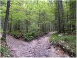 2
2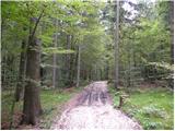 3
3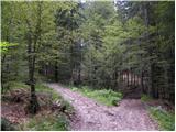 4
4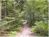 5
5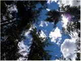 6
6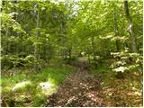 7
7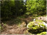 8
8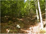 9
9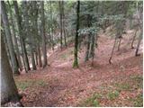 10
10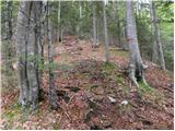 11
11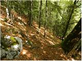 12
12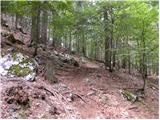 13
13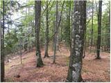 14
14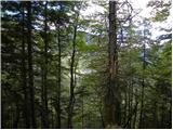 15
15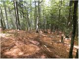 16
16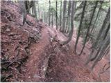 17
17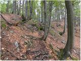 18
18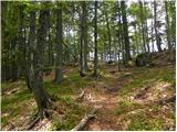 19
19 20
20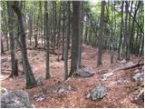 21
21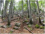 22
22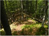 23
23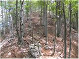 24
24 25
25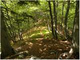 26
26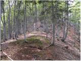 27
27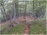 28
28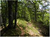 29
29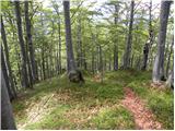 30
30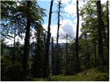 31
31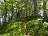 32
32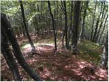 33
33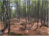 34
34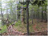 35
35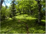 36
36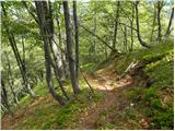 37
37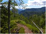 38
38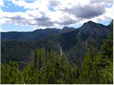 39
39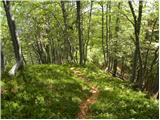 40
40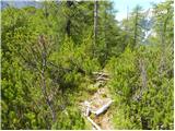 41
41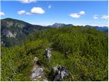 42
42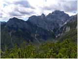 43
43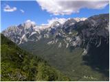 44
44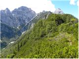 45
45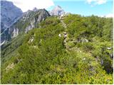 46
46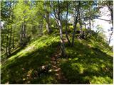 47
47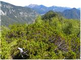 48
48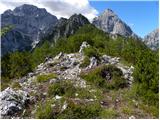 49
49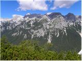 50
50
Discussion about the trip Kosmačev preval - Požar
|
| tango9. 09. 2020 |
The ascent to Črna gora always surprises me because of the steepness, and currently the beginning is also a bit harder to "find" as logging is taking place in this area, mainly of spruce bark beetles. Otherwise, the ridge path to Požar in weather like today is pure pleasure, the abundance of views indescribable. The described path is also a complete escape from the crowds that flock to the Julians these days, as we met and heard no one on the entire path. I recommend it, again and again!
|
|
|
|
| tango24. 08. 2022 15:15:03 |
My wife and I can't help but regularly visit this lonely ridge. This year we even saw the beginning, as there is a shy cairn at the junction on the path from Kosmačev preval to Mojstrana. Nice, peaceful, really wonderful views from the cliffs of Rjavina all around to Kukova špica and Sleme, Kepe and further along the Karavanke and KSA. Otherwise dry, no sign of Kotarica or Lengarjev studenec!
|
|
|
|
| Ulmus27. 09. 2022 14:27:29 |
I too didn't meet other mammals on the entire path except chamois  . Crowds at the doors you look down on nicely. I think the estimated time of 4 h is exaggerated, the path is less than 6 km long, so average hiker walks it in less than three hours. . Crowds at the doors you look down on nicely. I think the estimated time of 4 h is exaggerated, the path is less than 6 km long, so average hiker walks it in less than three hours.
|
|
|
|
| djimuzl27. 09. 2022 17:04:33 |
We, the below average, in just under three and a half hours 
|
|
|
|
| navdušena22. 06. 2023 09:02:05 |
Has anyone gone on this path this year yet, is there anything special?
|
|
|
|
| navdušena24. 06. 2023 16:10:13 |
Today we did the traverse - from Kot to Požar and then descent to Kosmačev preval. I don't know where we missed - or maybe not, we didn't go past the bivouac. The trail after the initial "introduction" becomes very steep but followable, traceability somewhat lost later when the steepness eases. But follow the ridge and it goes. Very nice. Bear? None in sight.
|
|
|
|
| ljubitelj gora24. 06. 2023 21:53:57 |
On the left side at the edge, because the path goes in the middle. ----if you went Požar-Črna gora
|
|
|
To post a comment you must log in:
If you do not yet have a username, you must first
register.