Kostanjevica na Krasu - Veliko Cerje (via Fajti hrib)
Starting point: Kostanjevica na Krasu (295 m)
| Latitude/Longitude: | 45,84510°N 13,64380°E |
| |
Route name: via Fajti hrib
Walking time: 1 h 55 min
Difficulty: easy unmarked way
Elevation gain: 48 m
Elevation difference along the route: 250 m
Map: Goriška - izletniška karta 1:50.000
Recommended equipment (summer):
Recommended equipment (winter):
Views: 3.650
 | 1 person like this post |
Access to starting point:
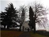
A) We leave the highway through the Vipava Valley at the exit for Šempeter and Nova Gorica, then from the nearby intersection we continue straight towards the industrial zone and Italy. A little further, we turn left towards Vrtojba and Miren, and then we follow the signs for Miren, Komen and Opatje Selo. When the settlement Miren ends, we ascend to the Karst plateau in a few hairpin turns, and we follow the road to the settlement Kostanjevica na Krasu, where we turn left towards Temnica and Lipa, and still in Kostanjevica we park at an appropriate place near the church.
B) We drive to Nova Gorica, then we continue driving towards Šempeter pri Gorici and further to Vrtojba and Miren, and then we follow the signs for Miren, Komen and Opatje Selo. When the settlement Miren ends, we ascend to the Karst plateau in a few hairpin turns, and we follow the road to the settlement Kostanjevica na Krasu, where we turn left towards Temnica and Lipa, and still in Kostanjevica we park at an appropriate place near the church.
Route description:
From the intersection on the eastern side of the church we head onto a side road, by which there are signs for Ruska jama. The path ahead leads us on a macadam road, where we first bypass a bigger structure on the left, then on the right side bypass abandoned buildings of the territorial defense in Kostanjevica na Krasu. A few minutes ahead at the fork of roads we choose left (on the right we reach the ridge of Črni hribi between Veliki vrh and Renški vrh), along it we then lightly descend.
When after some time we start lightly ascending, from the triangular intersection we continue right (left Ruska jama and Cerje), then we moderately ascend to a saddle, where we reach the marked path Cerje - Trstelj.
On the saddle we leave the road and continue left (right Trstelj), then we start ascending on the mountain path, which in a few minutes brings us to the summit of Fajti hrib.
From Fajti hrib, where there stands an information board with short descriptions of the Soča front, we continue on the marked path, which starts descending towards the northwest. After a few minutes of steeper descent we reach a poorer macadam road, which we follow to the left, past the entrance to the cavern we lightly descend to a smaller saddle and intersection, where we leave the road.
We continue on the marked path towards Cerje, which then first lightly ascends, then lightly descends, at junctions we follow the blazes. A little further the path from Vrtoče joins, and we still follow the signs for Cerje. The path ahead passes onto terrain where there was a wildfire in August 2019, and we then follow the quite panoramic path to the monument on Cerje.
Starting point - Fajti hrib 1:10, Fajti hrib - Cerje 0:45.
Description and pictures refer to the condition in February 2020.

Along the route: Fajti hrib (433m), Veliko Medvejšče (376m)
Photos:
 1
1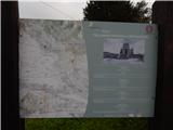 2
2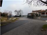 3
3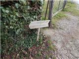 4
4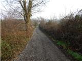 5
5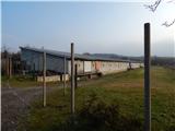 6
6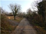 7
7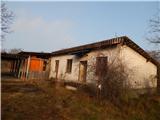 8
8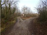 9
9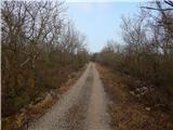 10
10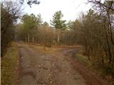 11
11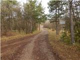 12
12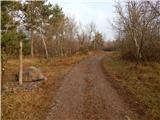 13
13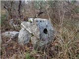 14
14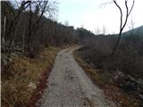 15
15 16
16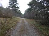 17
17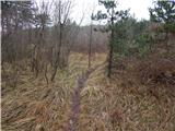 18
18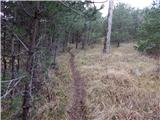 19
19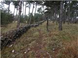 20
20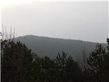 21
21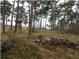 22
22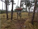 23
23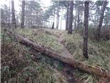 24
24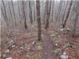 25
25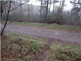 26
26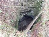 27
27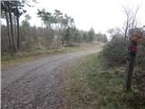 28
28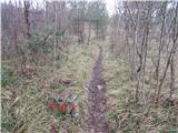 29
29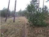 30
30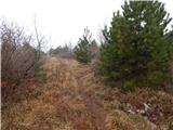 31
31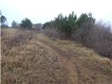 32
32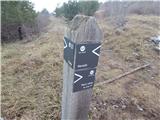 33
33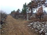 34
34 35
35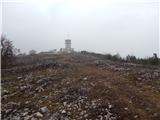 36
36 37
37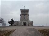 38
38
Discussion about the trip Kostanjevica na Krasu - Veliko Cerje (via Fajti hrib)
|
| mirank17. 07. 2022 11:23:35 |
Currently extensive forest fire on the southern slope of Črnih hribov from Renški vrh towards Cerje, smoke stretches a couple of km into Italy as it's burning in fairly strong bora. Fire trucks can be heard on emergency runs up there, obviously all societies from Goriška are engaged.
|
|
|
To post a comment you must log in:
If you do not yet have a username, you must first
register.