Ljubelj - Hochstuhl/Stol (lower path)
Starting point: Ljubelj (1058 m)
| Latitude/Longitude: | 46,43240°N 14,26020°E |
| |
Route name: lower path
Walking time: 4 h 50 min
Difficulty: easy marked way
Elevation gain: 1178 m
Elevation difference along the route: 1400 m
Map: Karavanke - osrednji del 1:50.000
Recommended equipment (summer):
Recommended equipment (winter): ice axe, crampons
Views: 42.406
 | 3 people like this post |
Access to starting point:
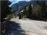
From the Ljubljana - Jesenice highway, at the Podtabor junction we continue in the direction of Ljubelj and Tržič. We continue driving on first the fast road, then the regional road, which we follow all the way to the Ljubelj border crossing. Just before the border crossing we turn left (direction Zelenica) and then after some 10 meters of additional driving, we park on a large parking lot.
Route description:
At the beginning of the parking lot, signposts for Stol, Vrtača and Dom na Zelenici direct us onto a wide cart track, which starts to ascend beside the torrent. When a little higher the cart track turns left, we continue straight on the mountain path, which continues through the forest and soon returns to the cart track. The cart track a little higher turns right and brings us out of the forest onto the ski slope of the former Zelenica ski area. There follows a short steeper ascent on the ski slope, then the path flattens and leads us along the foot of the screes below Begunjščica.
From the marked path, a path running along the service road soon branches off to the right, while we continue along the "road" to the nearby Koča Vrtača hut.
At the hut the road turns right, while we continue straight ahead in the direction of the mountain path to Zelenica. For a short time we continue below the former single-seater lift Zelenica II, then the path starts to ascend more steeply up the slope, which is partly overgrown with dwarf pines. After a few hairpin turns we return to the service road, along which we continue with a view of the Šentanski plaz gully.
The path ahead leads us across the slopes of Spodnji Plot (the peak on which a sport climbing route was created years ago), then from the road we turn right onto a footpath that cuts a longer bend. When we return to the road we are already at the upper station of the former single-seater lift Zelenica II, and only a few steps of descent separate us from Dom na Zelenici.
We bypass Dom na Zelenici on the right side, behind the hut we go left and start ascending beside the ski slope. After some 10 steps of ascent, the path to Vrtača and the upper path to Stol branch off to the right, while we continue slightly left in the direction of Dom pri izviru Završnice. A short ascent follows, then we start descending along the cart track. After a short descent we reach the end of the second, now former ski slope, then we descend easily along a wide path that mostly leads across pastures. With fine views of Begunjščica on the left and Vrtača on the right, we arrive at the source of Završnica. Behind the source the path descends more steeply for some 10 steps, then turns right and, with a view of Lake Bled, brings us to Dom pri izviru Završnice.
We continue in the direction of Stol, initially along the cart track; when the cart track turns slightly right, we continue straight onto the marked path, which starts to ascend more steeply. The path ahead enters a valley between Srednji vrh on the left and Vrtača on the right, and we ascend through this valley all the way to the Šija saddle, where there is a marked junction.
We continue slightly left in the direction of the lower path to Stol (left Srednji vrh, right Vrtača and upper path to Stol). The path ahead first descends gently across the slopes of Srednji vrh, then turns right and descends more steeply past a spring and a ruined concrete structure. After this we cross the torrent, then the path continues without major changes in elevation across the slopes of Vrtača. When we reach the valley V Kožnah, the path through Zagon joins from the left at the very start of the valley, while we continue straight ahead along the path, which starts ascending again. A little further on, among mighty boulders, we join the upper path to Stol.
We continue straight ahead as the path leads us past several large boulders. There follows a short somewhat steeper ascent and we reach a junction, where the path to Celovška koča and Svačica branches off to the right, or the path via Vatelca or Skleda joins us. Here too we continue straight ahead; the path from the valley between Srednja peč 1920 m (Srednja peč is a less known peak on the left) and the Orlic ridge (Orlice is a more difficult-to-access ridge between the Belščica saddle and Stol) gradually leads onto a larger scree field, across which we ascend diagonally to the right, then the path gradually enters a steeper valley between Mali Stol on the left and Stol on the right. Here the path ascends steeply, then gradually flattens and brings us to a marked junction, where the path to the nearby Prešernova koča branches off to the left (5 minutes), while we continue right and in 10 minutes of further walking ascend to the highest peak of the Karawanks.
Ljubelj - Koča Vrtača 0:40, Koča Vrtača - Dom na Zelenici 0:40, Dom na Zelenici - Dom pri izviru Završnice 0:20, Dom pri izviru Završnice - Šija 0:40, Šija - Stol 2:30.

Photos:
 1
1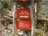 2
2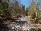 3
3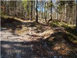 4
4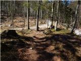 5
5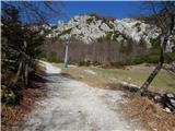 6
6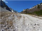 7
7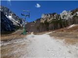 8
8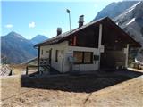 9
9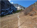 10
10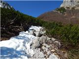 11
11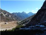 12
12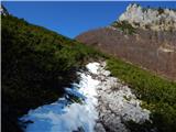 13
13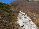 14
14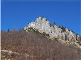 15
15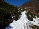 16
16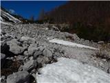 17
17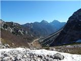 18
18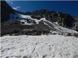 19
19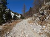 20
20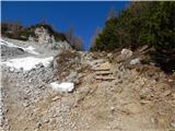 21
21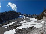 22
22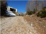 23
23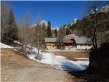 24
24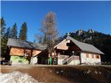 25
25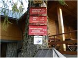 26
26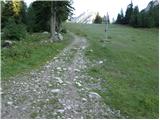 27
27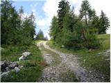 28
28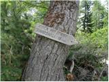 29
29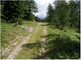 30
30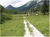 31
31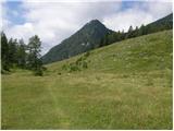 32
32 33
33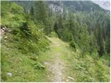 34
34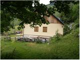 35
35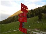 36
36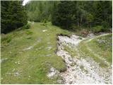 37
37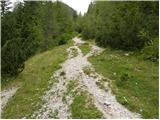 38
38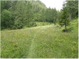 39
39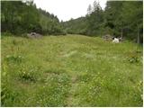 40
40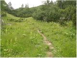 41
41 42
42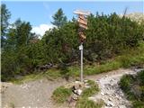 43
43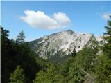 44
44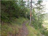 45
45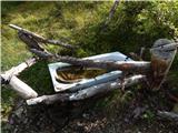 46
46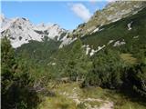 47
47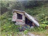 48
48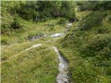 49
49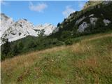 50
50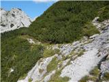 51
51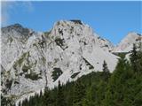 52
52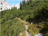 53
53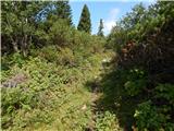 54
54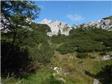 55
55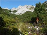 56
56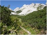 57
57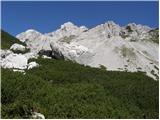 58
58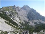 59
59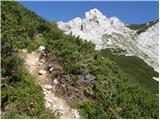 60
60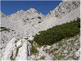 61
61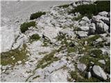 62
62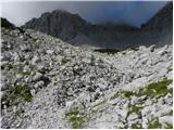 63
63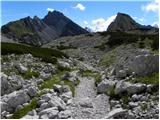 64
64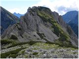 65
65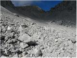 66
66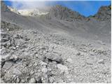 67
67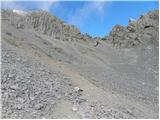 68
68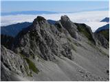 69
69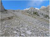 70
70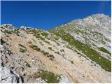 71
71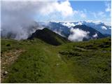 72
72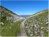 73
73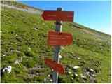 74
74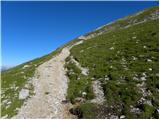 75
75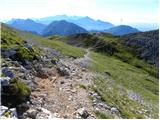 76
76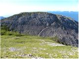 77
77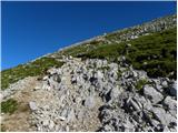 78
78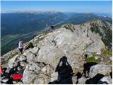 79
79 80
80
Discussion about the trip Ljubelj - Hochstuhl/Stol (lower path)
|
| ceko9. 01. 2012 |
How is the trail in the snow this year?
|
|
|
|
| as778019. 08. 2012 |
Does anyone know about the Zelenica chairlift in summer? Does it run on weekends and until when (also in September)?
|
|
|
|
| matttt1. 09. 2013 |
On 31.8. I did the described route. The landscape itself is very beautiful, but it is catastrophically poorly marked and very overgrown, so I had quite a few orientation problems. I could describe it as easy off-trail. Later, when the upper path joins it, everything is in perfect order again. The path is rather poorly visited, so I recommend it to those who like peace and little traffic on the trail.
|
|
|
|
| velkavrh2. 09. 2013 |
Whenever I go to Stol from Ljubelj, I always use it for the descent. This year too. Everything is really as mattt wrote. I wouldn't say it's poorly marked, because you actually don't notice the marks at all, I'd rather say that it's little walked on. At the saddle I always turn down to the hut Pri izviru Završnice. This one is much more pleasant than the one over the scree.
|
|
|
|
| cebelca20. 07. 2014 |
Today I walked this path. The path is normally traceable and nicely trodden. There is indeed a lot of vegetation along the path, but it doesn't bother because the path is clearly visible and doesn't get lost. I even liked it because everything is green and colorful from flowers  Given the large amount of cut bushes along the path, it might be that they have also tidied it up a bit. The markings seemed sufficient to me. Given the large amount of cut bushes along the path, it might be that they have also tidied it up a bit. The markings seemed sufficient to me.
|
|
|
|
| mikkeni27. 06. 2021 11:46:51 |
What are the conditions? Dry path from Ljubelj?
|
|
|
|
| Lazo27. 06. 2022 21:44:07 |
Hello
Here, I'm attaching a recording of the entire path to Vrtača and Stol from Ljubelj.
Back to the starting point via the marked LOWER PATH.
Safe steps!
https://youtu.be/5sPJbXHRxBA
|
|
|
To post a comment you must log in:
If you do not yet have a username, you must first
register.