Starting point: Ljubelj (1058 m)
| Latitude/Longitude: | 46,43240°N 14,26020°E |
| |
Walking time: 1 h 15 min
Difficulty: easy marked way
Elevation gain: 445 m
Elevation difference along the route: 445 m
Map: Karavanke - osrednji del 1:50.000
Recommended equipment (summer):
Recommended equipment (winter): ice axe, crampons
Views: 30.086
 | 1 person like this post |
Access to starting point:
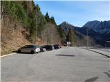
From the highway Ljubljana - Jesenice, we take the exit Ljubelj and follow the road ahead to the border crossing. Just a few meters before the border crossing, we will notice a parking lot on the right side, where we park.
Route description:
At the end of the parking lot, we notice signposts for Koča na Ljubelju, which after a few stairs take us to the old Ljubelj road. We follow this road, which is moderately ascending and in winter is converted into a sledding track, all the way to the mountain hut Koča na Ljubelju. We reach it amid places with nice views on Košutica, Veliki vrh and Begunjščica after 45 minutes of walking.
From the mountain hut, we continue left in the direction of Zelenica and Polna peč. The path ahead goes past the mountain hut and immediately behind it starts ascending. The steepness soon decreases and the path brings us to a mostly vegetated ridge, from which occasionally some views open up. After a few more minutes, we already notice the peak of Polna peč in front of us, which the path bypasses on its northern side along steep slopes. The path, which almost circles the peak, brings us to a path junction a few steps below the summit. Here we continue left in the direction of Povna peč (Polna peč) along the path, which brings us to the panoramic peak in a few steps (right Zelenica).
The description refers to April 2017, and the pictures are from December 2016 and April 2017.

Photos:
 1
1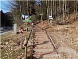 2
2 3
3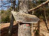 4
4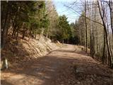 5
5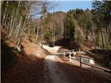 6
6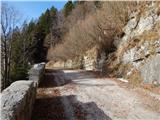 7
7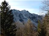 8
8 9
9 10
10 11
11 12
12 13
13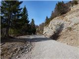 14
14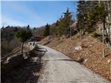 15
15 16
16 17
17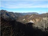 18
18 19
19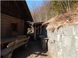 20
20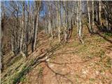 21
21 22
22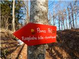 23
23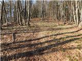 24
24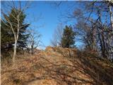 25
25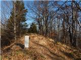 26
26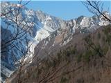 27
27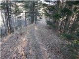 28
28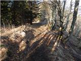 29
29 30
30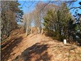 31
31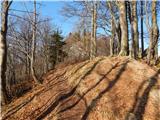 32
32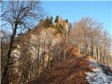 33
33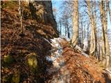 34
34 35
35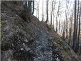 36
36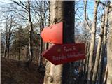 37
37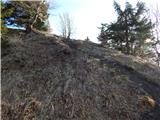 38
38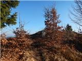 39
39 40
40 41
41 42
42
Discussion about the trip Ljubelj - Polna peč
|
| Lunca27. 07. 2011 |
quite overgrown and neglected path is not marked at all... not at the hut, no marks in between, on the signposts in the penultimate picture the letters are completely faded... But it goes... since it's obvious from the map that the path follows the border ridge, and as long as you see border markers along the path, you know you're on the right track 
|
|
|
|
| skalar5027. 07. 2011 |
indeed the path is more for naturists; due to high grass, ferns, etc. long pants come in handy.
But it's worth just below the summit also turning right and continuing along the edges to Zelenica then circling down to Ljubelj. Very short section of the path, a few meters of fixed cables.
|
|
|
|
| KARAMELICA7. 01. 2017 |
We were up there a little after the new year. The hut at the old Ljubelj was full, the surroundings nicely decorated for New Year. Then we continued the trail to Polna peč. The trail seemed interesting to us, as it passes by the border markers indicating the state border. At the top there is a neat metal box with a stamp and logbook. The trail is marked, so it's impossible to get lost. We returned the same way back past the hut at the old Ljubelj and then along the trail to the border crossing. 
|
|
|
|
| BrankaM12. 10. 2017 |
What is the path from Polna peč to Zelenica like in terms of difficulty? Is it marked? Thanks
|
|
|
|
| luva150512. 03. 2020 |
Hello, what is the path from Ljubelj like? Thanks
|
|
|
|
| orchigu11. 07. 2021 19:54:05 |
Hi, this might be useful to someone in the future:
I walked the path yesterday. The path from Ljubelj is easy, mostly on a gravel road past the hut, then into the little forest, all along the border with Austria. It's a bit overgrown, but nicely passable, I didn't notice any markings  But it's impossible to get lost on this path. The summit has great views. But it's impossible to get lost on this path. The summit has great views.
The path over Ljubeljščica to Zelenica is marked as very demanding and it holds true, I preferred to turn back and go the same way. The hut keeper at Ljubelj had already warned me that some sections are exposed, unsecured, crumbly and with a drop on both sides. I decided not to test my luck
|
|
|
|
| ucakakla21. 12. 2022 07:03:00 |
Hello, what is the path from the Ljubelj hut to the top of Polna peč like in the snow?
|
|
|
|
| turbo21. 12. 2022 07:25:13 |
Usually it's trampled, just below the summit the slope is exposed, on hard (icy, frozen) snow there is risk of slipping (photos 34,35,36).
|
|
|
|
| Majdag3. 10. 2025 17:47:50 |
1.10.... Hikers from DU Javornik Kor. Bela went to Polna peč. Fog accompanied us all the time and there were no views. But it was very cold, gloves were useful too. But no problem if the company is good. The path is nice at the beginning, then with altitude it becomes more muddy and slippery. It was pleasantly warm in the hut and the friendly caretaker served us quickly. Nice trip.
https://jelenkamenmajdag.blogspot.com/2025/10/pravljica-meglenega-dne-polna-pec.html
|
|
|
To post a comment you must log in:
If you do not yet have a username, you must first
register.