Lozice - Vojkova koča na Nanosu
Starting point: Lozice (300 m)
| Latitude/Longitude: | 45,78500°N 14,00300°E |
| |
Walking time: 3 h
Difficulty: easy marked way
Elevation gain: 940 m
Elevation difference along the route: 940 m
Map: Nanos 1:50.000
Recommended equipment (summer):
Recommended equipment (winter): ice axe, crampons
Views: 8.177
 | 1 person like this post |
Access to starting point:
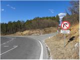
a) From the Ljubljana–Koper motorway, take the Razdrto exit and continue on the old road towards Nova Gorica. After Razdrto the road starts to descend more steeply; follow it to the junction where a road closed to public traffic branches off left downhill towards Lozice, and right towards the former expressway construction site. The mentioned junction is near the 7 km road marker and there are also signposts for Nanos. Since we must not turn left or right at the junction, it is better to park the vehicle a few hundred metres higher, in one of the parking spaces along the road.
b) From the Nova Gorica–Razdrto expressway, take the Vipava exit and continue on the old road towards Razdrto. Drive through Podnanos and past the junction of the road leading to Nanos. From this junction follow the main road for only two more kilometres, then reach the place where a road closed to public traffic branches off sharply right and steeply downhill towards Lozice, and left towards the former expressway construction site. This junction is near the 7 km road marker and there are also signposts for Nanos. Since we must not turn left or right at the junction, it is better to park the vehicle a few hundred metres lower, in one of the parking spaces along the road.
Route description:
From the starting point we first walk to the junction mentioned in the access description, then continue along the ascending road with signposts for Nanos. The road initially climbs steeply, then levels out temporarily and leads us under the viaducts of the expressway. A few dozen metres further we reach an unmarked junction, where we continue sharply right onto the road that comes very close to the expressway.
When we see the transmitters on the right side (which may not be visible in fog), on the left side of the road we notice markings for Nanos that direct us left. We continue ascending through a belt of shrubs to a meadow, where the path quickly leads us to a spring. Above it we turn left into low forest, through which we begin to ascend first gently, then moderately. Higher up we reach a somewhat wider path, which we immediately leave as the markings direct us left onto a gradually steeper trail. After a few dozen metres we cross another cart track; the trail, which gradually turns left, becomes somewhat steeper. This is followed by a traverse ascent to the left, which brings us to the “Lozice rest area”, where the path from Podnanos (starting point Hrašče) joins from the left.
Here we continue right towards the hunting lodge. The relatively wide path leads us in numerous switchbacks across increasingly steep slopes. This section of the path passes through quite scenic areas offering a beautiful view of the Vipava Hills. Higher up we reach a somewhat more demanding section where the otherwise wide path traverses a short exposed slope (especially in snow and ice there is a great risk of slipping). Above the exposed traverse we reach a marked junction, where we continue sharply right towards “Strmec” (left downhill Podnanos, straight ahead Hunting Lodge Vojkovo).
The path ahead becomes quite steep and much less trodden, but is not particularly demanding orientation-wise. Higher up it leads us out of the forest and after a break in slope levels out completely. Here we continue straight on a barely visible trail, which after two minutes of walking joins the well-trodden and marked path Hunting Lodge Vojkovo–Vojkova koča on Nanos.
When we reach the mentioned path we follow it right (left Hunting Lodge, 10 minutes). It leads us further across grassy slopes occasionally overgrown with shrubs and individual pines. The easy and barely ascending path then joins a road for a short time, but leaves it again after a few steps. It moves a little further right and begins to ascend moderately across increasingly scenic slopes of Nanos. Here an unmarked path joins from the right, which branched off right a little lower down. The path ahead becomes slightly steeper and after a few minutes of walking leads us to the church of St. Hieronymus.
From the church we continue slightly right towards Vojkova koča along a trail that a little higher up is joined from the right by the gentle path from Razdrto. After a few steps we reach a less noticeable junction where an unmarked path to Grmada branches off left. We continue slightly right on the marked path, which for some time ascends parallel to the road. The path moves a little further right from the road and leads onto the scenic north-western edge of Nanos. Here the so-called Janez path joins almost imperceptibly from the right; we continue straight on the wide trail that leads us towards the transmitters on Nanos. Just before them the path turns left, descends into a belt of forest and then leads us past the monument to Janko Premrl – Vojko to Vojkova koča on Nanos.
Lozice - Brižniki 0:40, Brižniki - Pod lovsko kočo 0:20, Pod lovsko kočo - razpotje vzhodno od lovske koče Vojkovo 0:20, razpotje vzhodno od lovske koče Vojkovo - sv. Hieronim 1:05, sv. Hieronim - Vojkova koča 0:35.

Photos:
 1
1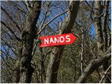 2
2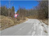 3
3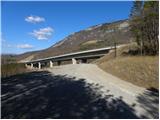 4
4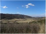 5
5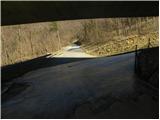 6
6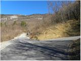 7
7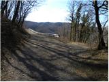 8
8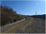 9
9 10
10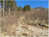 11
11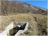 12
12 13
13 14
14 15
15 16
16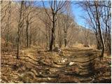 17
17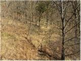 18
18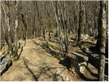 19
19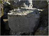 20
20 21
21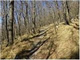 22
22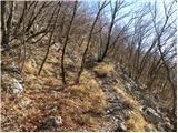 23
23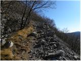 24
24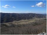 25
25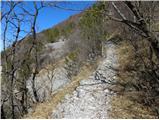 26
26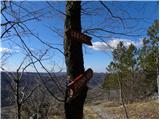 27
27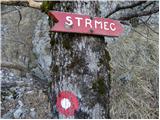 28
28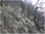 29
29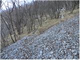 30
30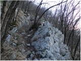 31
31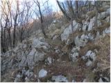 32
32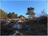 33
33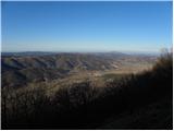 34
34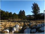 35
35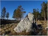 36
36 37
37 38
38 39
39 40
40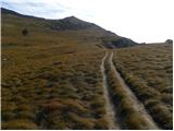 41
41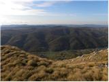 42
42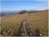 43
43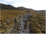 44
44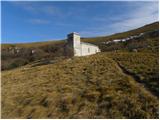 45
45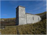 46
46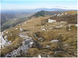 47
47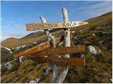 48
48 49
49 50
50 51
51 52
52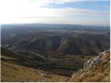 53
53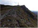 54
54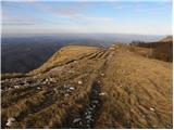 55
55 56
56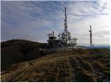 57
57 58
58 59
59
Discussion about the trip Lozice - Vojkova koča na Nanosu
To post a comment you must log in:
If you do not yet have a username, you must first
register.