Starting point: Luče (522 m)
| Latitude/Longitude: | 46,35530°N 14,74820°E |
| |
Walking time: 4 h 40 min
Difficulty: easy marked way
Elevation gain: 1540 m
Elevation difference along the route: 1575 m
Map: Kamniške in Savinjske Alpe 1:50.000
Recommended equipment (summer):
Recommended equipment (winter): ice axe, crampons
Views: 48.075
 | 2 people like this post |
Access to starting point:
From the highway Ljubljana - Maribor, we take the exit Šentrupert, and then continue driving in the direction of Logarska dolina. At the beginning of the settlement Luče, only a few meters before the road crosses the river Savinja, we will notice on the left side of the road a larger macadam parking lot, where we park.
We can also reach the starting point via the mountain pass Volovjek (Kranjski Rak). In this case, in Luče we turn right in the direction towards Mozirje and then only a few dozen meters after the bridge over the river Savinja we park on the aforementioned parking lot.
Route description:
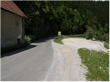
Between the parking lot and the bridge over the river Savinja, we will notice by the road a sign for the mountain hut Koča na Loki, which directs us to the path that first steeply ascends the stairs. The path soon flattens, and then continues along the ridge that steeply descends towards the river Savinja. Further, we enter a dense forest, and the path quickly brings us to a chapel, behind which there is a smaller junction.
We continue on the right path, which begins to ascend steeper and steeper, then flattens and turns right. A short traverse to the right follows, then we step out of the forest onto an extensive meadow. Further, the poorly visible path ascends diagonally across the mentioned meadow, then brings us to a smaller hamlet, where we again notice the blazes. The path ahead leads us past a few houses and above them into a belt of bushes, through which we ascend to the nearby road. We only cross the mentioned road, as the signposts located by a smaller religious symbol direct us to a footpath that further moderately ascends through the forest. A little higher, a nice view of Raduha opens up, and we continue on the marked path, which a little higher brings us to the road, which already after a few meters reaches a marked junction. We continue slightly left and continue the ascent along the road in the direction of Raduha. Further, we ascend the road for quite some time, which has some marked shortcuts (blazes on this section are very rare), then we reach a newly built road, where in the middle of the left bend a wide marked cart track branches off to the right. We continue the ascent along the mentioned cart track, which higher again brings us to the mentioned road, and we walk along it only a few dozen steps, then on the left side we notice a marked path leading towards the mountain pastures Loka and Arta (the branch-off from the newly built road is not marked). Further, we ascend diagonally parallel to the road, and the path a little further brings us to a large bench by which there is a marked junction.
We continue on the right path (left to mountain pasture Arta), which for some time still ascends diagonally, then brings us to the road leading towards Snežna jama. We reach the mentioned road right at the junction, where a forest road closed to public traffic branches off to the right, leading towards mountain pasture Loka. We head onto the mentioned road, along which with 15 minutes of moderate ascent we climb to the mountain hut Koča na Loki pod Raduho.
From the hut, we continue along the marked path in the direction of Raduha, which already after a few dozen steps splits into two parts. We continue slightly left (slightly right to Durce) along the path that gently ascends along the left edge of the valley. The path soon turns left and steeply ascends through a belt of sparse forest. The steepness soon eases, and the path leads us through some smaller meadows into a belt of dwarf pines, where it further ascends moderately to occasionally steeply. After approximately one hour of walking from the mountain hut Koča na Loki, the path from Durce joins from the right, and we continue left along the traverse path in the direction of Raduha. The increasingly scenic path bypasses the summit of Mala Raduha on the south side, then brings us to the main ridge, from which a nice view opens up to the northern side.
We continue along the marked path, to which the climbing path from the mountain hut Koča na Grohatu soon joins from the right. The path ahead again begins to ascend more steeply and then after a few minutes of further walking brings us to the 2062 m high summit.

Photos:
 1
1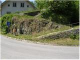 2
2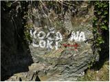 3
3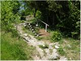 4
4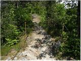 5
5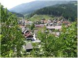 6
6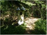 7
7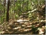 8
8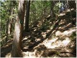 9
9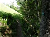 10
10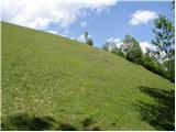 11
11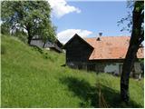 12
12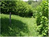 13
13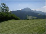 14
14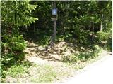 15
15 16
16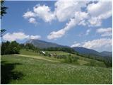 17
17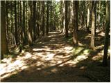 18
18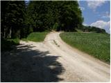 19
19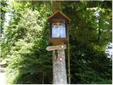 20
20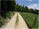 21
21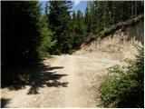 22
22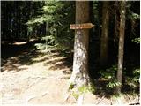 23
23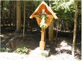 24
24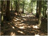 25
25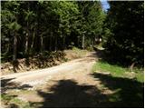 26
26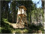 27
27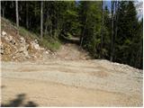 28
28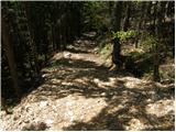 29
29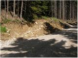 30
30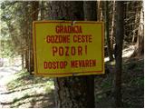 31
31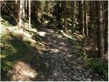 32
32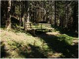 33
33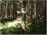 34
34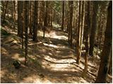 35
35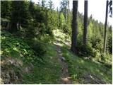 36
36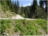 37
37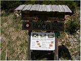 38
38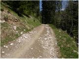 39
39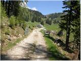 40
40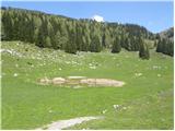 41
41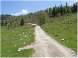 42
42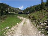 43
43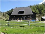 44
44 45
45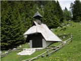 46
46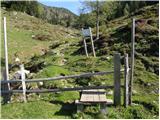 47
47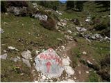 48
48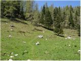 49
49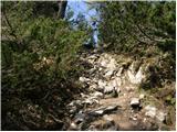 50
50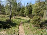 51
51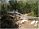 52
52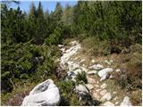 53
53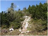 54
54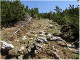 55
55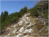 56
56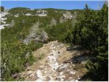 57
57 58
58 59
59 60
60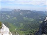 61
61 62
62 63
63 64
64 65
65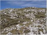 66
66 67
67
Discussion about the trip Luče - Velika Raduha
|
| Marx30. 06. 2013 |
30.06.2013.
Went on this path from Luče to Velika Raduha. The path is well marked at the start to the hamlet, there are some green-white marks. When we reach the road (pic 19) marking problems start which simply disappear... to pic 30 there's only one single mark. Junctions are marked with arrows (on one the arrow is on the ground), but one (somewhere before the hunting observatory on pic 27) is missing altogether. Only from pic 28 markings are finally drawn again... but quite faded.
The bench on pic 33 is at the junction where we're just going to the hut on Loki (that's marked) but nowhere an arrow for planina Arta which branches off almost imperceptibly upwards north here... And that part from bench to Arta is marked with now almost completely faded marks...
From the hut onwards no more marking problems.
Maybe someone will attack me for those criticisms, but when going first time no nice feeling of uncertainty because no marks...
|
|
|
|
| anazala4. 04. 2017 |
Raduha. Nice tour for a day trip. 1.4.2017. It's the first of April. But still believe me. Quite some snow in shady areas. Crampons not necessary.
|
|
|
|
| urosp8217. 07. 2022 18:59:44 |
Today I was on Raduha, from Luče. The trail is very well signposted and marked all the way. It's true that to the hut on Loki there's quite some walking on macadam road, but it comes in very handy on the way down, otherwise the lower half hour from Luče is a bit steeper, then onwards gently to the hut. From the hut to the summit it's a very pleasant and beautiful trail, requires some fitness, but the views reward all the effort.
|
|
|
|
| magic2k8. 05. 2026 15:52:10 |
Today I went from Luč. The path is very nicely marked, no snow. I see that no one publishes the path length.. well, almost 10 km one way. So you'll know.
|
|
|
To post a comment you must log in:
If you do not yet have a username, you must first
register.