Malga Crocifisso - Sas de Adam
Starting point: Malga Crocifisso (1599 m)
| Latitude/Longitude: | 46,41995°N 11,72798°E |
| |
Walking time: 2 h 35 min
Difficulty: easy marked way
Elevation gain: 831 m
Elevation difference along the route: 850 m
Map: Tabacco 06 1:25.000
Recommended equipment (summer):
Recommended equipment (winter): ice axe, crampons
Views: 351
 | 2 people like this post |
Access to starting point:
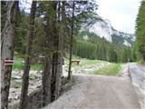
A) Access from Gorenjska: Through the Karawanks Tunnel, we drive to Austria, and then continue driving towards Spittal and further towards Lienz (a little after Spittal the motorway ends). Further, we drive on a relatively nice and wide road through the Drava Valley, which brings us to Italy. The road further leads past Dobbiaco / Toblach and Brunico / Bruneck. Only a little after the last-mentioned place, past which a bypass leads, we turn left into the Val Badia valley. Further, we drive through the mentioned valley past the places La Villa and Corvara. Next follows an ascent over the passes Passo Campolongo and Passo Pordoi. From the pass Passo Pordoi, we then descend on the western side into the Val di Fassa valley. In the place Pozza di Fassa, at the roundabout, we continue left in the direction of Val San Nicolo. We follow this road to the alpine pasture Malga Crocifisso. From the alpine pasture, we can continue a little less than a kilometre along the road and then turn left (marked with the sign "Ferrata") across a small bridge where we park.
B) From the Primorska side: From Nova Gorica, we drive to Italy and further on the motorway towards Venice / Venezia. At the place Portogruaro, we leave the motorway towards Venice and continue right on the motorway towards the place Pordenone. At the next motorway junction near the place Conegliano, we continue right towards the place Belluno. We follow the motorway to the exit for Belluno. When we leave the motorway, we come to a larger roundabout, which we leave at the exit for Belluno and the place Feltre. In the smaller roundabout in the place Belluno, we then continue right towards the place Agordo. We follow this road all the way to the place Pozza di Fassa in the Val di Fassa valley. In the place Pozza di Fassa, at the roundabout, we continue right in the direction of Val San Nicolo. We follow this road to the alpine pasture Malga Crocifisso. From the alpine pasture, we can continue a little less than a kilometre along the road and then turn left (marked with the sign "Ferrata") across a small bridge where we park.
Route description:
From the starting point, we continue left on the road which ascends through a strip of forest and soon brings us to a ski slope. We continue on the mentioned road which further runs along the ski slope from which beautiful views start to open up on the peaks above the Val di San Nicolo valley.
When the ski slope turns left, we leave the road which runs along the ski slope and head slightly right onto a cart track which leads into the forest. If we miss the junction, we can also continue further along the ski slope, which also leads towards the hut Rifugio Buffaure. From the junction, we continue on the cart track which starts to ascend through the forest and soon we will notice a feeding station for wildlife on the right side. We continue straight ahead and the cart track turns into a path. The path then turns right and then mostly ascends in zigzags through the forest. The path is otherwise marked with red-white markers, which are relatively rare. During the ascent, the path occasionally brings us to shorter clearings from which a nice view also opens up on the surrounding peaks. Such a path then continues all the way until we come out of the forest onto grassy slopes from which a view opens towards the hut Rifugio Buffaure. The path then turns left and follows the last ascent to the hut.
From the hut, we continue right on a gentle wide path from which a beautiful view opens towards the mountain group Catinaccio (Rosengarten). The path quickly brings us to a junction where we continue right on path 613 following the signs "Col de Valvacin, Sas d'Adam", straight ahead the path leads towards the upper station of the circular cabin cable car.
From the junction, we walk on a gentle road which runs along the ski slope. Later the road turns slightly right and starts to ascend somewhat more steeply. Such a path then soon brings us to the hut Rifugio Baita Cuz.
From the hut, we continue on the road which turns slightly left and starts to ascend steeply along the ski slope. We continue further on the steep road all the way to the ridge where the upper station of the Pala del Geiger cableway is. Here, a view also opens briefly to the northern side towards the mountain groups Sassolungo and Sella. We continue right on the road, which further is gentler and moves away from the ridge to the right side. Along this road, we soon reach the hut Rifugio el Zedron, which is located at the summit Col de Valvacin. We reach the summit by bypassing the hut on the right side, then at the ridge where there is a junction, we continue left and in a few steps reach the panoramic summit.
From the summit, we return to the mentioned junction and continue along the ridge towards the east. Further on, we always walk on a relatively gentle path which runs along the grassy ridge. At some places, the slopes along the ridge are somewhat steeper but in dry conditions they are not dangerous for slipping. When we approach the summit Sas de Adam somewhat more closely, the path ascends somewhat more steeply again. Along the panoramic path, we soon reach the summit.

Photos:
 1
1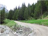 2
2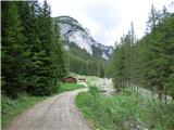 3
3 4
4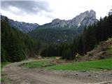 5
5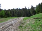 6
6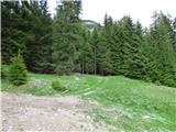 7
7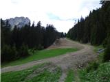 8
8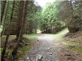 9
9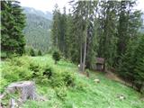 10
10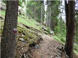 11
11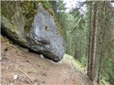 12
12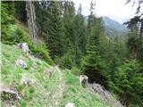 13
13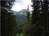 14
14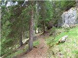 15
15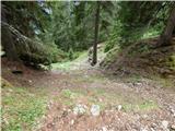 16
16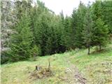 17
17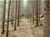 18
18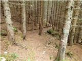 19
19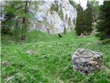 20
20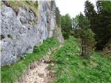 21
21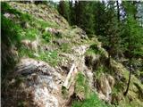 22
22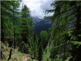 23
23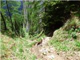 24
24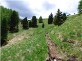 25
25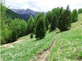 26
26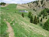 27
27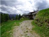 28
28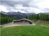 29
29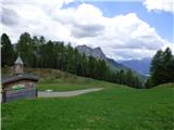 30
30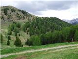 31
31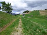 32
32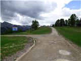 33
33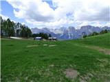 34
34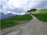 35
35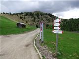 36
36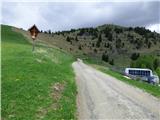 37
37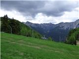 38
38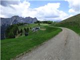 39
39 40
40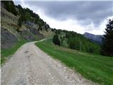 41
41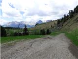 42
42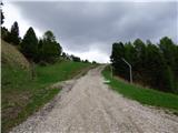 43
43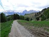 44
44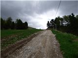 45
45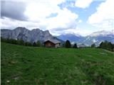 46
46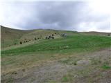 47
47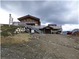 48
48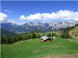 49
49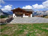 50
50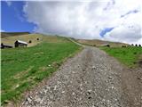 51
51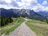 52
52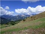 53
53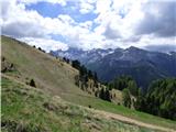 54
54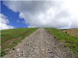 55
55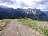 56
56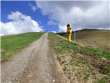 57
57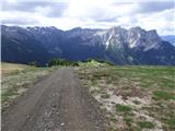 58
58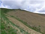 59
59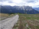 60
60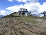 61
61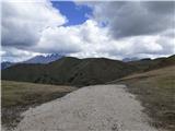 62
62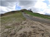 63
63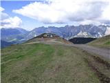 64
64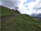 65
65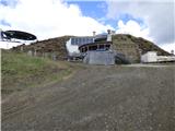 66
66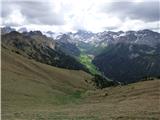 67
67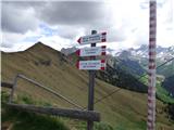 68
68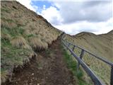 69
69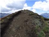 70
70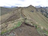 71
71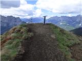 72
72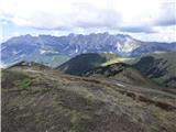 73
73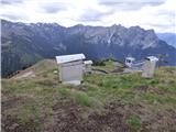 74
74 75
75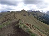 76
76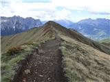 77
77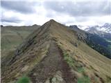 78
78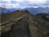 79
79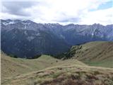 80
80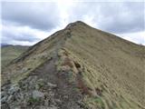 81
81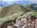 82
82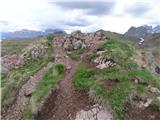 83
83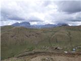 84
84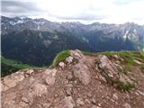 85
85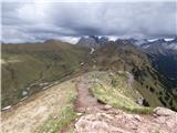 86
86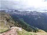 87
87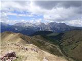 88
88
Discussion about the trip Malga Crocifisso - Sas de Adam
To post a comment you must log in:
If you do not yet have a username, you must first
register.