Starting point: Mašun (1022 m)
| Latitude/Longitude: | 45,62826°N 14,36613°E |
| |
Walking time: 3 h 35 min
Difficulty: easy marked way
Elevation gain: 672 m
Elevation difference along the route: 725 m
Map: Snežnik 1:50.000
Recommended equipment (summer):
Recommended equipment (winter): ice axe, crampons
Views: 1.574
 | 3 people like this post |
Access to starting point:
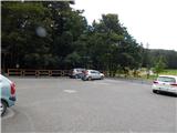
From Ilirska Bistrica or Pivka we drive to Knežak, and from there we follow the signs for Mašun. There follow a few kilometers of driving on a somewhat winding, but entirely asphalted road to Mašun. We park on the asphalted parking lot near the inn Mašun.
Route description:
From the parking lot, we walk to the nearby crossroad, from which we continue slightly right in the direction of European footpath E6 and Snežnik. At first, we still walk on an asphalt road, and the asphalt soon ends and we continue on a wider macadam road, on which we walk to a distinct left turn. At the turn, to which we need a little less than 20 minutes of walking, we go right on a marked cart track, and it quickly changes into a poorly beaten forest path, where we follow the blazes of European footpath. A little further, we reach the macadam road, on which we step right at the turning area, from the turning area we go slightly left and continue on a cart track which at first slightly descends, then continues without major changes in altitude. At the smaller junction, where the wider cart track turns slightly to the right, we go straight and then we reach another forest road which we follow to the left. There follow a few smaller crossroads, where we continue straight, when we reach a wider macadam road we follow it to the right in the direction of Snežnik and Sviščaki. The path ahead leads us also past the cottage Škrli, at the marked crossroad, where the road sign for Snežnik and Sviščaki directs to the right, we continue straight and follow the blazes. A few minutes further the signs for European footpath E6 direct us right onto a steeper cart track, on which we ascend through the forest. At the smaller junction of cart tracks we go right, a little higher from the cart track slightly left onto a footpath, which soon reaches a macadam road. We follow the road briefly to the left, then poorly visible signs direct us slightly right, where we ascend over a newer clearing. When we reach the road again we ascend along it through the left serpentine, at the abandoned hut we go right onto a worse road, where we continue to follow the signs of path E6. At the nearby crossroad we go left once again, when the road turns sharply left we leave it and continue right on the marked path, which after a few minutes reaches the next road, which we follow to the right. There follows some moderate ascent on the macadam road, when we arrive at the junction, where path E6 branches off to the left, and the road continues toward Sviščaki, we continue left onto the cart track following the signs of European footpath E6. The cart track soon changes into a steeper footpath ascending through the beech forest. When we reach the at first indistinct forested ridge of Mali Snežnik we join the path from Grda draga, where classic Knafelc blazes appear for the first time.
We continue in the direction of Snežnik and Mali Snežnik, this time on a somewhat steeper path, which leads us past the memorial. Above the memorial the first extensive view opens up, reaching across Nanos all the way to the Alps. Continuing we ascend on a path which leads us through the dwarf pines. When the steepness eases we arrive at the old stone trigonometric point, located on the summit, or a few steps below the summit of Mali Snežnik, from where the view opens onto Veliki Snežnik, Istria, Primorska, Notranjska...
Description and pictures refer to the state of September 2020.

Along the route: Vrata (1024m)
Photos:
 1
1 2
2 3
3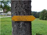 4
4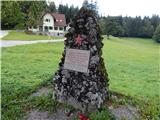 5
5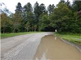 6
6 7
7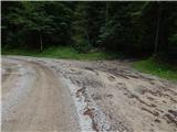 8
8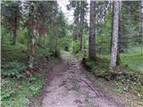 9
9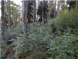 10
10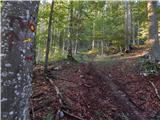 11
11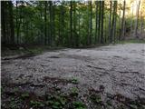 12
12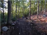 13
13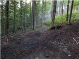 14
14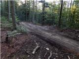 15
15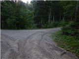 16
16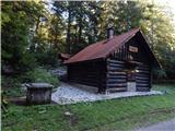 17
17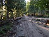 18
18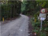 19
19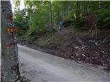 20
20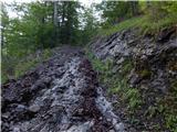 21
21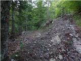 22
22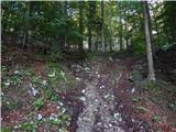 23
23 24
24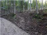 25
25 26
26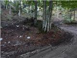 27
27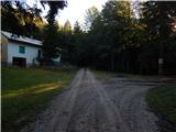 28
28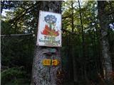 29
29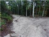 30
30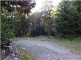 31
31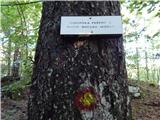 32
32 33
33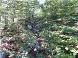 34
34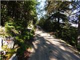 35
35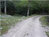 36
36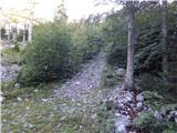 37
37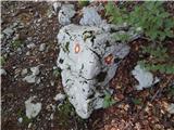 38
38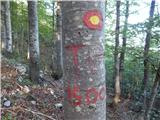 39
39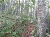 40
40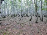 41
41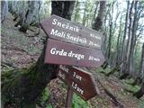 42
42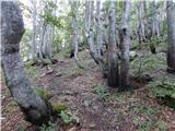 43
43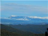 44
44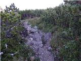 45
45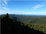 46
46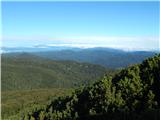 47
47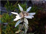 48
48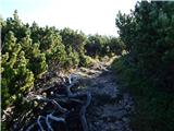 49
49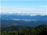 50
50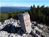 51
51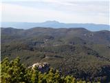 52
52
Discussion about the trip Mašun - Mali Snežnik
|
| marco24. 09. 2020 |
There are no border stones on Mali Snežnik and generally on Snežnik.
That concrete thing on M. Snežnik is a trigonometric point marking an important geodetic point.
If I am not mistaken, it is 3rd order on Mali, 1st order on Veliki Snežnik.
Regards
|
|
|
|
| Tadej24. 09. 2020 |
Thanks for the heads-up. I have corrected it.
|
|
|
|
| padez26. 01. 2021 |
I'm wondering why the cameras on Snežnik and Svišćaki haven't been working for over a month. For Snežnik I could understand somehow, but Svišćaki? The road is asphalted and plowed, but instead of images there's darkness...
|
|
|
|
| marco26. 01. 2021 |
The reason why the cameras on Snežnik and Svišćaki don't work is essentially very simple... and at the same time very complicated... like many things in this modern time... so let's get to the essence.
The system was voluntarily set up by local radio amateurs and hikers, and simplified, it works like this:
The Wi-Fi signal arrives via air link to Svišćaki from Snežnik.
The Wi-Fi signal reaches Snežnik from Slavnik.
As far as I know, the signal reaches Slavnik via cable to the radio amateur station at the top, which sends it further to Snežnik as mentioned.
All this operates on amateur radio technology, which I won't explain now.
The problem arises on Snežnik, where the entire system collapses due to cloud cover, snow, rime, hoarfrost, bad weather etc.
Namely, in the hut on Snežnik, all the accompanying hi-tech equipment needs power - i.e. electricity - and this electricity depends on photovoltaic cells, which in winter are mostly covered with winter delights like snow, hoarfrost, rime... and even when these cells are cleaned (which locals persistently try to do), the problem with the transmitter remains, which is high under the ridge of the hut, and its cleaning and maintenance in the given conditions is not only already demanding, but certainly very problematic or dangerous.
Thanks to all Hribonet viewers for understanding anyway.
Best regards and good luck!
|
|
|
|
| marco26. 01. 2021 |
And this is the state of the cells and the 'antenna':
|
|
|
|
| padez27. 01. 2021 |
Marko, thanks for the explanation...
|
|
|
To post a comment you must log in:
If you do not yet have a username, you must first
register.