Nomenj - Koča na Soriški planini (via Planina Strmne)
Starting point: Nomenj (490 m)
| Latitude/Longitude: | 46,28930°N 14,00300°E |
| |
Route name: via Planina Strmne
Walking time: 2 h 45 min
Difficulty: easy unmarked way
Elevation gain: 816 m
Elevation difference along the route: 835 m
Map: TNP 1:50.000
Recommended equipment (summer):
Recommended equipment (winter): ice axe, crampons
Views: 1.770
 | 2 people like this post |
Access to starting point:
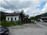
A) We drive to Bled, from where we continue driving towards Bohinj. Just before Bohinjska Bistrica, at the settlement Nomenj, where by the main road are situated the bus station, railway station and inn Gostilna pri Matičku, the described path begins. At the starting point there are no appropriate places for parking.
B) We drive to Bohinjska Bistrica, then we continue driving towards Bled. Just before Bled, at the settlement Nomenj, where by the main road are situated the bus station, railway station and inn Gostilna pri Matičku, the described path begins. At the starting point there are no appropriate places for parking.
Route description:
From the inn Gostilna pri Matičku we continue in the direction of the waterfall Grmečica, where the path first leads parallel to the main road, but we walk on a worse macadam road. Soon we go right through the underpass under the railway track, then we go right again in the direction of the waterfall Grmečica and Eminov plavž. We continue on the macadam road, which over pastures brings us to the former parking lot; today parking is allowed only with a permit for fishermen and users of the canyon (canyoning).
From the parking lot we continue further on the macadam road, which quickly brings us to the footbridge over the river Sava Bohinjka. After the bridge we continue left towards Eminov plavž (right the waterfall Grmečica) and walk on the macadam road to the nearby Eminov plavž, where there is an information board.
Over the small wooden bridge we walk to the renovated ruins of the plavž, then we continue on the cart track in the direction towards the source of Plavžarica (the signpost points somewhat too far to the right). Further on we first ascend along the left side of Plavžarica, higher we cross it and continue the ascent briefly along the left bank, but the path turns further to the right before the source, where at the triangular junction of cart tracks we choose the one that ascends. Some junctions follow, and we follow the "main" cart track, by which we ascend to the forest road, which we follow right towards Nemški Rovt (if we continue left we can reach Bitenjska planina and further Ratitovec). Further on we walk for some time on the macadam road, after crossing the usually dry bed of Grmečica we continue straight from the junction. When we reach the asphalt road we go left (right Nemški Rovt), along it to the first left bend, from which we continue slightly right onto the cart track that ascends along the gully. When a little further ahead the cart track enters the bottom of the valley, it disappears, and higher it is overgrown by lush vegetation. Before the somewhat steeper head of the valley, we notice a path on the left that ascends transversely from the gully and after a short traverse brings us to another path, which we follow right upwards, so we walk above the "bed" of the gully or valley. Above the steep section, due to which the path left the valley, we return to the valley; due to the windthrow in December 2017, continuing on the old path is practically impossible. When climbing over fallen trees and crawling under them, we keep the direction straight or slightly left, soon stepping onto a newer cart track that formed during the cleanup of the fallen trees. At the mentioned cart track's junctions we follow slightly right, and when we reach the macadam road, we go right again (if we continue left on the mentioned road, we return to the asphalt road). The macadam road splits quickly, and we choose the left path (here we would step onto a wider road if the old path were followable, which due to fallen trees is impassable). Further the road leads us across the expansive Planina Strmne, where we reach the marked path Bohinjska Bistrica - Soriška planina.
A few steps further we leave the road and continue left towards Soriška planina (straight Orožnova koča), and the path leads us across a moderately steep hayfield. After a small hut the path enters the forest, through which it ascends moderately to occasionally steeply, and higher we cross another forest road. The marked path, along which there are mostly older markings, then brings us to the high-voltage power line, along which we ascend for some time; further we also cross the road leading to the pass Vrh Bače. On this section the path enters a small valley, along which we easily ascend to the main road, along which we continue to the large parking lot at the foot of Soriška planina, where there is also the bar Brunarica.
Behind the information boards we go right and ascend to the Litostrojska koča on Soriška planina in a few minutes.
The description and pictures refer to the condition in 2018 (May).

Along the route: Planina Strmne (935m), Bohinjski preval (1280m)
The trip can be extended to the following destinations: Vrh Bače,
Planina Za Črno goro,
Kobla,
Krevl,
Dravh,
Lajnar,
Šavnik,
Slatnik (southeastern peak),
Možic,
Slatnik (northwestern peak),
Rušni vrh,
Črna prst
Photos:
 1
1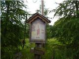 2
2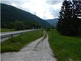 3
3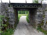 4
4 5
5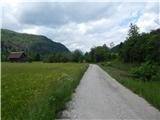 6
6 7
7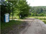 8
8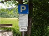 9
9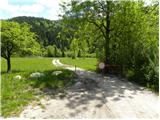 10
10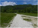 11
11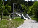 12
12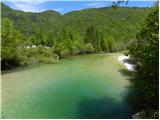 13
13 14
14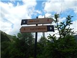 15
15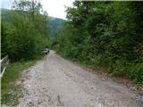 16
16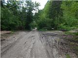 17
17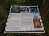 18
18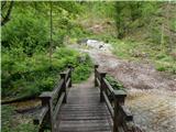 19
19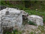 20
20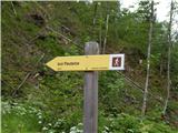 21
21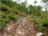 22
22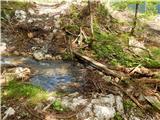 23
23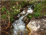 24
24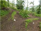 25
25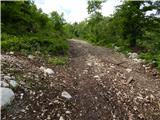 26
26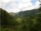 27
27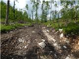 28
28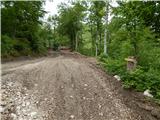 29
29 30
30 31
31 32
32 33
33 34
34 35
35 36
36 37
37 38
38 39
39 40
40 41
41 42
42 43
43 44
44 45
45 46
46 47
47 48
48 49
49 50
50 51
51 52
52 53
53 54
54 55
55 56
56 57
57 58
58 59
59 60
60 61
61 62
62 63
63 64
64 65
65 66
66 67
67 68
68 69
69 70
70 71
71 72
72 73
73
Discussion about the trip Nomenj - Koča na Soriški planini (via Planina Strmne)
To post a comment you must log in:
If you do not yet have a username, you must first
register.