Olipova planina - Potoški Stol
Starting point: Olipova planina (1320 m)
| Latitude/Longitude: | 46,44140°N 14,12350°E |
| |
Walking time: 2 h 40 min
Difficulty: easy unmarked way
Elevation gain: 694 m
Elevation difference along the route: 800 m
Map: Karavanke - osrednji del 1:50.000
Recommended equipment (summer):
Recommended equipment (winter): ice axe, crampons
Views: 7.422
 | 2 people like this post |
Access to starting point:
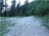
From the highway Ljubljana - Jesenice we go to the exit Lesce and follow the road ahead in the direction of Žirovnica and Jesenice. After a few km of driving, we will get to a crossroads, where the road to Žirovnica and Moste branches off to the right (from the direction of Jesenice left). Only a few meters ahead in the next crossroads, we turn left to Moste (right Žirovnica). Further, we drive past a monument to fallen soldiers, where the road starts ascending on a hill below the railway track. On top of the slope, we turn right (at the sign Vila Karin), and we continue towards Završniško jezero and Valvasorjev dom. The road then flattens and brings us to a crossroads, where the road to Valvasorjev dom branches off to the left. We go on the mentioned road (straight Koča pri izviru Završnice), which starts first gently, then steeper and steeper ascending on an occasionally quite rough road (the steepest parts are asphalted). Higher, the road brings us to a somewhat larger crossroads, where we continue left in the direction of Potoška planina (right Doslovška planina). The road then flattens and a little further brings us to the next crossroads, where a road towards Valvasorjev dom branches off to the right, and we continue on the left lower road, which then for quite some time continues without large changes in altitude. The road then leads us past a turn-off of the path to Ajdno and then starts ascending steeper on an occasionally quite rough road. The road then again flattens and past Potoška planina brings us to the spring Urbas, near which there are a few smaller parking spots. We continue driving, and the road leads us over some smaller crossroads, where we always stick to the most trafficked one. The road then again steeply ascends and a little higher brings us to a larger parking lot, where we park.
Route description:
From the parking lot, we continue on a worse macadam road which gradually changes into a wide cart track, and it past a trough with water brings us on the edge of the mountain pasture Stamare, from which a nice view towards the Julian Alps opens up.
From the mountain pasture, we continue right past shepherd and hunting cottage on at first a little poorly visible footpath which goes higher into the forest and joins a wider path, which comes from the other part of the mountain pasture. Further, the path turns slightly right and starts ascending steeply. Higher, the path passes out of the forest on slopes covered with dwarf pines and turns a little towards the left. Next follows a light diagonal ascent and the path brings us to the mountain pasture Hrašenska planina, where we notice a shepherd hut.
Here before we cross a grazing fence we turn right and we ascend on at first still easy to follow path. After a short ascent through dwarf pines the path passes on slightly vegetated grassy slopes, where it starts vanishing (look for cairns). Further, we follow occasionally barely visible footpath which crosses slopes towards the east. The footpath then again becomes easier to follow and brings us to the shepherd hut on the mountain pasture below Belščica.
From the mountain pasture, we continue in a gentle diagonal ascent towards the bivouac (direction east), which we already see in front of us and we reach it after good 10 minutes of additional walking.
Only a little left from the bivouac we will notice a poorly visible footpath which further ascends towards the east. Further, we ascend on the mentioned footpath which diagonally ascends over occasionally somewhat steeper slopes. The path which crosses two more distinct gullies higher brings us on a marked path, which we follow to the right. Already after a few steps of walking on the marked path, the path to Vajnež branches off to the left (20 minutes), and we continue straight on the path which slightly turns to the right and after a few steps of descent brings us into a small valley between Vajnež and Potoški Stol (near Vajneževo sedlo). The path only crosses the mentioned small valley and then steeply ascends towards the ridge of Potoški Stol. On the ridge the marked path turns left, and we follow it to the spot where it leaves the ridge. We continue straight on a wide and gentle ridge, all the way to the top of Potoški Stol, which we reach in a few dozen steps.
From the top, we can descend a few dozen meters to the cross on Potoški Stol. In fog we will hardly find the cross.
Izhodišče - Planina Stamare 15 minutes, Planina Stamare - Hrašenska planina 45 minutes, Hrašenska planina - bivouac on Belščica 40 minutes, bivouac on Belščica - Potoški Stol 1:00.

Photos:
 1
1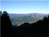 2
2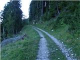 3
3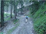 4
4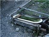 5
5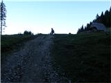 6
6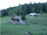 7
7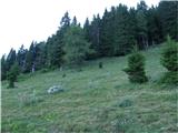 8
8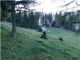 9
9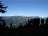 10
10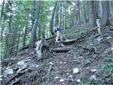 11
11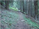 12
12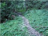 13
13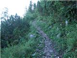 14
14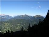 15
15 16
16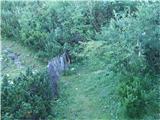 17
17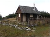 18
18 19
19 20
20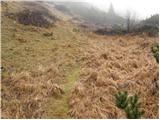 21
21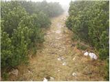 22
22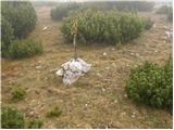 23
23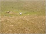 24
24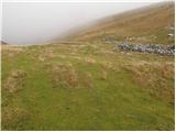 25
25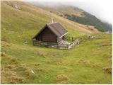 26
26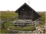 27
27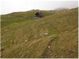 28
28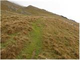 29
29 30
30 31
31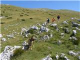 32
32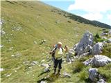 33
33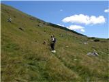 34
34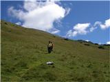 35
35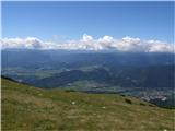 36
36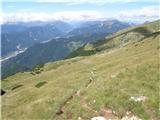 37
37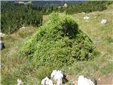 38
38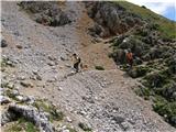 39
39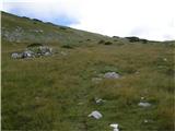 40
40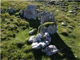 41
41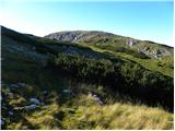 42
42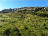 43
43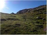 44
44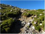 45
45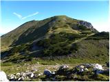 46
46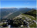 47
47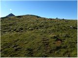 48
48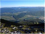 49
49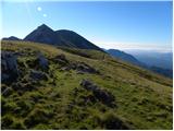 50
50 51
51
Discussion about the trip Olipova planina - Potoški Stol
To post a comment you must log in:
If you do not yet have a username, you must first
register.