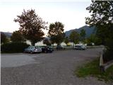
Parkirišče Alpspitzbahn - Alpspitze (Ostgrat)
Starting point: Parkirišče Alpspitzbahn (760 m)
| Latitude/Longitude: | 47,47154°N 11,06208°E |
| |
Route name: Ostgrat
Walking time: 6 h 15 min
Difficulty: difficult marked way
Elevation gain: 1868 m
Elevation difference along the route: 1910 m
Map:
Recommended equipment (summer): helmet, self belay set, lamp
Recommended equipment (winter): helmet, self belay set, ice axe, crampons, lamp
Views: 2.605
 | 3 people like this post |
Access to starting point:
Through the Karawanks Tunnel, we drive into Austria, then continue towards Spittal and further towards Lienz (shortly after Spittal, the highway ends). Further on, we drive along a relatively nice and wide road through the Drau Valley, which brings us into Italy. The road then leads past Dobbiaco / Toblach and Brunico / Bruneck. We continue on the main road and then join the highway towards Austria (direction Brenner, Innsbruck). In Innsbruck, we continue on the highway, which runs westwards along the River Inn (at the highway junction, direction Garmisch). We soon leave the highway at the exit for Garmisch. The road then starts to ascend towards the Scharnitz pass, where the border between Austria and Germany is. From the pass, we descend to the German side and follow the signs for Garmisch-Partenkirchen. When driving through the mentioned town, we follow the signs for Austria and Ehrwald. A little before the end of Garmisch-Partenkirchen, we turn left, where the signs "Alpspitze" direct us. We follow this road to the large parking lot at the bottom station of the cable cars Alpspitzbahn and Kreuzeckbahn.
Route description:
From the parking lot, we head towards the bottom station of the Alpspitzbahn cableway and first cross the railway track, then head onto the macadam road that runs between both cableways. At the beginning, the macadam path leads past a few houses, and along the path we will also notice signposts marking the path towards the Kreuzeck hut. The road then turns left and starts steeply ascending through the forest. Further on, the road runs occasionally along the ski slope, from which a view opens towards Garmisch-Partenkirchen, then again through the forest.
Later, the path brings us to a wider macadam road, along which we continue right following the signs "Kreuzeck". We follow the gentle wide road only briefly, as the signposts soon direct us left onto a steeper road beside the ski slope. Here, the path leads past the artificial lake Speichersee and later rejoins the wider road. We walk along the mentioned road for some time, then the signs for Kreuzeck direct us right onto a footpath.
Here, we ascend in zigzags through the forest, soon emerging from the forest again with a view also opening towards the Zugspitze summit. A short ascent follows beside the ski slope, and the path brings us to the private Trögelhütte hut.
At the hut, we continue right along a narrow macadam road, which we leave after a short ascent and continue on the footpath. Further on, we ascend through the forest, and along the path we will also notice boards with various verses written on them. Higher up, the path brings us to the Kreuzalm pasture, where we rejoin the macadam road. On the pasture, where a fine view opens towards the Alpspitze summit, we continue right along the macadam road, soon reaching the Kreuzeckhaus hut, which is also the upper station of the Kreuzeckbahn cableway.
At the junction located just below the hut, we continue left towards the Hochalm pasture. From the junction, the path descends slightly and leads past a viewpoint with various boards beside it. Here, first a footpath joins from the left from the ski jumps in Garmisch-Partenkirchen, and then from the right a path from Hammersbach. We continue along the macadam road, which soon brings us to another junction.
At the junction, we continue left along the gentle road towards the Hochalm pasture; right and upwards leads a somewhat longer path over the Längenfelder summit, also to the Hochalm pasture. From the junction, the road heads south, and from the left the Bernadeinsteig path joins from the Stuibenhütte hut. The road ascends slightly further and brings us to the hut on the Hochalm pasture.
At the fork on the pasture, we continue slightly left along the road following the signs "Osterfelderkopf"; right leads the road towards the Längenfelder cableway and a somewhat steeper footpath towards the Osterfelderkopf summit, which is also the upper station of the Alpspitzbahn gondola cableway. From the fork, the road starts to ascend somewhat more steeply southwards and leads past the smaller Bergwachthütte hut. Further on, the road becomes gentler, and soon a view opens onto the precipitous north face of the Bernadeinkopf summit, along which runs an extremely demanding secured path (difficulty D/E). The gentle road then brings us to a marked fork. First, from the left, the path from the Reintal valley and Bockhütte hut joins, and shortly after we reach another fork. This time, the Schöngänge path towards the Alpspitze summit branches left, as does the already mentioned extremely demanding secured climbing path on Bernadeinkopf. At the fork, we continue slightly right along the macadam road running beside the ski slope. Here, we have a very fine view from the path onto the north faces of the Bernadeinkopf and Alpspitze summits, and numerous boards along the path describe the surroundings in an interesting way. Later, the road turns right and leads us through a small notch, from which a view opens towards the Osterfelderkopf summit.
Further on, the path turns slightly left and then ascends grassy slopes towards the summit. Higher up, a steeper path from the Hochalm pasture joins, followed by a short ascent to the Osterfelderkopf summit, where there is also the Alpspitz restaurant and the upper stations of the Alpspitzbahn and Hochalmbahn cableways.
From the Alpspitze restaurant, we continue left along the gentle and wide path crossing the slopes southwards. Our path then crosses a fence and briefly continues crossing the slopes southwards, then brings us to a marked fork.
At the fork, we continue left; right leads the path over the Rinderscharte notch into the Höllental valley. From the fork, a short ascent follows with the aid of some steel cables, then a less steep path brings us below the walls of the Alpspitze summit, where there is another fork.
Right leads the secured Alpspitz Ferrata path towards the Alpspitze summit; we continue left along the path named Nordwandsteig. The still relatively gentle path then brings us to a tunnel. The tunnel, which is not overly long, eases the crossing of the precipitous slope. We will walk more easily through the tunnel with a headlamp, which is not strictly necessary as the tunnel is relatively short. When we exit the tunnel, the path crosses steep slopes eastwards for a while and is mostly secured with a steel cable. Such a path then brings us to gentler slopes on the eastern side of the Alpspitze summit, where there is also a fork.
Straight ahead leads the path towards the Schöngänge path and the Bernadeinkopf summit, which is about 15 minutes' walk away. We continue right upwards and ascend steeply via a ladder. A short crossing follows along the steel cable, then the path brings us to gentler scree slopes. We can avoid the steep section with the ladder by heading onto the scree before the ladder. This is recommended only if there are no snow patches on the scree.
At the scree where there is a marked fork, we continue south following the signs "Alpspitze über Ostgrat"; right leads the "Ostflanke" path, also towards the Alpspitze summit.
From the fork, we ascend slightly over the scree and soon reach the eastern ridge. Here, we continue right and ascend the wide and panoramic ridge. Later, the ridge becomes somewhat narrower and steeper, aided by fixed protections. Higher up, the ridge becomes less demanding again, but caution is still needed due to the loose scree on the path. Along the increasingly scenic path, we soon reach the summit.

Photos:
 1
1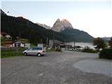 2
2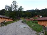 3
3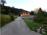 4
4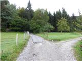 5
5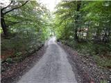 6
6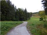 7
7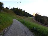 8
8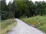 9
9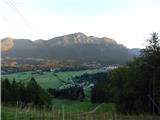 10
10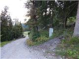 11
11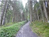 12
12 13
13 14
14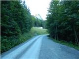 15
15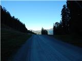 16
16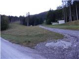 17
17 18
18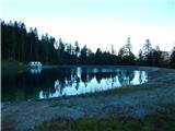 19
19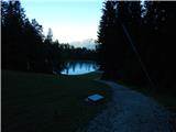 20
20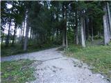 21
21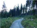 22
22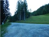 23
23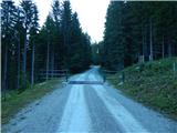 24
24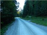 25
25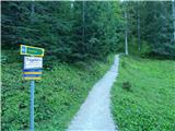 26
26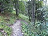 27
27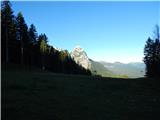 28
28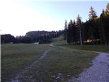 29
29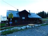 30
30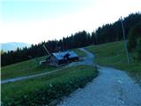 31
31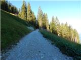 32
32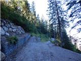 33
33 34
34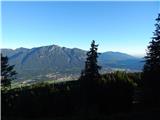 35
35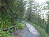 36
36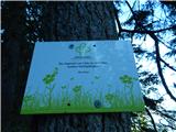 37
37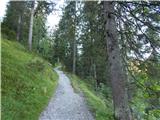 38
38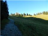 39
39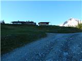 40
40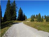 41
41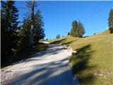 42
42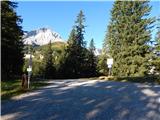 43
43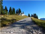 44
44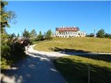 45
45 46
46 47
47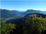 48
48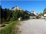 49
49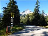 50
50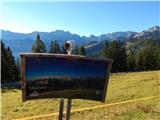 51
51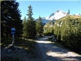 52
52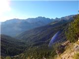 53
53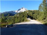 54
54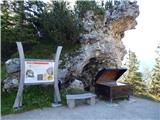 55
55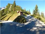 56
56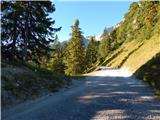 57
57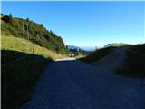 58
58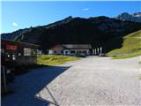 59
59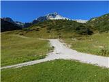 60
60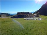 61
61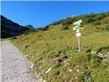 62
62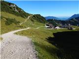 63
63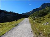 64
64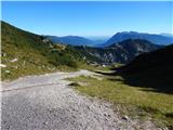 65
65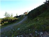 66
66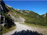 67
67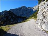 68
68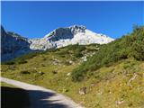 69
69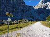 70
70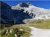 71
71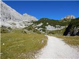 72
72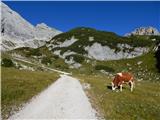 73
73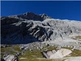 74
74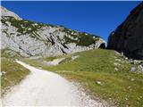 75
75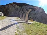 76
76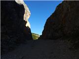 77
77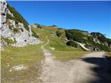 78
78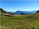 79
79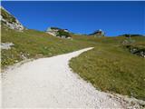 80
80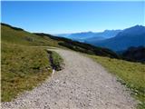 81
81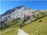 82
82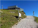 83
83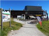 84
84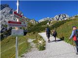 85
85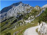 86
86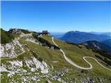 87
87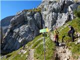 88
88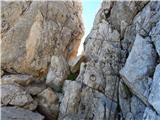 89
89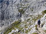 90
90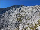 91
91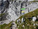 92
92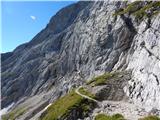 93
93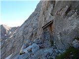 94
94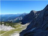 95
95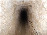 96
96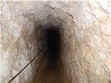 97
97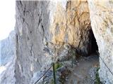 98
98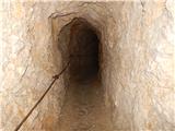 99
99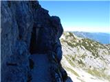 100
100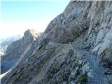 101
101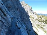 102
102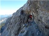 103
103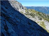 104
104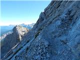 105
105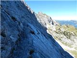 106
106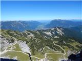 107
107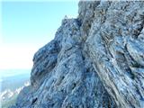 108
108 109
109 110
110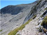 111
111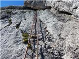 112
112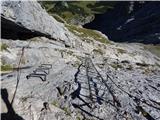 113
113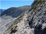 114
114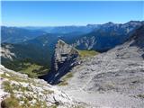 115
115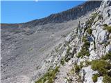 116
116 117
117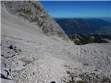 118
118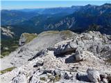 119
119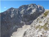 120
120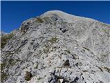 121
121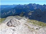 122
122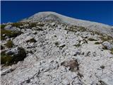 123
123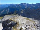 124
124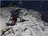 125
125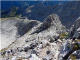 126
126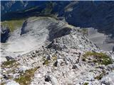 127
127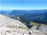 128
128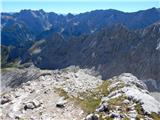 129
129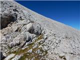 130
130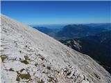 131
131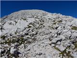 132
132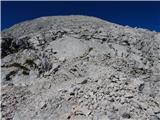 133
133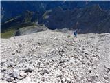 134
134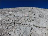 135
135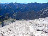 136
136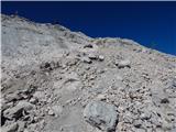 137
137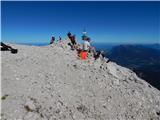 138
138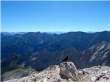 139
139 140
140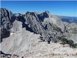 141
141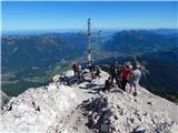 142
142
Discussion about the trip Parkirišče Alpspitzbahn - Alpspitze (Ostgrat)
|
| VanSims10. 10. 2013 |
Easiest approach to Alpspitz! Apart from a few easier ladders (the one in picture 112 might be the hardest) and one slightly steeper ascent along the rope, plus a few more ropes on the ridge, it's ordinary hiking; where it's exposed, it's secured with a rope. Expect oncoming traffic as it serves as a descent route for those ascending via Alpspitz Ferrata.
On descent via this path, take care in the upper gravelly section and a few exposed spots lower on the ridge.
For a slightly harder approach, take Schönegänge (A/B I-), which joins the path above the crossing or shortly after the ladder in picture 112. The Alpspitz Ferrata itself is not overly difficult (max. B, perhaps once or twice) and after the initial interesting section to the logbook at the notch, it starts to drag a bit. 
You can reach the Alpspitze restaurant by cable car and save time; via the described path, you can descend to the parking lot after visiting the summit.
|
|
|
To post a comment you must log in:
If you do not yet have a username, you must first
register.