Parkirišče Erichhütte - Hoher Kopf (Königsjodler)
Starting point: Parkirišče Erichhütte (1339 m)
| Latitude/Longitude: | 47,39164°N 13,04879°E |
| |
Route name: Königsjodler
Walking time: 7 h
Difficulty: extremely difficult marked way
Via ferrata: D
Elevation gain: 1536 m
Elevation difference along the route: 1800 m
Map:
Recommended equipment (summer): helmet, self belay set
Recommended equipment (winter): helmet, self belay set, ice axe, crampons
Views: 4.165
 | 2 people like this post |
Access to starting point:
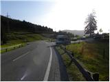
Through the Karawanks Tunnel, we drive to Austria, and then we continue driving on the Tauern motorway. Further, we drive through the Katschberg Tunnel and later also the Tauern Tunnel / Tauerntunnel; we follow the motorway towards Salzburg (also Solnograd) only up to the exit for Bischofshofen, from where we continue driving on a four-lane road towards the already mentioned town. From Bischofshofen, we follow the signs for Höchkonig and Dienten am Höchkonig. The road starts ascending and brings us to the Dientner Sattel. From the saddle, we continue for another 100 meters along the road which starts descending, and then we will notice the parking lot on the right side of the road, on which we park.
Route description:
From the parking lot, we continue following the signs »Erichhütte 30 min« on the mountain road which is closed to traffic. The macadam road on which we ascend leads us past pastures with a nice view on the High Tauern and on the nearby peaks above the hut Erichhütte. The path then leads us through a short stretch of forest where we also cross a smaller stream. Further on, the path again runs along pastures all the way to the hut Erichhütte on the alpine pasture Schönbergalm.
From the hut, we continue right following the signs »Königsjodler Klettersteig, Hochkönig« and begin to ascend slightly on grassy slopes towards the northeast. The path soon brings us to a junction where we continue left in the direction of Hochkönig, right leads the path towards the summit Taghaube (2159 m).
Further on, the path ascends for some time along sparse dwarf pines, then brings us via a slightly steeper grassy slope to another junction. Right leads the secured climbing path to Granlspitz (2307 m), we continue left towards the notch Hochscharte.
Here the path turns slightly left and brings us from grassy slopes to steeper rocky slopes, which we first cross towards the north. After the crossing, the path turns right and ascends towards the notch Hochscharte. On this section, the path is quite crumbly and a shorter ladder helps us, but the path here is not particularly demanding yet. At the notch, we continue left and after a short ascent we are again at a junction. Right branches off the somewhat easier path No. 432, which leads towards the notch Birgkarscharte and further to Hochkönig or Hoher Kopf. We continue left and the path quickly brings us to the entrance to the secured climbing path Königsjodler.
Before entering the climbing section, we equip ourselves with a helmet and self-belaying device; the use of climbing gloves is also recommended.
In the initial section, the path ascends steeply along the steel cable towards the ridge to the tower named Flower Tower. Follows the path along a somewhat exposed ridge along which we then ascend more steeply. The path then shifts to the left side of the ridge and follows the crossing of a steep wall towards a narrow notch (difficulty C/D). We cross the narrow notch to the other side with the help of the steel cable and follows a steep ascent towards the tower Teufels Turm (difficulty C). From the tower, we then descend steeply (difficulty C/D) and cross the notch below us via a hanging bridge. The bridge is made of three steel cables, we walk on one, the other two we use for holding and self-belaying. Follows a short crossing of steep walls and a steep descent in which some pegs also help us (difficulty C).
After the descent, the path brings us to a somewhat less exposed and unsecured section of the path. After a short ascent, the path is secured again and follows an ascent along a still somewhat less sharp ridge upwards, which brings us to the next tower (difficulty B/C). Follows a short descent, then with the help of just one steel cable (Flying Fox), which is tensioned to the adjacent tower, we cross the notch below us. If we do not have suitable equipment for such a crossing, we can also continue on the path that descends into the notch. For crossing the notch along the steel cable, the use of a double pulley with rope is recommended. With some caution, however, it can also be crossed with an additional sling. On the other side of the notch then follows again a somewhat less steep ascent along the steel cable. The path soon brings us again to the exposed ridge (Teufels Hörndl). After a few short ascents and descents (difficulty C), follows a somewhat steeper ascent to the sharp extremely exposed ridge (difficulty C/D). During the ascent, some pegs also help us. Further on, we ascend the ridge for a short time, then follows a descent into the notch. A somewhat less steep path then brings us to a junction, where right downwards an emergency exit is possible. The path by which it is possible to descend is technically less demanding, but due to crumbly rock and sparingly placed protections, considerable caution is required.
At the junction where we are approximately halfway along the secured climbing path, we continue straight and ascend a less steep unsecured slope, which brings us to one of the more difficult sections of the path. Follows a fairly long mostly vertical ascent (difficulty D) to the next tower named Kummetstein. On this section of the path, there is also a risk of falling rocks. A little below the top of the tower, there is a summit register box by the path. Follows again a short descent along the ridge from which increasingly beautiful views open up, especially towards the summit Hochkönig. The path brings us to the next notch and shifts to the left side of the ridge. Follows another very steep ascent (difficulty D) in which some pegs help us. When we reach the ridge again, the path becomes somewhat less demanding for a while (difficulty A/B). Follows the last steeper ascent (difficulty C/D), then the path gradually becomes less demanding and brings us to the summit Hoher Kopf where the secured climbing path ends. On the summit, a nice view opens up also to the north side towards the glacier and to the other mountains in the Berchtesgaden Alps, which are located on the German side of the border.
The described path is extremely demanding and is suitable only for experienced mountaineers with mandatory self-belaying and sufficient arm strength. The Königsjodler path is the longest secured climbing path in the federal state of Salzburg (Salzburger Land), so good physical condition is also required.
We descend right towards the notch Birgkarscharte and then downwards along path No. 432. During the descent, great caution is needed as the path is very crumbly and quite poorly secured. Lower down, we then ascend slightly towards the notch Hochscharte where the beginning of the climbing path Königsjodler is. From there, we descend past the hut Erichhütte back to the starting point.

Along the route: Erichhütte (1545m), Hochscharte (2283m), Teufelshörnln (2522m), Kematstein (2772m)
Photos:
 1
1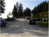 2
2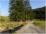 3
3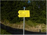 4
4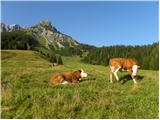 5
5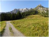 6
6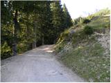 7
7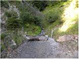 8
8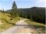 9
9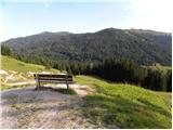 10
10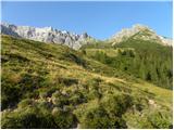 11
11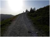 12
12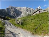 13
13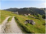 14
14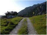 15
15 16
16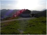 17
17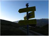 18
18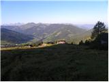 19
19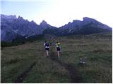 20
20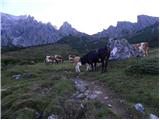 21
21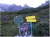 22
22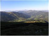 23
23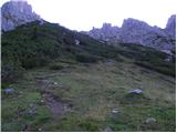 24
24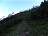 25
25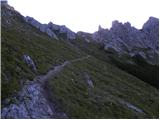 26
26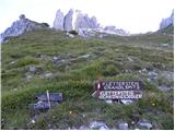 27
27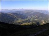 28
28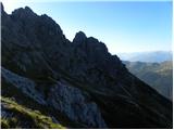 29
29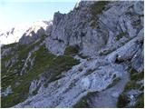 30
30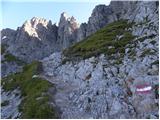 31
31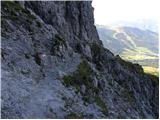 32
32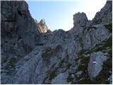 33
33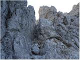 34
34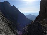 35
35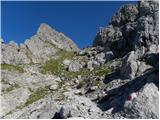 36
36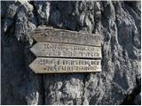 37
37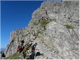 38
38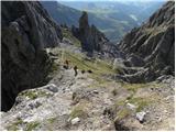 39
39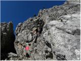 40
40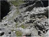 41
41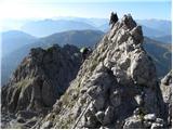 42
42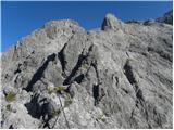 43
43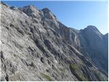 44
44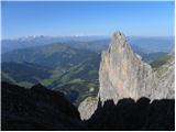 45
45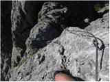 46
46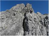 47
47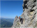 48
48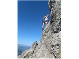 49
49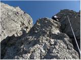 50
50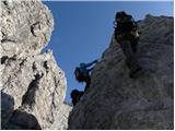 51
51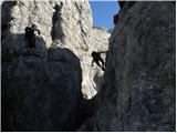 52
52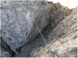 53
53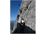 54
54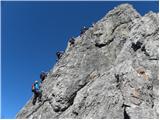 55
55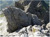 56
56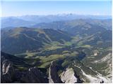 57
57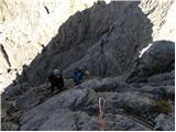 58
58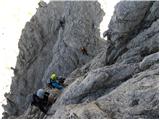 59
59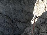 60
60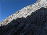 61
61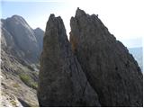 62
62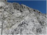 63
63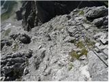 64
64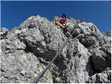 65
65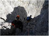 66
66 67
67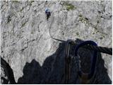 68
68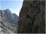 69
69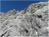 70
70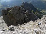 71
71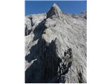 72
72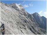 73
73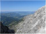 74
74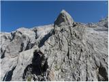 75
75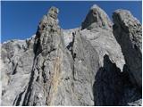 76
76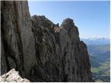 77
77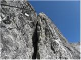 78
78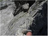 79
79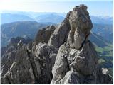 80
80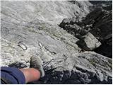 81
81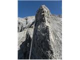 82
82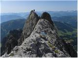 83
83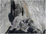 84
84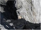 85
85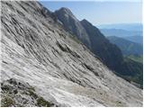 86
86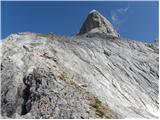 87
87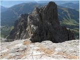 88
88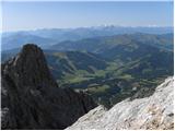 89
89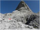 90
90 91
91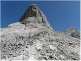 92
92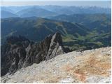 93
93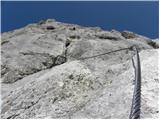 94
94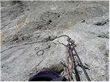 95
95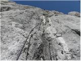 96
96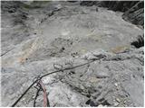 97
97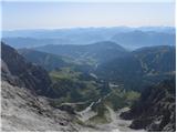 98
98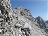 99
99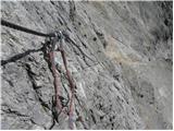 100
100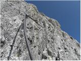 101
101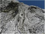 102
102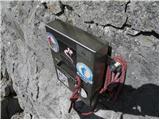 103
103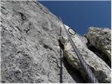 104
104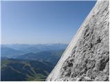 105
105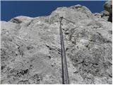 106
106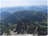 107
107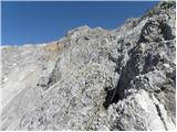 108
108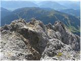 109
109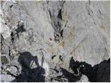 110
110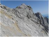 111
111 112
112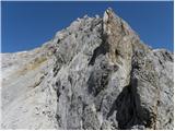 113
113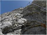 114
114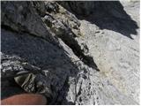 115
115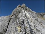 116
116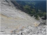 117
117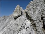 118
118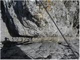 119
119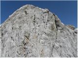 120
120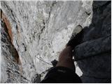 121
121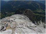 122
122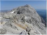 123
123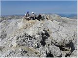 124
124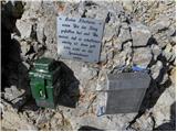 125
125 126
126
Discussion about the trip Parkirišče Erichhütte - Hoher Kopf (Königsjodler)
|
| medo*7. 09. 2011 |
Was up there recently:
http://www.hribi.net/trenutnerazmere.asp?aut=1&gorovjeid=10005&id=2723
Nice and strenuous tour, best done in two days because with the drive it's a big chunk. We overnighted at the summit of Hochkönig in the Matras-Hause hut and descended to Arthurhaus. Due to occupancy, need to reserve the hut in time and have multiple cars for transport to the start or hike an extra three hours there.
|
|
|
To post a comment you must log in:
If you do not yet have a username, you must first
register.