Parkplatz Glocknerwinkel - Großglockner (Klasična smer)
Starting point: Parkplatz Glocknerwinkel (1920 m)
| Latitude/Longitude: | 47,02159°N 12,68881°E |
| |
Route name: Klasična smer
Walking time: 7 h 30 min
Difficulty: very difficult marked way
Elevation gain: 1878 m
Elevation difference along the route: 1950 m
Map:
Recommended equipment (summer): helmet, self belay set, ice axe, crampons, lamp
Recommended equipment (winter): helmet, self belay set, ice axe, crampons, lamp
Views: 6.520
 | 4 people like this post |
Access to starting point:
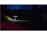
Enter the following coordinates into navigation: 47.02159°N 12.68881°E or the name: Parkplatz Glocknerwinkel. Approximately 2.5 km before the destination, at 47.01077°N 12.67198°E, there are barriers where you take a parking ticket (Fig. 1). The parking fee (2025) is 15 € for less than 24 hours and 18 € for more than 24 hours. From the parking lot, Grossglockner is visible to the north (Fig. 2).
Route description:
The route can be completed in one day, starting the hike before 5 a.m. Usually, however, on the first day we ascend to Erzherzog Johann Hütte (3454 m) and on the next day continue to the summit and back to the valley. I recommend (not mandatory) bringing a rope as well, which you will use on the glaciers and especially on the last (4th) section of the route, where the path is poorly protected. If not accompanied by a guide, prior experience with snow, ice, and rock climbing is mandatory.
1. Parking lot (1920 m)–Lucknerhütte (2241 m) – 1 h
The path starts on a gravel road (Fig. 3), which then becomes a hiking trail (Fig. 7). In the distance, we already see our first goal (Fig. 9). When we reach the second gate, we turn right back onto the wide gravel road (Fig. 10). After a while, we turn left onto the hiking trail (Fig. 12) and arrive at Lucknerhütte at 2241 m (Fig. 13).
2. Lucknerhütte (2241 m)–Stüdlhütte (2802 m) – 1 h 30 min
Along the gravel path, after a while we reach a junction where we continue straight (Fig. 15) towards Stüdlhütte. Soon after, we cross the river over a wooden bridge (Fig. 17). At about 2600 m, we reach a junction (Fig. 19), where we turn left (if turning right, we would bypass Stüdlhütte and join the described route at about 2900 m - this direction is suitable for descent). From the junction, a rocky path (Fig. 20) separates us from Stüdlhütte by another 200 m of elevation.
3. Stüdlhütte (2802 m)–Erzherzog Johann Hütte (3454 m) – 2 h 30 min
We start at the sign (Fig. 23), continuing towards Erzherzog Johann Hütte and soon reach another junction (Fig. 26), where we turn left towards Erzherzog Johann Hütte. After a while, we spot the Grossglockner summit (Fig. 28) and the Erzherzog Johann Hütte (Fig. 29). We are now in the glacier area, so be careful where you step, as there may be ice on the ground and rocks on it (Fig. 32). At about 2950 m, put on crampons and rope up if you have a rope. Cross the glacier diagonally as shown in Fig. 30. Be careful of crevasses (Fig. 34). ATTENTION! Even on the trodden path, there can be holes (Fig. 37 and 38), so proceed cautiously, especially on the last part of the glacier. When reaching the rocky section (Fig. 39), remove crampons and don the self-belay harness. Two options: right (Fig. 41) up the ladder by the rock (harder) or left (Fig. 40) along the cable (easier). After 10 m, the paths merge and continue on rocks along the cable. About 150 m elevation to the hut remains. The hut is not visible, hidden behind rocks (Fig. 44).
4. Erzherzog Johann Hütte (3454 m)–Grossglockner (3798 m) – 2 h (depending on crowds)
From the hut, continue on the rocky path (Fig. 46) and soon reach the second glacier (Fig. 49), where crampons are put on again. Although there are no crevasses here, roping up is possible. Reach a rocky wall (Fig. 50), remove crampons. Be careful here, especially with crowds, as the terrain is inclined and space is limited. Then climb up one of the two ropes (Fig. 51). Here begins the hardest part of the ascent - rock climbing (Fig. 52). The path is poorly protected, with occasional iron pegs (Fig. 55). Most people rope up here, especially on descent. Just before the summit, the path dips slightly (Fig. 56), then ascends again (Fig. 57). At the top is an iron cross (Fig. 58). Remember, the descent is even more demanding. The total timetable includes an additional 30 min for breaks at the huts.

Along the route: Lucknerhütte (2241m), Stüdlhütte (2802m), Erzherzog Johann Hütte (3454m)
Photos:
 1
1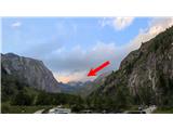 2
2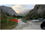 3
3 4
4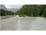 5
5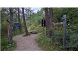 6
6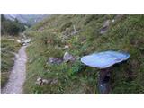 7
7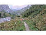 8
8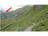 9
9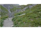 10
10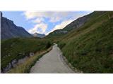 11
11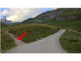 12
12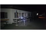 13
13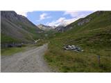 14
14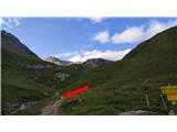 15
15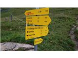 16
16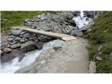 17
17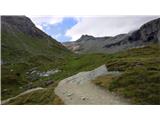 18
18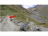 19
19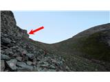 20
20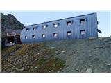 21
21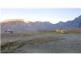 22
22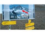 23
23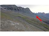 24
24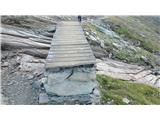 25
25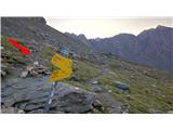 26
26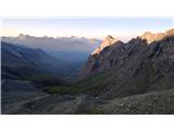 27
27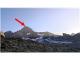 28
28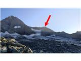 29
29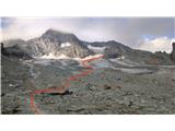 30
30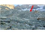 31
31 32
32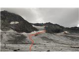 33
33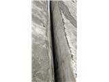 34
34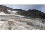 35
35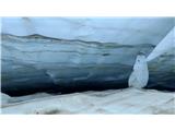 36
36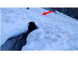 37
37 38
38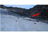 39
39 40
40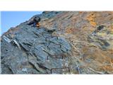 41
41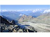 42
42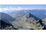 43
43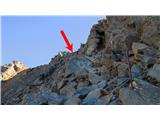 44
44 45
45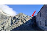 46
46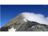 47
47 48
48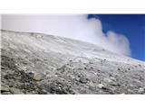 49
49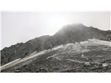 50
50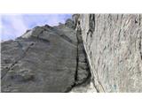 51
51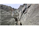 52
52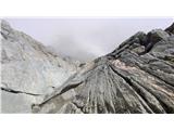 53
53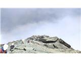 54
54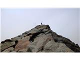 55
55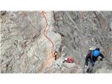 56
56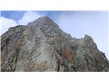 57
57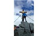 58
58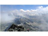 59
59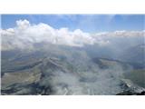 60
60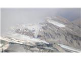 61
61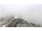 62
62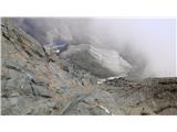 63
63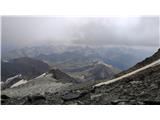 64
64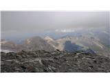 65
65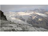 66
66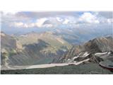 67
67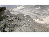 68
68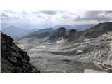 69
69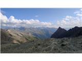 70
70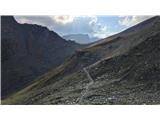 71
71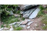 72
72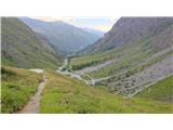 73
73 74
74
Discussion about the trip Parkplatz Glocknerwinkel - Großglockner (Klasična smer)
To post a comment you must log in:
If you do not yet have a username, you must first
register.