Passo di Costalunga / Karerpass - Rifugio Roda di Vael
Starting point: Passo di Costalunga / Karerpass (1752 m)
| Latitude/Longitude: | 46,40461°N 11,61347°E |
| |
Walking time: 1 h 40 min
Difficulty: easy marked way
Elevation gain: 528 m
Elevation difference along the route: 528 m
Map: Tabacco 06 1:25.000
Recommended equipment (summer):
Recommended equipment (winter): ice axe, crampons
Views: 1.633
 | 3 people like this post |
Access to starting point:
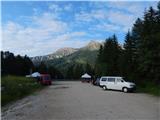
Access from Gorenjska: Through the Karawanks Tunnel, we drive to Austria, and then we continue driving towards Spittal and forward towards Lienz (a little after Spittal the highway ends). Further, we drive on a relatively nice and wide road through the Drau valley, which brings us to Italy. The road further leads past Dobbiaco / Toblach and Brunico / Bruneck. Only a little after the last-mentioned town, past which a bypass road leads, we turn left into the Val Badia valley. Further, we drive through the mentioned valley past the settlements La Vila and Corvara. Next follows an ascent over the mountain passes Passo Campolongo and Passo Pordoi. From the mountain pass Passo Pordoi we then descend on the west side into the Val di Fassa valley. A little after the settlement Pozza di Fassa we turn right towards the mountain pass Passo di Costalunga / Karerpass. A few hundred meters before the mountain pass, we park on a large parking lot named »Valate«. The parking lot is situated on the right side of the road.
From the Primorska side: From Nova Gorica, we drive to Italy and drive forward on the highway towards Venice / Venezia. At the town Portogruaro we leave the highway towards Venice and continue right on the highway towards Pordenone. At the next highway junction near Conegliano, we continue right towards Belluno. We follow the highway to the exit for Belluno. When we leave the highway we come to a bigger roundabout, which we leave at the exit for Belluno and the town Feltre. In the smaller roundabout in the town Belluno we then continue right towards the town Agordo. We follow this road all the way to the town Moena in the Val di Fassa valley. In the town Moena we then continue right towards the town Canazei, but only to the town Vigo di Fassa where we go left towards the mountain pass Passo di Costalunga / Karerpass. A few hundred meters before the mountain pass, we park on a large parking lot named »Valate«. The parking lot is situated on the right side of the road.
Route description:
From the parking lot, we head onto a narrow cart track following the signs »Rifugio Roda di Vael«. The cart track at the beginning ascends through the forest and soon brings us to a marked junction. To the left, the path branches off towards the mountain hut Rifugio Paolina, and we continue right towards the mountain hut Rifugio Roda di Vael.
Further, we still walk on the cart track, which is mostly ascending through the forest, and occasionally a view also opens up towards the mountain group Latemar. Higher, the path brings us out of the forest onto pastures from which a view also opens up towards the south.
On the mountain pasture where there is also a shepherd's hut, the cart track ends, and we continue on a footpath, which still runs towards the east. The path then turns slightly to the left and starts to ascend somewhat more steeply on increasingly panoramic slopes. Soon we will see ahead of us the huts Rifugio Roda di Vael and Baita Marino Pederiva, to which there is only a short ascent. A little before the huts, the path from the mountain hut Rifugio Paolina also joins from the left.

Along the route: Baita Marino Pederiva (2275m)
Photos:
 1
1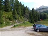 2
2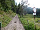 3
3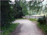 4
4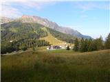 5
5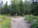 6
6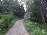 7
7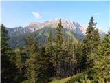 8
8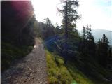 9
9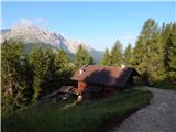 10
10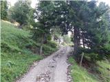 11
11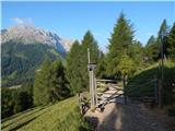 12
12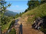 13
13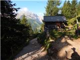 14
14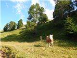 15
15 16
16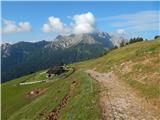 17
17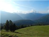 18
18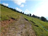 19
19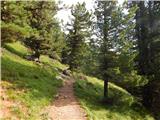 20
20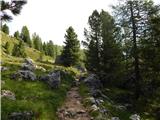 21
21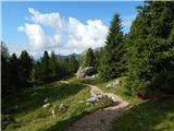 22
22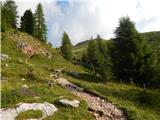 23
23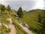 24
24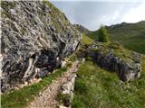 25
25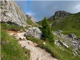 26
26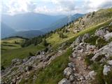 27
27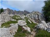 28
28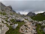 29
29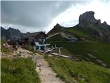 30
30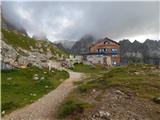 31
31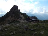 32
32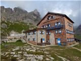 33
33
Discussion about the trip Passo di Costalunga / Karerpass - Rifugio Roda di Vael
To post a comment you must log in:
If you do not yet have a username, you must first
register.