Planina Blato - Koča pri Triglavskih jezerih (via Štapce)
Starting point: Planina Blato (1147 m)
| Latitude/Longitude: | 46,31120°N 13,85010°E |
| |
Route name: via Štapce
Walking time: 3 h 15 min
Difficulty: partly demanding marked way
Elevation gain: 538 m
Elevation difference along the route: 775 m
Map: Triglav 1:25.000
Recommended equipment (summer): helmet
Recommended equipment (winter): helmet, ice axe, crampons
Views: 101.343
 | 6 people like this post |
Access to starting point:
From the Ljubljana-Jesenice motorway, take the Lesce exit and follow the road towards Bled and further towards Bohinjska Bistrica. Continue driving towards Lake Bohinj (Ribčev laz), where you reach a junction and continue right towards Stara Fužina. In Stara Fužina, at the junction by the chapel, turn sharply left onto the ascending road towards Planina Blato, Planina Vogar and Dolina Voje. The road then leads to the toll and parking fee collection point, from there follow it to the next junction, turning left (right Voje). Follow the road to the next junction (after driving for quite some time), where you turn sharply right towards Planina Blato (straight Planina Vogar). Follow this road to the parking lot before Planina Blato.
Route description:
From the marked parking lot in front of Planina Blato, return a little back and head onto the wide and initially also steep cart track, along which there are signs for Planina pri Jezeru. After about ten minutes of ascent, you reach a marked junction, from where you continue left towards Planina pri Jezeru (slightly right Planina v Lazu and also the steep path towards Planina pri Jezeru).
Continuing on the less steep cart track, which continues to lead through the forest, a marked path joins from the left a little further on, leading past Kosijev dom on Vogarju, but we continue right and keep walking on the cart track. Higher up, the path leads through a narrow passage, then crosses quite steep slopes where there is a high risk of slipping on ice and snow, otherwise the path is not demanding. At the end of the steep slope, the aforementioned steep path joins quite unobtrusively from the right, the cart track turns left here and enters the fairly cold Pungrat valley, where we ascend through mostly spruce forest. When the path levels out higher up, another path joins from the left leading past Planina Vodični vrh, but we keep slightly to the right and continue walking on the cart track, beside which the forest begins to thin. A few minutes of easy walking follow and we step onto the pastures of Planina pri Jezeru, where the Koča na Planini pri Jezeru stands on a small hill.
At the hut, a path branches right towards Planina v Lazu, but we continue left from the hut and descend to a marked junction where there are also a few shepherd's dwellings.
Choose the wider right path along which there are signs for Planina Dedno polje and Koča pri Triglavskih jezerih (slightly left Pršivec, Planina Viševnik and Črno jezero).
Continuing ascent on the cart track, which is quite rocky on steep sections, after about ten minutes of ascent we reach the point where a path over Krištofojca branches left towards Planina Viševnik, but we continue straight on the gradually less steep cart track leading through gradually sparser forest. A bit more easy walking follows on the path, which later turns slightly right, and when the path turns back towards the west, we reach the edge of Planina Dedno polje, from where a walk to the central part of the pasture follows, where there is also a marked junction by the shepherd's huts.
Bypass the shepherd's huts and cheese dairy on the left side and continue straight towards Koča pri Triglavskih jezerih (right Dolina Za Kopico). From the pasture onwards, we begin a moderate ascent, and a path from the nearby hunting hut joins almost unobtrusively from the left. A little further, the path passes another branch towards Planina Viševnik (path along Griva (1758 m)), and in the next few minutes we arrive at the upper edge of the vast Planina Ovčarija, from where a beautiful view opens up to the Bohinj-Tolmin mountains, sometimes called the Lower Bohinj mountains. From here a short descent follows and we reach a junction in the northeastern part of the pasture.
Continue slightly right towards Koča pri Triglavskih jezerih and Mala Tičarica (left Planina Viševnik), and the path soon splits again.
From the junction, follow the signs for the path over Štapce (straight path over Prodov), both leading towards Koča pri Triglavskih jezerih, the right one, which we will continue on, also towards Mala Tičarica and Zelnarice. We soon leave Planina Ovčarija and the path ascends moderately to steeply through increasingly sparse forest, which higher up is replaced by dwarf pines. After a half-hour ascent, the path levels out and brings us to Štapce, where the next marked junction is.
Continue on the left path towards Triglavska jezera (right Mala Tičarica and Zelnaric ridge) and quickly step to the edge, where a beautiful view opens up over part of the Dolina Triglavskih jezer and the mountains surrounding the mentioned valley, with the view reaching as far as Krn.
From Štapce, first a steep, well-protected descent over a rocky step follows, then the path goes onto scree, over which we descend to the belt of dwarf pines. A little more descent follows and from the left the path over Prodov and the path from Koča pri Savici (path over Komarča) join us, but we continue right and in the continuation walk along Dvojno jezero. When we leave the lake, only a few dozen steps of easy walking separate us from Koča pri Triglavskih jezerih.
Starting point - Planina pri Jezeru 1:00, Planina pri Jezeru - Planina Dedno polje 0:30, Planina Dedno polje - Planina Ovčarija 0:45, Planina Ovčarija - Štapce 0:35, Štapce - Dvojno jezero 0:20, Dvojno jezero - Koča pri Triglavskih jezerih 0:05.

The trip can be extended to the following destinations: Dom na Komni,
Planina Lopučnica,
The lake Jezero v Ledvicah (1 h),
Rušnata glava,
The lake Zeleno jezero,
The lake Rjavo jezero,
Zasavska koča na Prehodavcih,
Mala Tičarica,
Velika Tičarica,
Koča na Doliču,
Kopica,
Vodnikov Vršac (Vršac nad Zadnjico),
Čelo,
Mala Zelnarica,
Malo Špičje,
Velika Zelnarica,
Vrh Hribaric,
Veliko Špičje (2 h 30 min),
Vršaki (Vzhodni vrh),
Kanjavec,
Triglav
Photos:
 1
1 2
2 3
3 4
4 5
5 6
6 7
7 8
8 9
9 10
10 11
11 12
12 13
13 14
14 15
15 16
16 17
17 18
18 19
19 20
20 21
21 22
22 23
23 24
24 25
25 26
26 27
27 28
28 29
29 30
30 31
31 32
32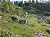 33
33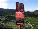 34
34 35
35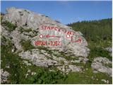 36
36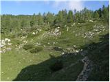 37
37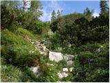 38
38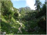 39
39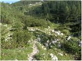 40
40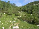 41
41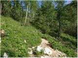 42
42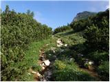 43
43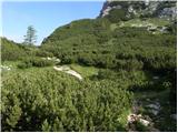 44
44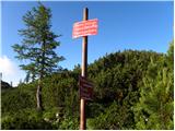 45
45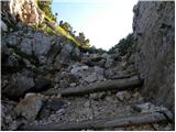 46
46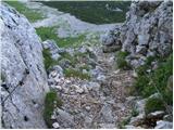 47
47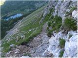 48
48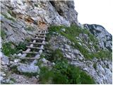 49
49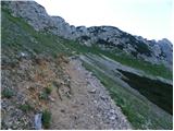 50
50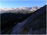 51
51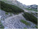 52
52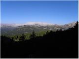 53
53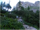 54
54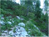 55
55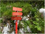 56
56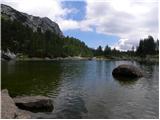 57
57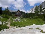 58
58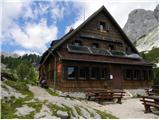 59
59
Discussion about the trip Planina Blato - Koča pri Triglavskih jezerih (via Štapce)
|
| Gost24. 08. 2007 |
Wonderful, well-maintained path. Via Štapce nice, nicely passable. Thanks to everyone who works on it. Jožica
|
|
|
|
| nrugelj23. 07. 2008 |
Does anyone know if you can still drive to Planina Blato? Maybe also the parking fee 
Thanks,lp
|
|
|
|
| Žiga Šubic23. 07. 2008 |
Hi!
Yes you can drive to the parking lot at Planina Blato. The parking fee is quite high at 10 EUR.
Best regards
|
|
|
|
| majdicst23. 07. 2008 |
On Saturday (July 19th) we set off on this trail. The road is normally drivable; in the last month they even asphalted an additional quite long section. Parking might be a problem if you arrive later, as you have to park quite a bit before the parking lot.
The trail to the Triglav Lakes is really one of the most beautiful in this part of the Julian Alps. I recommend from Ovčarija to the Triglav Lakes via Prode, return via Štapce. The descent from Štapc to the Triglav Lakes valley can be quite demanding for many, while the ascent is much easier. Perhaps on the return, instead of from Ovčarija via Dedno polje, go via Planina Viševnik. It is somewhat longer, but you don't return on the same path and in both cases you reach the planina at the Lake.
|
|
|
|
| Nickster23. 07. 2008 |
The most beautiful part of the Julian Alps!
Here I also went to Triglav
|
|
|
|
| nrugelj24. 07. 2008 |
Biggest thanks for the info - the price is quite... But then it's a nice trip and you forget about it  . LP . LP
|
|
|
|
| katjuša225. 07. 2008 |
As written, or written by majdicst, we hiked it on Sunday
the parking lot was full, parking expensive, parking master very unfriendly (I console myself that he's a student),
otherwise a very nice tour, because we walked slowly and observed the surroundings, ate cheese and schnapps, we needed almost eight hours for the path together, and we did a circular route as well
on the path there are almost no steep ascents or descents except the one right before the end, view superb, hosts friendly and path very well marked
I recommend to all who are not in a hurry and know how to enjoy nature
|
|
|
|
| TinaPRR4. 08. 2008 |
Trip for the soul
|
|
|
|
| Biser gora5. 08. 2008 |
Especially in autumn, when it's peaceful and the larches turn yellow.
|
|
|
|
| Petrca16. 08. 2012 |
Wonderful path. Truly one for the soul. We set off on an almost circular route, first over Štapce and back over Prode. Enthralled. 
|
|
|
|
| BlazG15. 10. 2013 |
Really extremely nice path, to the Koča we went via Prode, back via Štapce, then before Dedno polje turned via planina Viševnik, nothing special but still pleasant path that ends nicely above the planina at Jezero and offers nice view of the lake. Then just to Blato ...
|
|
|
To post a comment you must log in:
If you do not yet have a username, you must first
register.