Planina Polog - Krn (via planina Sleme)
Starting point: Planina Polog (457 m)
| Latitude/Longitude: | 46,23730°N 13,72230°E |
| |
Route name: via planina Sleme
Walking time: 6 h 30 min
Difficulty: partly demanding marked way
Elevation gain: 1787 m
Elevation difference along the route: 1970 m
Map: Julijske Alpe - zahodni del 1:50.000
Recommended equipment (summer):
Recommended equipment (winter): ice axe, crampons
Views: 9.076
 | 1 person like this post |
Access to starting point:
First, we drive to Tolmin, from there we follow the road in the direction of Zatolmin (we leave the main road at the traffic light). In Zatolmin we notice signposts for Javorca, which direct us onto an ascending road towards Javorca. Occasionally quite narrow and in parts precipitous road after approximately 8 km of driving brings us to a smaller junction, where the road towards Javorca branches off to the left upwards. Here we turn left and we follow the road for just over 100 m to a marked parking lot.
Route description:
From the parking lot, we continue on a concrete road which quickly enters the forest and starts to ascend steeply. After approximately 15 minutes of walking, the forest thins out, and the road turns sharply to the right. There follows only a few minutes of walking along the edge of pastures and the road brings us to the memorial church of the Holy Spirit on Javorca.
We bypass the church on the left side and continue on a wide and initially gentle cart track which quickly enters the forest. Here we can hear to our left below us the roaring of the waterfall of Peščak stream, but we continue on the marked path (cart track), which higher crosses the mentioned stream over a bridge. Further, we ascend on a moderately steep cart track which further runs partly through the forest, partly through dense shrubbery and brambles. Higher, we cross another of the numerous grazing fences and the path brings us to the mountain pasture Črča, on which a few old cottages stand.
Just before the cottages on the mountain pasture, the signs for mountain pastures Sleme, Medrje and Laška seč direct us slightly to the left, where we ascend through high grass to an indistinct ridge along which the grazing fence runs. Further, we ascend along the grazing fence, then the path enters dense forest, where it steeply ascends for a short time to a trough with water. Here the path turns slightly to the right, after a few 10 steps bringing us to the next grazing fence. We cross the grazing fence and walk to the cottages on the mountain pasture Laška seč.
Above the mountain pasture the path goes into the forest, which continues on a wide cart track. Somewhat higher we emerge from the forest, and just a few meters after crossing the grazing fence we continue left on a poorly visible and poorly marked path. The path higher joins the cart track and brings us just a few meters further to the shepherd's cottage on the mountain pasture Medrja.
From the cottage on the mountain pasture we ascend diagonally to the left, where we soon reach a poor forest road. We follow the road to the left, which after an initial gentle ascent gradually begins to descend lightly. Higher we approach the mountain pasture Pretovč completely, and at the junction at the eponymous saddle we continue right in the direction of the mountain pasture Sleme. The road ahead begins to ascend more steeply, higher crosses a belt of dense forest, then levels out and brings us to the mountain pasture Sleme amid ever finer views.
On the mountain pasture at the NOB monument we continue left onto a panoramic grassy ridge, along which we walk to the former junction. Here the signs for Krn and Rdeči rob direct us left onto the lower path (the upper path has been closed for a long time due to impassability), which crosses the slopes to the left. The path further quickly brings us to a steep and wide gully, across which runs an excellently arranged path (if the path is damaged the passage is deadly dangerous). The path further passes onto grassy slopes, crosses another smaller gully across which the path is likewise model-arranged. After that the path enters a belt of forest, where it continues to cross relatively steep slopes. The slope then levels out, and the path brings us over a grazing fence to the grazing areas of the mountain pasture Leskovica, where the otherwise marked path begins to disappear. We descend diagonally somewhat to the right, where we pick up the path from the mountain pasture Kuhinja towards the lake in Lužnica.
We continue in the direction of Krn and the path becomes steeper and steeper upwards. Further, we ascend steep slopes between Maselnik (1906 m) on the left and Veliki Stador (1903 m) on the right. Higher the path turns and brings us into a small cirque, where to the right an unmarked path to Rdeči rob branches off (the branch is marked). The marked path here turns left and ascends over a short steep slope, then levels out and brings us to the saddle between Maselnik and Škofič. Here we continue straight and then along the lower path (the right upper path bypasses the lake), arriving at the lake in Lužnica after a few minutes' descent, which we can already see from the aforementioned saddle.
From the lake we gently ascend along a poorly visible little path (direction north), then join the path which bypasses the lake on the right side. Further, we ascend through a beautiful high-alpine valley (Peski po Lužnici), then the path turns somewhat to the left and ascends more steeply. A short steep ascent follows and the path brings us to the ridge north of Srednji vrh. Here the path turns right and brings us to Prag (2068 m) in a few minutes. At Prag, where there is a marked junction, we continue left in the direction of Batognica (straight down Krnsko jezero right Vrh nad Peski and Koča na planini Razor) along the path which moderately ascends the summit slope of Batognica. We then follow this increasingly panoramic path to the summit, which we reach after 15 minutes of further walking.
From Batognica we continue on an initially somewhat poorly visible path, which continues along the left side of the summit. The path, which initially descends only gently, soon brings us into steeper terrain, where we begin to descend more steeply. After a short descent, we reach relatively steep steps, along which we descend steeply. On this section there is a great risk of slipping due to scree on the path. The path ahead gradually levels out and brings us just a little further to Krnska škrbina (we can also reach the škrbina if at Prag we continue along the so-called Northern path, which bypasses the summit of Batognica; the latter is somewhat shorter but also substantially less panoramic).
From the škrbina we continue straight (left Planina Kuhinja, right Krnsko jezero) along the path which begins to ascend the grassy slope of the mountain. We then follow this increasingly panoramic path to the panoramic summit, which we reach after approximately 30 minutes of walking from Krnska škrbina.

Photos:
 1
1 2
2 3
3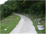 4
4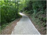 5
5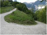 6
6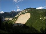 7
7 8
8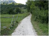 9
9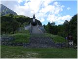 10
10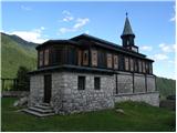 11
11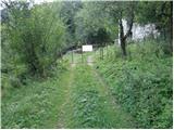 12
12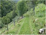 13
13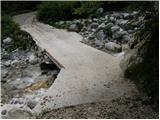 14
14 15
15 16
16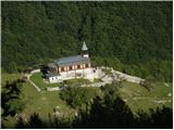 17
17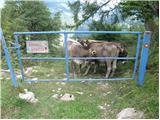 18
18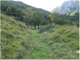 19
19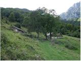 20
20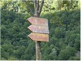 21
21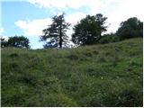 22
22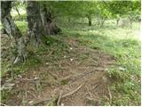 23
23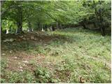 24
24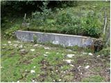 25
25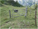 26
26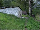 27
27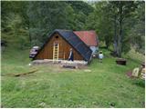 28
28 29
29 30
30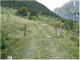 31
31 32
32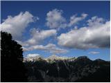 33
33 34
34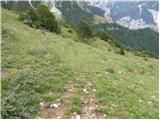 35
35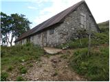 36
36 37
37 38
38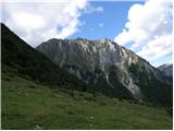 39
39 40
40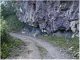 41
41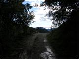 42
42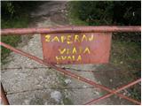 43
43 44
44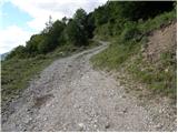 45
45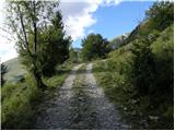 46
46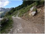 47
47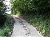 48
48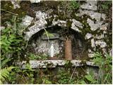 49
49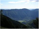 50
50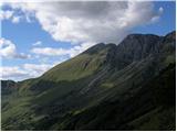 51
51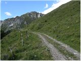 52
52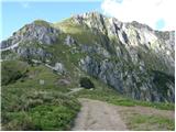 53
53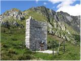 54
54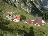 55
55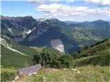 56
56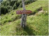 57
57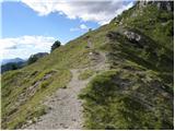 58
58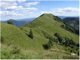 59
59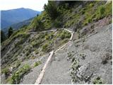 60
60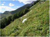 61
61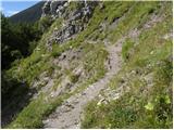 62
62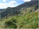 63
63 64
64 65
65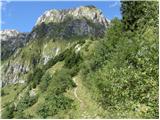 66
66 67
67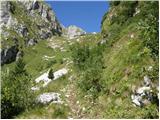 68
68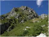 69
69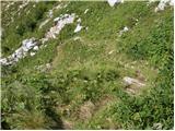 70
70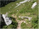 71
71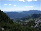 72
72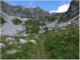 73
73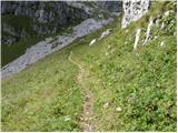 74
74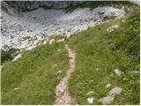 75
75 76
76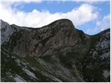 77
77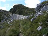 78
78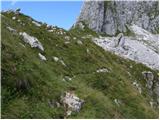 79
79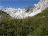 80
80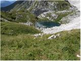 81
81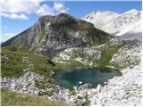 82
82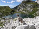 83
83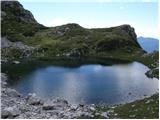 84
84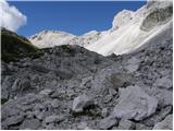 85
85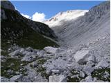 86
86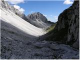 87
87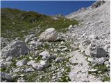 88
88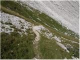 89
89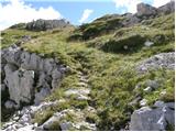 90
90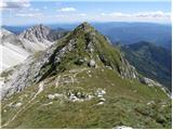 91
91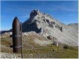 92
92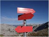 93
93 94
94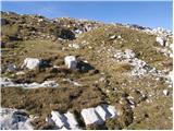 95
95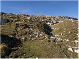 96
96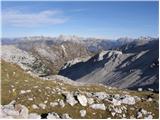 97
97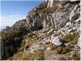 98
98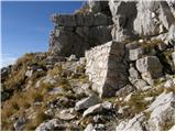 99
99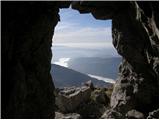 100
100 101
101 102
102 103
103 104
104 105
105 106
106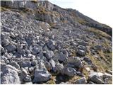 107
107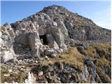 108
108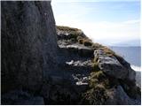 109
109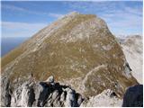 110
110 111
111 112
112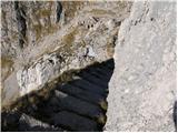 113
113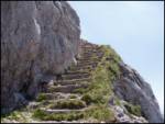 114
114 115
115 116
116 117
117 118
118 119
119 120
120 121
121 122
122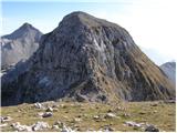 123
123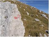 124
124 125
125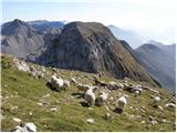 126
126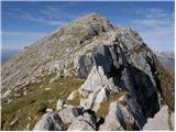 127
127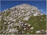 128
128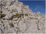 129
129 130
130
Discussion about the trip Planina Polog - Krn (via planina Sleme)
|
| winni27. 06. 2020 |
The road Zatolmin -> Javorca is closed to all traffic.
|
|
|
To post a comment you must log in:
If you do not yet have a username, you must first
register.