Planina Polog - Planina Črča
Starting point: Planina Polog (457 m)
| Latitude/Longitude: | 46,23730°N 13,72230°E |
| |
Walking time: 1 h
Difficulty: easy marked way
Elevation gain: 343 m
Elevation difference along the route: 343 m
Map: Julijske Alpe - zahodni del 1:50.000
Recommended equipment (summer):
Recommended equipment (winter):
Views: 4.667
 | 1 person like this post |
Access to starting point:
First, we drive to Tolmin, from there we follow the road in the direction of Zatolmin (we leave the main road at the traffic light). In Zatolmin we notice signposts for Javorca, which direct us onto an ascending road towards Javorca. The occasionally quite narrow and in places precipitous road brings us after approximately 8 km of driving to a smaller crossroad, where the road towards Javorca branches off to the left upwards. Here we turn left and follow the road for just over 100 meters to a marked parking lot.
Route description:
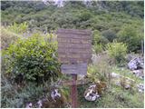
From the parking lot, we continue on a concrete road which quickly enters the forest and starts ascending steeply. After approximately 15 minutes of walking, the forest thins out, and the road turns sharply to the right. There follows only a few minutes of walking along the edge of the pastures and the road brings us to the memorial church of the Holy Spirit on Javorca.
We bypass the church on the left side and continue on a wide and initially gentle cart track, which quickly enters the forest. Here we can hear the roaring of the waterfall of the stream Peščak to our left below us, while we continue on the marked path (cart track), which higher crosses the mentioned stream over a bridge. Further, we ascend on a moderately steep cart track, which continues partly through the forest, partly through dense bushes and brambles. Higher, we cross one more of the numerous grazing fences and the path brings us to the mountain pasture Črča, on which a few old cottages stand.

Photos:
 1
1 2
2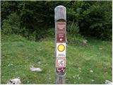 3
3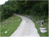 4
4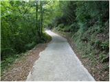 5
5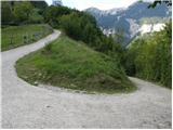 6
6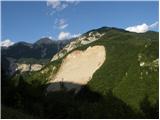 7
7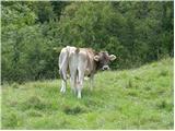 8
8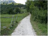 9
9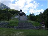 10
10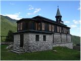 11
11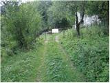 12
12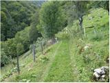 13
13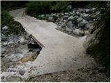 14
14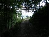 15
15 16
16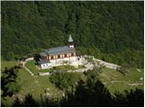 17
17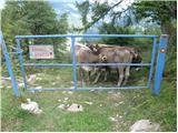 18
18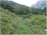 19
19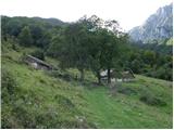 20
20
Discussion about the trip Planina Polog - Planina Črča
|
| vlastat18. 07. 2013 |
Interesting trip! Just a small note regarding location names. Locals call the alpine pasture Črče and not Črča, and Mederje not Medrja. Both end with e not a. It seems right to respect this in records.
|
|
|
|
| winni27. 06. 2020 |
The road Zatolmin -> Javorca is closed to all traffic.
|
|
|
To post a comment you must log in:
If you do not yet have a username, you must first
register.