Planina Vodol - Velika Raduha
Starting point: Planina Vodol (1324 m)
| Latitude/Longitude: | 46,42340°N 14,77690°E |
| |
Walking time: 2 h 40 min
Difficulty: easy marked way
Elevation gain: 738 m
Elevation difference along the route: 800 m
Map: Kamniške in Savinjske Alpe 1:50.000
Recommended equipment (summer):
Recommended equipment (winter): ice axe, crampons
Views: 31.486
 | 3 people like this post |
Access to starting point:
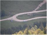
A) From the Ljubljana - Maribor highway, take the Šentrupert exit, then continue driving towards Mozirje, Ljubno ob Savinji and Logarska dolina valley. From Ljubno, drive on the main road for approximately 6 km, then in the settlement Strmec, signs for Raduha and Snežna jama cave direct us to the right onto a narrower and at first still asphalted road. At the crossroads, we follow the signs for Snežna jama cave, and we follow the road which higher up loses the asphalt covering to the mountain pasture Vodol. We park at the crossroad, where in the middle of the left turn a worse road branches off to the right, which leads to the upper part of the mountain pasture Vodol.
B) From the Ljubljana - Jesenice highway, take the Vodice exit, then continue driving towards Kamnik. In Kamnik, follow the signs for Gornji Grad and mountain pass Črnivec, but only 1 km before the mentioned mountain pass turn left in the direction of Kranjski Rak and Podvolovljek. From Kranjski Rak (mountain pass Volovljek) start descending towards Luče, where turn right towards Mozirje. From Luče drive towards Mozirje approximately 3 km, then in the settlement Strmec, signs for Raduha and Snežna jama cave direct us to the left onto a narrower and at first still asphalted road. At the crossroads, we follow the signs for Snežna jama cave, and we follow the road which higher up loses the asphalt covering to the mountain pasture Vodol. We park at the crossroad, where in the middle of the left turn a worse road branches off to the right, which leads to the upper part of the mountain pasture Vodol.
Route description:
From the starting point, we first walk to the upper part of the mountain pasture Vodol, where signs for Koča na Loki direct us left onto a footpath that ascends transversely along the upper edge of the mountain pasture. The path ahead enters the forest, where it then ascends transversely for quite some time. Higher up, we exit the forest, and the path quickly brings us to the shepherd huts on mountain pasture Javorje.
On the other side of the mountain pasture we step onto a poor forest road, along which we begin to descend more noticeably. After a short descent, we notice the blazes that direct us right into the forest, through which after a few minutes of further descent we descend to Koča na Loki pod Raduho.
From the hut we continue on the marked path towards Raduha, which already after a few tens of steps splits into two parts. We continue slightly left (slightly right Durce) along the path that gently ascends along the left edge of the valley. The path soon turns left and steeply ascends through a belt of sparse forest. The steepness soon eases, and the path leads us via a few smaller meadows into a belt of dwarf pines, where it continues moderately to occasionally steeply ascending. After approximately one hour of walking from Koča na Loki, the path from Durce joins from the right, and we continue left along the transverse path towards Raduha. The increasingly scenic path bypasses the summit of Mala Raduha on the south side, then brings us to the main ridge, from which a nice view opens onto the northern side.
We continue along the marked path, to which the climbing path from Koča na Grohatu soon joins from the right. The path ahead begins to ascend more steeply again and after a few minutes of further walking brings us to the 2062 m high summit.

Photos:
 1
1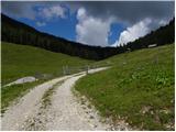 2
2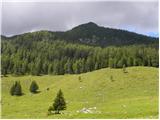 3
3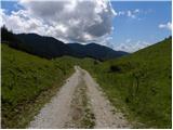 4
4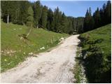 5
5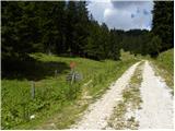 6
6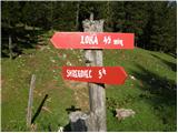 7
7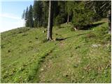 8
8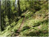 9
9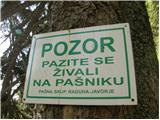 10
10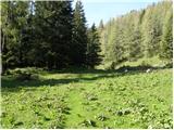 11
11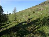 12
12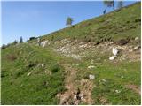 13
13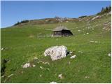 14
14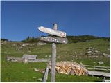 15
15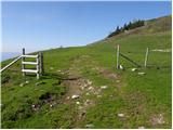 16
16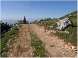 17
17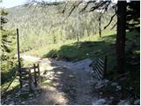 18
18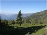 19
19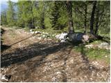 20
20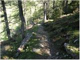 21
21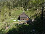 22
22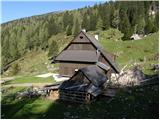 23
23 24
24 25
25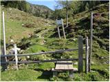 26
26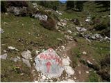 27
27 28
28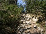 29
29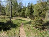 30
30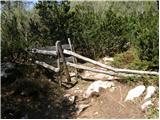 31
31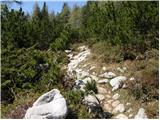 32
32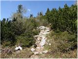 33
33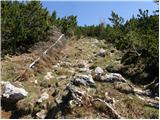 34
34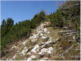 35
35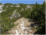 36
36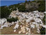 37
37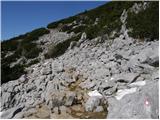 38
38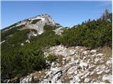 39
39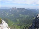 40
40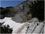 41
41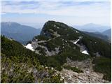 42
42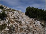 43
43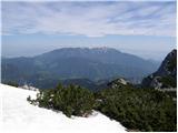 44
44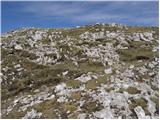 45
45 46
46
Discussion about the trip Planina Vodol - Velika Raduha
|
| monikahribolazka27. 09. 2019 |
Trip completed on 26.9.2019. It was great, the ground in the forest on the path from Raduha to Koča na Loki was soggy and caution is needed so you don't slip. Otherwise a wonderful trip.
|
|
|
To post a comment you must log in:
If you do not yet have a username, you must first
register.