Plockenpass - Rifugio Marinelli
Starting point: Plockenpass (1360 m)
| Latitude/Longitude: | 46,60270°N 12,94470°E |
| |
Walking time: 2 h 30 min
Difficulty: partly demanding marked way
Elevation gain: 762 m
Elevation difference along the route: 820 m
Map: Tabacco 9
Recommended equipment (summer):
Recommended equipment (winter): ice axe, crampons
Views: 6.511
 | 2 people like this post |
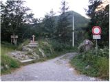
Access to starting point:
From Trbiž/Tarvisio we head onto the highway towards Videm/Udine. At the settlement Carnico, we leave the highway and first follow the signs towards the settlement Tolmezzo, then the signs for Austria and the mountain pass Pso di Croce Carnico / Plöckenpass. Still on the Italian side of the mountain pass, we park on a large parking lot.
Route description:
At the parking lot, we go on a narrow road following the signs for Rifuggio Marinelli (path 146). Already after a few dozen meters, we come to a junction where we go right on a military mule track on which we then ascend through a sparse forest and meadows below the steep slopes of the mountain Creta di Collinetta (2238m). The military mule track turns into a footpath and soon we also come to a junction, where the path to the mentioned mountain branches off to the right.
We continue on the left path, which in a gentle ascent crosses grassy slopes and brings us to a smaller plain. From the left an unmarked path from the mountain pasture Collinetta di Sotto joins us here, only a little after that we come to a marked junction where the path to Cresta Verde (2150m) branches off to the right. We continue on path 146 towards the mountain hut Marinelli to which we have less than two hours. Here the path becomes somewhat steeper and ascends through slightly overgrown bushes and high grass. When we come out of the bushes the path becomes more level and to the right branches off the path to Creta di Collina (2659m).
Here while crossing quite steep slopes we start to descend and some fixed safety gear helps us too. There follows a somewhat more demanding descent through a natural window and crossing steep slopes covered with nettles, which brings us to a junction.
The right path leads to Cima di Mezzo (2713m), while we continue on the left path towards the hut. The path starts ascending again over meadows and a little before the hut we join the cart track (path 148). Here we will also notice the lake Laghetto di Plotta beside the path. The cart track soon ends and to the hut only a few minutes of ascent remain.

Photos:
 1
1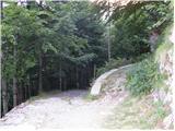 2
2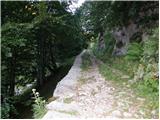 3
3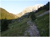 4
4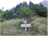 5
5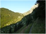 6
6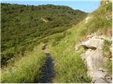 7
7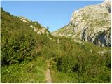 8
8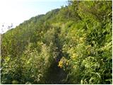 9
9 10
10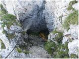 11
11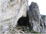 12
12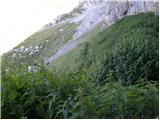 13
13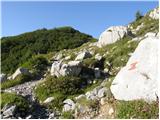 14
14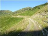 15
15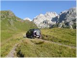 16
16 17
17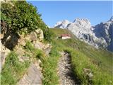 18
18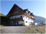 19
19
Discussion about the trip Plockenpass - Rifugio Marinelli
|
| GORNIK 123. 06. 2009 |
Does anyone know what the conditions are like on this path?
|
|
|
|
| triglavski24. 06. 2009 |
I have already been in those parts at the beginning of this month. Snow was only in some hollows and posed no problems, now it is surely all clear. Otherwise, the path is completely easy, I saw no scree areas anywhere, only bushes that do not obstruct walking, through a natural gap some fixed ropes are installed that facilitate passage, but it is not difficult. Recommended, just the weather needs to improve.
|
|
|
|
| Edelweiß2. 07. 2025 23:04:23 |
I was on this path last week. No snow anywhere anymore, the path is completely dry. The wire ropes look quite new and some new pegs have been added or replaced. By the lake which is very small (it would be more appropriate to use the word pond) and from which only tufts of tall grass were visible, there is also a bench for rest.
|
|
|
To post a comment you must log in:
If you do not yet have a username, you must first
register.