Podbrdo - Sveti Lenart (Bača pri Podbrdu)
Starting point: Podbrdo (515 m)
| Latitude/Longitude: | 46,21510°N 13,97390°E |
| |
Walking time: 30 min
Difficulty: easy marked way
Elevation gain: 236 m
Elevation difference along the route: 236 m
Map: Škofjeloško in Cerkljansko hribovje 1:50.000
Recommended equipment (summer):
Recommended equipment (winter): crampons
Views: 5.130
 | 1 person like this post |
Access to starting point:
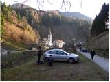
A) First, we drive to Škofja Loka, and then we continue driving towards Železniki and Tolmin. When we get to Podbrdo, we need to pay attention, because we will turn right immediately behind the church onto a narrower local road which starts ascending along the river Bača. We park on a suitable place by the road, or on a smaller parking lot by the local cemetery.
B) From the road Idrija - Most na Soči, at settlement Bača pri Modreju we turn right, or left, if we come from the direction of Posočje, and we continue driving towards Podbrdo. At the end of the settlement Podbrdo, we need to pay attention, because we will turn left just before the church of St. Miklavž onto a narrower local road which starts ascending along the river Bača. We park on a suitable place by the road, or on a smaller parking lot by the local cemetery.
Route description:
From the starting point, we continue on the initially still asphalted road, from which soon a marked footpath towards Vrh Bače branches off sharply to the left. We continue past an old residential house, behind which we gradually enter the forest. Through the forest, we ascend on a relatively well-marked and partly also quite steep mountain path, which higher up levels out and brings us from the forest onto a short panoramic slope, across which we walk to the nearby little church of St. Lenart.
Photos:
 1
1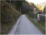 2
2 3
3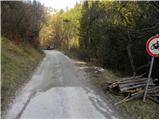 4
4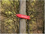 5
5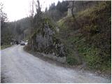 6
6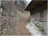 7
7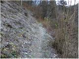 8
8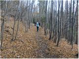 9
9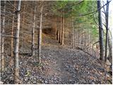 10
10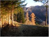 11
11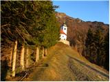 12
12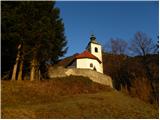 13
13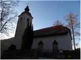 14
14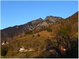 15
15
Discussion about the trip Podbrdo - Sveti Lenart (Bača pri Podbrdu)
|
| cveto zgaga28. 04. 2013 |
In the village Bača pri Podbrdu you can see a 500-year-old church, in the old cheese dairy there is a very interesting exhibition "Bača through time" which is the history of these places (special is the settlement, there was an important freight route from Bohinj already centuries ago, many famous historical figures crossed the pass here, from this village there was also one at the imperial court with Franz Joseph for a full 28 years....
At the homestead "Pr' Martinu" you can see a house ethno-museum with an old hearth and unique devices and tools from these places (call the local guide - a day or two in advance at tel. 041 259 139.
|
|
|
To post a comment you must log in:
If you do not yet have a username, you must first
register.