Podljubelj (Lajb) - Dobrča
Starting point: Podljubelj (Lajb) (770 m)
| Latitude/Longitude: | 46,41510°N 14,27010°E |
| |
Walking time: 4 h 30 min
Difficulty: partly demanding marked way
Elevation gain: 864 m
Elevation difference along the route: 1050 m
Map: Karavanke - osrednji del 1:50.000
Recommended equipment (summer):
Recommended equipment (winter): ice axe, crampons
Views: 10.741
 | 1 person like this post |
Access to starting point:
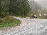
We leave the Gorenjska highway at the Podtabor junction, and then we continue driving towards the Ljubelj border crossing. Further on, we drive past the turn-off for Bistrico pri Tržiču, and higher up also past the turn-off for Podljubelj. A little after the road sign 4.5 km, after the underpass we turn right and then once again right into Podljubelj. We park at a suitable place by the sign which marks the beginning of Podljubelj.
Route description:
From the parking lot, we continue along the road which crosses a narrower bridge (overpass) and on the other side turns left. After a few dozen steps along the road, we notice signs for Preval, Begunjščica and Dobrča. Further, we continue on the road which ascends above the village and at the end of the village we notice a sign prohibiting further driving. The road, which further moderately ascends, soon crosses the stream over a bridge and continues on a mostly vegetated slope. Somewhere halfway up the ascent to Preval, the road crosses some panoramic slopes, then goes back into the forest, where we have two options for continuing. On the right side of the road we notice a steep cart track which soon brings us to Preval, or we can continue on a slightly gentler road which brings us to Preval just a minute later. At Preval both paths join and only a short ascent follows to the hut, which we notice on the left side.
From the hut we continue south towards Dobrča. The path soon enters the forest, where it initially descends slightly and after a few minutes brings us back to the ridge which we left soon after Preval. Here the sign for Dobrča directs us to the western slopes. The path ahead, without major changes in elevation, crosses locally somewhat steeper slopes. After some time the gentle path turns left and steeply ascends for a short while. The path then again crosses slopes which in wet are slightly dangerous for slipping. A little further ahead the path in a gentle ascent brings us back to the ridge. A steep descent follows along the ridge for more than 100 elevation metres to the saddle Vrh Luž. Here the path ascends slightly and after a few minutes brings us to the next indistinct saddle, where the path from Beli potok joins from the left. We continue straight ahead on the path which occasionally ascends somewhat more steeply. A short descent follows, then the path begins to ascend transversely across increasingly steeper slopes. The steepness of the slopes then eases and ahead of us we see a grazing fence. We cross the fence and just a few metres beyond it the path brings us to a cart track, where we continue right to the forest road by which we ascend to the Koča na Dobrči.
From the hut we return somewhat back to the pasture, where signs for Dobrča direct us across the pasture, past houses upwards. The path across the pasture is somewhat less visible but marked. When the path brings us to the edge of the forest it becomes clearly visible and somewhat further crosses a grazing fence. A little higher the path crosses a cart track and ascends to a junction, where the path from Brezje pri Tržiču joins. The steepness here eases and after a few minutes the path from Lešanska planina also joins from the right. Another five minutes of ascent follow along the forest-covered summit slope of Dobrča, which even at the top obstructs part of the view.
Lajb - Preval 1:30, Preval - Koča na Dobrči 2:30, Koča na Dobrči - Dobrča 30 minutes.

The trip can be extended to the following destinations: Šentanski vrh
Photos:
 1
1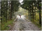 2
2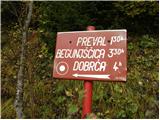 3
3 4
4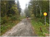 5
5 6
6 7
7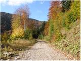 8
8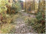 9
9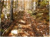 10
10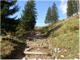 11
11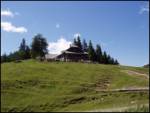 12
12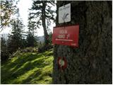 13
13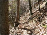 14
14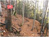 15
15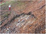 16
16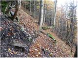 17
17 18
18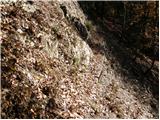 19
19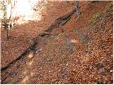 20
20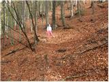 21
21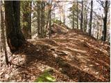 22
22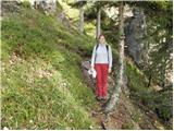 23
23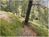 24
24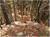 25
25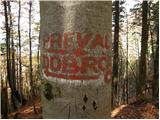 26
26 27
27 28
28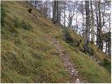 29
29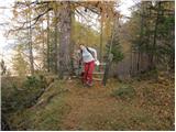 30
30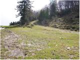 31
31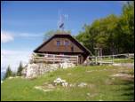 32
32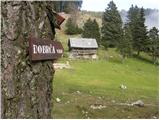 33
33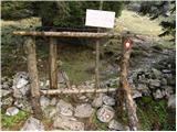 34
34 35
35 36
36 37
37
Discussion about the trip Podljubelj (Lajb) - Dobrča
|
| Gorazd G27. 02. 2010 |
While preparing the post about Dobrča
http://www.gore-ljudje.net/novosti/53063/
I checked what the "competition" writes and noticed an inaccuracy in the above description, probably caused by the inscription on a tree in one of the photos.
There is no Preval Dobrča in my opinion. On the tree next to the inscriptions "Preval" and "Dobrča" there are also arrows pointing right (to Preval) and left (to Dobrča), but this pass, as also written on maps and in guidebooks, is called Vrh Luž.
It would be right if the description and captions for the three photos were appropriately corrected.
|
|
|
|
| Tadej28. 02. 2010 |
Thanks, I have corrected it.
|
|
|
|
| hostar28. 02. 2010 |
That Preval means the Planina Preval below Begunjščica.
|
|
|
|
| Kriška28. 02. 2010 |
... which around here most people call Prevala.
|
|
|
|
| @rekar12. 07. 2014 |
I inform all users of the Dobrča - Preval path or vice versa that the path is cleared and passable without problems.
|
|
|
To post a comment you must log in:
If you do not yet have a username, you must first
register.